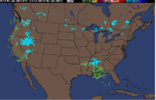
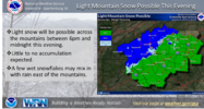
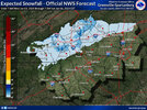
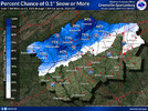
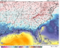
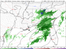
The latest HRRR runs have become more juicy with the moisture but I still have yet to see any ground truth out of either central Mississippi or Alabama
-
Hello, please take a minute to check out our awesome content, contributed by the wonderful members of our community. We hope you'll add your own thoughts and opinions by making a free account!
You are using an out of date browser. It may not display this or other websites correctly.
You should upgrade or use an alternative browser.
You should upgrade or use an alternative browser.
Wintry Jan 3-4 2024 System
- Thread starter SD
- Start date
- Joined
- Jan 5, 2017
- Messages
- 3,779
- Reaction score
- 5,990
If the HRRR is correct, you should start to see snow/rain reports out of northern MS in about 30 minutes to an hour.The latest HRRR runs have become more juicy with the moisture but I still have yet to see any ground truth out of either central Mississippi or Alabama
Makeitsnow
Member
Radar out of Columbus ms is showing returns down to about 2800 to 3000 feet and dropping.If the HRRR is correct, you should start to see snow/rain reports out of northern MS in about 30 minutes to an hour.
- Joined
- Jan 5, 2017
- Messages
- 3,779
- Reaction score
- 5,990
It looks like, to me, and if my trig math is right, that it took an hour to drop from around 3,800 ft to 2,800 ft. So, about 2 more hours it will be at the surface???Radar out of Columbus ms is showing returns down to about 2800 to 3000 feet and dropping.
- Joined
- Jan 5, 2017
- Messages
- 3,779
- Reaction score
- 5,990
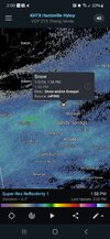
Closest mPing to me is Fulton, AL with "rain".
Mahomeless
Member
- Joined
- Oct 17, 2023
- Messages
- 899
- Reaction score
- 2,157
Im liking the area East of 65 and North of 20 in Alabama this afternoon.
accu35
Member
it’s been raining here all morning
Ron Burgundy
Member
Where is here?it’s been raining here all morning
Temps are a bit on lower side for region but that area still needs to main bulk of moisture to slow down some and delay as much as possible to help with Temps in later afternoon and needs to continue juicing up need to add more without too much WAAIm liking the area East of 65 and North of 20 in Alabama this afternoon.
Dad of Weather_Freak
Member
I'm near Gadsden, Al. and my temp has steadily increased from 26 at 5 AM to currently 38. No precipitation yet.
Wetbulbs are above freezing in most of North Ala, so not expecting much. Maybe a token flake or two at higher elevations.
Wetbulbs are above freezing in most of North Ala, so not expecting much. Maybe a token flake or two at higher elevations.
Virga, Virga, Virga!!!
Iceagewhereartthou
Member
Iceagewhereartthou
Member
- Joined
- Jan 2, 2017
- Messages
- 1,566
- Reaction score
- 4,279
Short drive to see flakes for me!
accu35
Member
South west BamaWhere is here?
hashslingingslasher256
Member
I wonder if Noccalula (so?) is high enough in elevation to see anything. I’m in Alabama City at work may drive up there once it starts.I'm near Gadsden, Al. and my temp has steadily increased from 26 at 5 AM to currently 38. No precipitation yet.
Wetbulbs are above freezing in most of North Ala, so not expecting much. Maybe a token flake or two at higher elevations.
Mahomeless
Member
- Joined
- Oct 17, 2023
- Messages
- 899
- Reaction score
- 2,157
Better off driving to CheahaI wonder if Noccalula (so?) is high enough in elevation to see anything. I’m in Alabama City at work may drive up there once it starts.
WeatherGirl205
Member
I think my eyes are playing tricks on me. I feel like I see little flakes a little south a Bham but when I stepped out I didn’t really feel anything. Probably wishful thinking. Ha! ?
- Joined
- Jan 5, 2017
- Messages
- 3,779
- Reaction score
- 5,990
Traffic cam at Hope Hull I-65 and Hyundai Blvd has snow falling. It's "spitting" and "sputtering" but it's there. Also, DOT AL has awesome cameras and navigation to them.
Makeitsnow
Member
Now down to 1000 feet but precip is light. Bhm is now down to 1000 and should reach within the hour..same with mxx.. Looks like there is a band of sleet..at least aloft..in central ga. Based on macons radar its probably reaching the ground. Hrrr continues to get wetter.It looks like, to me, and if my trig math is right, that it took an hour to drop from around 3,800 ft to 2,800 ft. So, about 2 more hours it will be at the surface???
Quite a temp bust on the hrrr. Prior runs had temps in the low to mid 40s in Alabama by now..instead its in the mid to upper 30s. Its running about 2 to 5 degrees cooler in ga vs prior runs.been stuck at 45 here for an hour. It had my local getting to 53 last night. Thats not going to happen with thickening clouds and top down cooling.
Makeitsnow
Member
Btw..just wanted to point out the insane dps in the mountains this morning. Mt mitchell had a dewpoint as low as -59! -20s and -30s were common at other sites. Goes to show you just how dry the mid levels were.
I must say the radar looks really solid all way back to MS and definitely further north and so far the Gulf Convection hasn't really factored as much as models had shown so upstream isn't getting choked off... Still alot to develop over next 4-5 hours for parts of East Alabama and West parts of Georgia alot going to depending on how much can get temp crash will take a good slug of rain not sure it's got enough puch even with the extra moisture
Ron Burgundy
Member
Camped out at 41/32 here for two hours. Grid forecast high was 47. No way we get there.Now down to 1000 feet but precip is light. Bhm is now down to 1000 and should reach within the hour..same with mxx.. Looks like there is a band of sleet..at least aloft..in central ga. Based on macons radar its probably reaching the ground. Hrrr continues to get wetter.
Quite a temp bust on the hrrr. Prior runs had temps in the low to mid 40s in Alabama by now..instead its in the mid to upper 30s. Its running about 2 to 5 degrees cooler in ga vs prior runs.been stuck at 45 here for an hour. It had my local getting to 53 last night. Thats not going to happen with thickening clouds and top down cooling.
- Joined
- Jan 2, 2017
- Messages
- 1,566
- Reaction score
- 4,279
Def flakes falling on some of those cams!(MP163)Traffic cam at Hope Hull I-65 and Hyundai Blvd has snow falling. It's "spitting" and "sputtering" but it's there. Also, DOT AL has awesome cameras and navigation to them.
severestorm
Member
NoSnowATL
Member
From WSBTV in Atlanta- Cloudy, with afternoon and evening showers. Snow or sleet may mix in, mainly in the mountains.
- Joined
- Jan 5, 2017
- Messages
- 3,779
- Reaction score
- 5,990
Yep, it's legit snowing in Hope Hull, AL. Which Hires had that, again?
*edit: That would be the Euro.
*edit: That would be the Euro.
That is a good slug of precip headed for my house, guess we will see what will happen.
MPing report of rain mixed with sleet in Montgomery
- Joined
- Jan 5, 2017
- Messages
- 3,779
- Reaction score
- 5,990
Yes, I saw that on the highway cams. Looks like up to about US 82/Cobbs Ford Road on the north side of Montgomery has some snow mixing in with the rain. Cool to see.MPing report of rain mixed with sleet in Montgomery
MPing report of sleet in Columbus, GA.
Windergawx
Member
Glenn Burns issues a frizzard warningHRRR each run keeps inching closer and closer to a band of decent heavy snow for parts of E. Alabama and West GA north of I-20 its been getting going a little sooner and larger each run... who knows
View attachment 139879
44 27dp not sure its going to work out but i bet we have something for the kids to look at. My youngest has never seen snow falling
- Joined
- Jan 5, 2017
- Messages
- 3,779
- Reaction score
- 5,990
I thought that band down in central GA would produce sleet based on the bright returns. Seeing some reports of snow in northern AL, too. Bodes well for north GA mountains tonight.MPing report of sleet in Columbus, GA.
Makeitsnow
Member
Hrrr at 12z has gone from literally zero precip to widespread .10 to even a max of .30 in ne al on the 17z r. It still looks underdone based on radar toward AtlantaHRRR each run keeps inching closer and closer to a band of decent heavy snow for parts of E. Alabama and West GA north of I-20 its been getting going a little sooner and larger each run... who knows
View attachment 139879
I see no real reason rain/snow mix or better doesn't extend east toward athens. There is an elevation difference but since temps are running behind guidance it seems at least possible. Even now the 17z hrrr shows my local getting to 50. Its still 45. Which means a slightly colder boundary layer. Hope it pans out.Glenn Burns issues a frizzard warning
44 27dp not sure its going to work out but i bet we have something for the kids to look at. My youngest has never seen snow falling
Yeah Dallas GA projected high was like 52 made it to 43 and should be going down from here over next few hours and when precip reachesHrrr at 12z has gone from literally zero precip to widespread .10 to even a max of .30 in ne al on the 17z r. It still looks underdone based on radar toward Atlanta
I see no real reason rain/snow mix or better doesn't extend east toward athens. There is an elevation difference but since temps are running behind guidance it seems at least possible. Even now the 17z hrrr shows my local getting to 50. Its still 45. Which means a slightly colder boundary layer. Hope it pans out.
Ron Burgundy
Member
MPing snow report in Woodstock fwiwI don’t know why but i have a good feeling. MPING snow back in northern Alabama. Elevation definitely will help me out.
I doubt that's real.MPing snow report in Woodstock fwiw
- Joined
- Jan 2, 2017
- Messages
- 1,566
- Reaction score
- 4,279

