accu35
Member
Dont mean to keep asking but can you back that frame up to Tennessee lol
Dont mean to keep asking but can you back that frame up to Tennessee lol
Yeah the NAM says we are wasting our time here lolNAM looks terrible lol


You think Gatlinburg/Sevierville will do good?NAM looks terrible lol
ENC FOR THE WIN! Gotta love the para haha

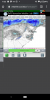
That it has. Let’s go down with the ship with this one. Can I at least get an accumulating snowfall? Or, hell, even just see pure snow falling without being mixed with rain??Well the V16 has been consistent, it may be consistently wrong but at least it's consistent....
View attachment 67858
Well the V16 has been consistent, it may be consistently wrong but at least it's consistent....
View attachment 67858
Seems I read somewhere next month but can't find it nowWhen does this go operational?
Hopefully not for a while until it's tweaked.When does this go operational?


Gfs para para the win??? Lol

The new GFS is snow happy. At least when it goes operational we'll get fantasy storms again.GFS para is not backing down, and the Euro is at least showing snow for the northern half of NC. It looks good for seeing snow here, just a matter of if it will accumulate any.
Can’t be any worse than the current GFS. I think the last verification score I saw had the GFS as the fourth best global model, aka last.The new GFS is snow happy. At least when it goes operational we'll get fantasy storms again.
I haven't seen. But it's not great.Can’t be any worse than the current GFS. I think the last verification score I saw had the GFS as the fourth best global model, aka last.
I feel like this will have a better shot and could do a little better for more areas. That ain't saying much, though.I’m definitely concerned about how long it will take for any potential changeover to occur. They always seem to occur later than expected. The storm earlier this month does not inspire much confidence, to say the least.
18z eps??


Euro shows that, I think many areas could see some wet snow, and the more Northeast you are towards NE NC, better chance of accumsGoes along with what I've been thinking. However it would be interesting if areas further west see a quick burst of snow
For sure. I think enc has a legitimately shot of maybe seeing an advisory out of this. Especially northeastern nc.Euro shows that, I think many areas could see some wet snow, and the more Northeast you are towards NE NC, better chance of accums
Look how far off shore that low is deepening. Just 50 -100 miles futher west,rates will do the trick like they are in ne nc. Looks 1000mb way east of hatteras. Only shot is bombogensis close to coast line. Closer to Wilmington, the better.I approve of this, even areas farther west would see snowflakes mix in View attachment 67913
For sure. I think enc has a legitimately shot of maybe seeing an advisory out of this. Especially northeastern nc.

Maybe this one will surprise!Everything according to models is directly over me for jackpots. Not gonna happen. Mark my words. Too warm boundary layer.