Im drinking some IPA's and then some Tom Collins, then 8 hours.
LOL. I am drinking an IPA as well. Love me some Voodoo Ranger IPA. Probably will skip the Tom Collins though. Need to have my wits tomorrow. ? You may actually end up doing okay!
Im drinking some IPA's and then some Tom Collins, then 8 hours.
Looks like RDU is at 50 as of 5pm. I recall with the Feb Feb 2015 system in Greensboro, we warmed into the 50s during the day under sunshine, but by 9 or 10 pm it was snowing heavily with temperatures near freezing, and we ended up with 6.4”. There is reason to be hopeful, but also concerned. I am usually too optimistic, mind you....You hate to lose the potential of a system like this to surface temps. Really is frustrating.
Love the Voodoo as well. Once I had my first IPA over snow frustration, I never went back to Lagers. Go drive yourself down 421 towards Boone and enjoy the 3-6 they are calling for. All snow, and winds to boot. Should be a pretty sight.LOL. I am drinking an IPA as well. Love me some Voodoo Ranger IPA. Probably will skip the Tom Collins though. Need to have my wits tomorrow. ? You may actually end up doing okay!
Well, you gotta lose it to something. Might as well be warm temps! A nice snowy 49 at the casa right now. Expecting that slow drop until the temperature-stabilizing cloud deck rolls in. Then we'll drift slowly through the 40s as the precip falls. Still think we see some flakes though.You hate to lose the potential of a system like this to surface temps. Really is frustrating.
Love the Voodoo as well. Once I had my first IPA over snow frustration, I never went back to Lagers. Go drive yourself down 421 towards Boone and enjoy the 3-6 they are calling for. All snow, and winds to boot. Should be a pretty sight.

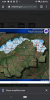
.png")
Yeah, definitely dangerous to try to decipher minute trends from a model that runs every hour. There’s always going to be small differences, and it runs 24 times a day...HRRR changes looks like noise to me....not my favorite model though.
Past 5 runs
View attachment 68586
Looks like Person, Halifax, Warren score no matter what hour.HRRR changes looks like noise to me....not my favorite model though.
Past 5 runs
View attachment 68586
They will all get hammered and we will all suffer. Just like the winter storm last yearI hope you all get blanked
Sincerely,
Jealous guy from Charlotte

Don't be salty. Lol. Don't worry. I bet Charlotte gets a storm before spring.I hope you all get blanked
Sincerely,
Jealous guy from Charlotte
Looks like RDU is at 50 as of 5pm. I recall with the Feb Feb 2015 system in Greensboro, we warmed into the 50s during the day under sunshine, but by 9 or 10 pm it was snowing heavily with temperatures near freezing, and we ended up with 6.4”. There is reason to be hopeful, but also concerned. I am usually too optimistic, mind you....
I think 1-3” for us, maybe 2-4” as you get north of Durham. I will be disappointed with less than an inch. Of course, I hold out hope for a 3-6” positive bust......
Voodoo Ranger is pretty good bang for the buck up here and a solid brew. frequent sales too. 43/32 here. Clouds rolled in right at sunset so not great for radiational cooling this evening. Soundings look good, just surface issues here once the rain gets here. Just curious how long changeover takes.LOL. I am drinking an IPA as well. Love me some Voodoo Ranger IPA. Probably will skip the Tom Collins though. Need to have my wits tomorrow. ? You may actually end up doing okay!
I don’t see it but we’ll see@Myfrotho704_ GSP says there's a chance for <1 inch
Looks like the HRRR is delaying the changeover A tad more each run for areas north
Hardly see any clouds back west so maybe some cooling can take place later.
HRRR goes even lower for the Triad this run. 1-2”
Whatever happens will happen. No use fussing over the models now. Sometimes wonder why we put ourselves through all this instead of just seeing what happens like non weather board folks.
Yeah, golf tooBecause we're all weenies and the ride is fun. 8-9 times out of 10, I'm gonna be disappointed, but that one time I'm not keeps me coming back time and time again. It's just like gambling
Because we're all weenies and the ride is fun. 8-9 times out of 10, I'm gonna be disappointed, but that one time I'm not keeps me coming back time and time again. It's just like gambling
Personally, I like the journey...the ups and downs and downs and downs. Plus, it's fun to try to forecast stuff.Whatever happens will happen. No use fussing over the models now. Sometimes wonder why we put ourselves through all this instead of just seeing what happens like non weather board folks.
We will see, my friend. Us Roanoke’s are hoping for anything.Voodoo Ranger is pretty good bang for the buck up here and a solid brew. frequent sales too. 43/32 here. Clouds rolled in right at sunset so not great for radiational cooling this evening. Soundings look good, just surface issues here once the rain gets here. Just curious how long changeover takes.
Wow. I looked at 5pm was partly cloudy,49 degrees. Life a mile high up. Wx changes on a dimeSnow has started on Beech Mountain per web cams. Coming down pretty good.