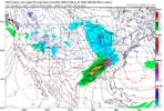
We are really only looking for events in that sweet can kicker range. This way we get all the excitement of snow without actually having to shovel any of it!Wasn't we really looking at the 7th Beyond for something to develop anyway? I didn't think we were ever looking at something before then
-
Hello, please take a minute to check out our awesome content, contributed by the wonderful members of our community. We hope you'll add your own thoughts and opinions by making a free account!
You are using an out of date browser. It may not display this or other websites correctly.
You should upgrade or use an alternative browser.
You should upgrade or use an alternative browser.
Pattern Jan 2025 Powered by Rheem AC
- Thread starter SD
- Start date
ITUSETOSNOW
Member
No offense, but it does not look that bad. Twenty degrees at 7 a.m.- we've already had that.As others have mentioned, this is brutally cold by our standards.
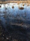
Seeing -10C 850mb temps ~1km off the surface means we would have some absolute instability to work with over some of our area lakes.
We could conceivably even get some really isolated light lake effect snow bands off some of the larger lakes around here if other things lined up just right. Vividly remember this happening in Jan 2014
View attachment 156877
- Joined
- Jan 23, 2021
- Messages
- 4,602
- Reaction score
- 15,197
- Location
- Lebanon Township, Durham County NC
I was thinking KDH or Duck would be the place to be myself.As others have mentioned, this is brutally cold by our standards.
Seeing -10C 850mb temps ~1km off the surface means we would have some absolute instability to work with over some of our area lakes.
We could conceivably even get some really isolated light lake effect snow bands off some of the larger lakes around here if other things lined up just right. Vividly remember this happening in Jan 2014
View attachment 156877
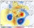
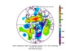
Those are 850 mb temps and -10C is quite cold for us at that level (see the anomalies below). And then you have to remember that is the 200 hr ensemble mean - that is an average of 51 ensemble members at 200 hours out.No offense, but it does not look that bad. Twenty degrees at 7 a.m.- we've already had that.
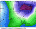
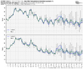
Look at the spread in surface min temps for that time frame and just beyond below - you can see a big spread so to have -10C already showing is quite impressive at H85 and an indicator that the incoming early January air mass could be truly frigid. Doesn't mean it will be, but it's a signal of the potential.
Last edited:
Lake Hartwell in SC produced a lake effect snow even in Jan of ‘96 I believe! Was the first and last time I’ve heard of it there. Low temps were in the 0-10 above range during that cold snap!!As others have mentioned, this is brutally cold by our standards.
Seeing -10C 850mb temps ~1km off the surface means we would have some absolute instability to work with over some of our area lakes.
We could conceivably even get some really isolated light lake effect snow bands off some of the larger lakes around here if other things lined up just right. Vividly remember this happening in Jan 2014
View attachment 156877
Euro suite never drives in a huge high and for the most part they are breezy through the whole duration of the cold, that would likely keep us from realizing what would otherwise be a floor in the single digits to low 10sNo offense, but it does not look that bad. Twenty degrees at 7 a.m.- we've already had that.
I remember light snow/flurries falling one night around new years that year. And that was one hell of a cold snapThe early Jan 2018 was similar to what we have coming up...we need some magic
View attachment 156882View attachment 156883
BHS1975
Member
It's been good while since I've seen single digits here. I wanna say about 10 years.Euro suite never drives in a huge high and for the most part they are breezy through the whole duration of the cold, that would likely keep us from realizing what would otherwise be a floor in the single digits to low 10s
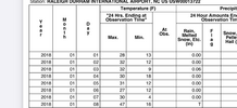
Pretty sure you had single digits in January 2018. I think pretty much the whole state did away from the immediate coastIt's been good while since I've seen single digits here. I wanna say about 10 years.
EWebb has it covered with a low temp map. Thinking we had single digits in 2014 & 2015 as wellPretty sure you had single digits in January 2018. I think pretty much the whole state did away from the immediate coast
But looking ahead, me thinks there will be plenty of twists and turns over the next few weeks. Maybe for the better / maybe not
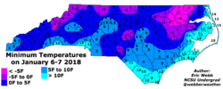
BHS1975
Member
Forgot about that one so 7 years. That's still a long time so seems we are way overdue.Pretty sure you had single digits in January 2018. I think pretty much the whole state did away from the immediate coast
LickWx
Member
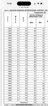
Wow! That is similar to jan 1985… a once in a lifetime event and everyone seems to have forgotten !EWebb has it covered with a low temp map. Thinking we had single digits in 2014 & 2015 as well
But looking ahead, me thinks there will be plenty of twists and turns over the next few weeks. Maybe for the better / maybe not
View attachment 156885
ITUSETOSNOW
Member
Atlanta was 3-8 above on Dec 24th, 2022.Forgot about that one so 7 years. That's still a long time so seems we are way overdue.
BHS1975
Member
It should be noted that it was aided east of US-1 by a pretty decent snowpack that was put down by that coastal storm. You can see the areas that had the heaviest totals were in the northeast part of the state where lows dropped to 5-8 degrees below zeroWow! That is similar to jan 1985… a once in a lifetime event and everyone seems to have forgotten !
Drizzle Snizzle
Member
The coldest weather I’ve ever experienced was on January 2, 2018 with a temp of -12 !
BHS1975
Member
That was only 2 days of freezing temps.Wow! That is similar to jan 1985… a once in a lifetime event and everyone seems to have forgotten !
CltNative90
Member
I remember the cold snap in 2018 being called a 1 in 250 year event by some meteorologists. The morning of the 7th was the coldest, but Raleigh stayed below freezing for a solid week straight and Charlotte was below 35. Ponds were frozen over with ice several inches thick. For areas west of US-1, it wasn't until a second cold snap later in the month that we finally received measurable snowfall, although the coastal "bomb cyclone" on January 3rd trended west in the 11th hour and surprised some areas like Pinehurst.It should be noted that it was aided east of US-1 by a pretty decent snowpack that was put down by that coastal storm. You can see the areas that had the heaviest totals were in the northeast part of the state where lows dropped to 5-8 degrees below zero
LickWx
Member
Uhh sir Raleigh had it’s longest stretch below freezing everThat was only 2 days of freezing temps.
Shane can find it but it was like the coldest or second coldest week ever
rambleon
Member
Was that the year we had 9+ inches on the ground and single digits for over A week, best I recall?Uhh sir Raleigh had it’s longest stretch below freezing ever
Shane can find it but it was like the coldest or second coldest week ever
LickWx
Member
We didn’t have 9 inches on the ground here but yeah it was cold for over a week, really even longerWas that the year we had 9+ inches on the ground and single digits for over A week, best I recall?
BHS1975
Member
accu35
Member

I’m gonna stay positive and happy and believe this will verify.
LickWx
Member
Oh I get it now, I was talking about 2018
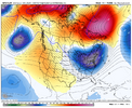
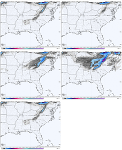
Some of the best ensemble snow means for our area on both the EPS and GEFS but I sure would like to see them get under 200 hours. We have been seeing them basically just go away or continue to get kicked back and its the same old song and dance.
I do feel better with the cold, but just hope we can score something.
I do feel better with the cold, but just hope we can score something.
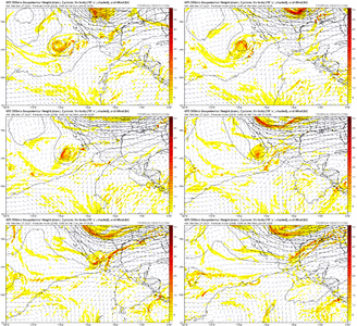
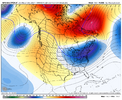
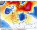
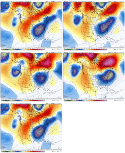
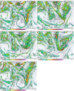
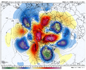
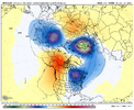
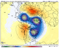
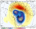
Trends over Greenland on last 4 runs of the GFS for Jan 3


Yeah that was very close to producing a light to mod event with wave dropping in from the NW. Was pretty good for TN / W NC1/3 to 1/6 is not dead yet. At least not if the GFS trends could continue.
View attachment 156894
View attachment 156895
If the gfs doesn't magically dissolve what it's building its going to be stupid cold for the last 5 days or so of this run
Webberweather53
Meteorologist
GFS tries to give us a quick hitting clipper system next week then follows it up with a potential cad event after that . Sounds about right if we get anything here

GFS suddenly has a -NAO. You love to see it. Most interested I’ve been in many years! Hoping we can bring a big dog home for RDU/eastern areas for once. I live near hickory feeling pretty good in the western part of the state for first few weeks of January!
Sent from my iPhone using Tapatalk
85'ish cutoff like normal!View attachment 156896
GFS with a D10 CAD event.

