-
Hello, please take a minute to check out our awesome content, contributed by the wonderful members of our community. We hope you'll add your own thoughts and opinions by making a free account!
You are using an out of date browser. It may not display this or other websites correctly.
You should upgrade or use an alternative browser.
You should upgrade or use an alternative browser.
Pattern Jan 2025 Powered by Rheem AC
- Thread starter SD
- Start date
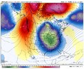
Yeah, I don't care what the GFS produces storm-wise, that's a spectacular run there with everything that it set in motion
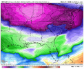
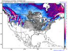
Snow and ice map from the GFS D10 CAD event.


Webberweather53
Meteorologist
Webberweather53
Meteorologist
Easily the coldest look I’ve seen in January since 2013-14 & 2017-18
- Joined
- Jan 23, 2021
- Messages
- 4,602
- Reaction score
- 15,197
- Location
- Lebanon Township, Durham County NC
Biggest flash freeze potential since January 2014 IMOEasily the coldest look I’ve seen in January since 2013-14 & 2017-18
GFS trying to do something.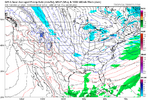

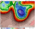
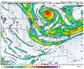
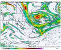
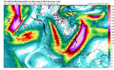
It'll be fun to see what the gfs does when it pulls this Cinnabon around and through the base of the trough View attachment 156908
BHS1975
Member
It's gonna be sweet! Get it?It'll be fun to see what the gfs does when it pulls this Cinnabon around and through the base of the trough View attachment 156908
SimeonNC
Member
I can't wait to see the ensembles
LickWx
Member
The 2m temps don’t appear as cold as the 850s would suggest
Webberweather53
Meteorologist
That gfs run was like getting into the DeLorean with doc brown and Marty and going to a time when we had winter where we were more worried about the actual waves and not trying to shoehorn a trough into the east
idk how we didn’t get something better in the fantasy range to come out that GFS run. Not that it matters to much at that range, but still.
End of the OP GFS wasn’t done. It was about to reinforce the cold again. I like what I’m seen back west
BHS1975
Member
Yeah our average highs used to be in the upper 40s in January so it didn't take much to get it cold enough for snow.That gfs run was like getting into the DeLorean with doc brown and Marty and going to a time when we had winter where we were more worried about the actual waves and not trying to shoehorn a trough into the east
LukeBarrette
im north of 90% of people on here so yeah
Meteorology Student
Member
2024 Supporter
2017-2023 Supporter
That wouldn’t happen in the first place, these types of vorts follow the mean flowIt'll be fun to see what the gfs does when it pulls this Cinnabon around and through the base of the trough View attachment 156908
LickWx
Member
That was back when the planet was artificially cooled by tons of aerosolsYeah our average highs used to be in the upper 40s in January so it didn't take much to get it cold enough for snow.
There's a dry threat if this kind of pattern sets up (see last part of post linked below - my post yesterday at 10:48 pm)....but the cold would get us in the batter's box at least - get an individual wave to sharpen and it's Atlanta Snowjam #3idk how we didn’t get something better in the fantasy range to come out that GFS run. Not that it matters to much at that range, but still.
Pattern - Jan 2025 Powered by Rheem AC
The 1" total probs jump from 10 to 30% over RDU on this map between Jan 7 & 11 & you just showed a map of mean snowfall between 2 dates, which is obviously not the same thing at all because of outliers. Anyways... moving on. January 8th at 00z (the end of the first week of January) is at...
southernwx.com
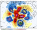
12z GEFS really with all the changes you'd want to see to get something to dig more in the 1/3 to 1/6 window and matches up with the op quite well.
View attachment 156917
That -AO block is just sick...got to be reading very low on that run.
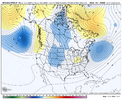
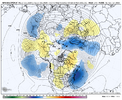
Man, we haven't had a good angle of the cold post in at least 5 years. Well done!i like this angle of cold. I think this is something we want to see. We’ve gotten so used to the coldest anoms spilling down north to south into the plains and slow bleeding our way. This serves us better to the south and east. Of course I’m just nitpicking long rang BS but I do like it. View attachment 156920

Iceagewhereartthou
Member
Yeah, seems like it's been forever. I still have no hope it will snow again here but it would be nice have some actual cold for longer than a day or two. Would love to see some teens and single digits but that run did not show any of those for our area. Still, the pattern shown looks fantastic; just hope it actually verifies!i like this angle of cold. I think this is something we want to see. We’ve gotten so used to the coldest anoms spilling down north to south into the plains and slow bleeding our way. This serves us better to the south and east. Of course I’m just nitpicking long rang BS but I do like it. View attachment 156920
Euro isn't as exciting as the gfs but it's cold after cold with a couple close calls. It's definitely not as enthusiastic as the gfs about getting a clean tall wc ridge like the gfs so the pattern as a whole is biased E
I mean we can all high five over great runs but I still think there are some issues in the Asia to npac region that could make this whole thing pretty underwhelming. Just ignoring it is unfair and how we get those but the pattern is supposed to be great postsHere comes Steve.
What you seeing over there SD?I mean we can all high five over great runs but I still think there are some issues in the Asia to npac region that could make this whole thing pretty underwhelming. Just ignoring it is unfair and how we get those but the pattern is supposed to be great posts
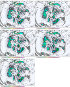
Some improvement shown on the EPS, last 3 runs for Jan 7 - pattern bumping west and improved Arctic Oscillation

olhausen
Member
That’s a low blowMeaningless argument- you Carolina peeps are going to get blanked in the snow department anyway. lol
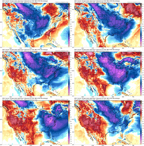
EPS bumping west and really cold (Jan 9)


I still think the pattern overall screams more clipper craziness than anything .. which, don’t get me wrong, can do some wild things outside of the usual clipper locations. Just think that’s generally where we are at the first week of January. Certainly room for things to time up right for something better and more widespread .. I’m just not seeing it as of right now
What time frame is mainly for? Post or pre 300 hours?
Until I get snowpack up here, yall won’t be able to realize the max potential of your cold!

