• Hello, please take a minute to check out our awesome content, contributed by the wonderful members of our community. We hope you'll add your own thoughts and opinions by making a free account!

Pattern Jan 2025 Powered by Rheem AC

I’m away or I’d pull it up, but how did the GEFS snowfall look? I’m assuming it not as good based off no one posting it.
 
Oh thats a shame...the EPS has been trending away from the 4"+ snow mean runs. What a tragedy.

View attachment 158160
That's ok .... I was rooting for just enough cold air for a solid frozen event. Don't need pipe bursting cold for that. As for the snow mean, it will change every 6 hours. Not worried too much being in the heart of "Cad Country".
 
I honestly think it's a bit premature to think this pattern is going to fail. Models have been all over the place and the general pattern supports winter weather in the southeast. Models are going to change every single day. You will have good and bad trends. It's easy to get down but just know the 12z EURO at hour 300 today is most likely not even close to being correct and will be different in 6 hours.
 
I'm glad I'm so old that I don't get worked up as much about this stuff as maybe I used to, haha

Some thoughts on the medium - long range...

Having looked thru the various modeling, I like a blend of the GEFS and Euro AI ideas going into mid-Jan. It was mentioned recently that JB was concerned about losing the -EPO. Most of the modeling is showing the AK ridge here retrograding and diving down into East Asia. Previously, the modeling was ridge-bridging the Arctic and driving more of the tropospheric PV down into Canada and yielding colder arctic plunges.

But in the end, it's probably a positive that we don't see that occur. The big Arctic plunge would lend more support for speeding up the Atlantic jet and breaking down the -NAO (+ Rocky Mtn Torque). In contrast, when you drop high pressure (ridging) down into East Asia, that almost certainly adds momentum into the Pac Jet, with it reaching the East Pacific a week later or so. At a time when the MJO is going to want to slow down the Pac Jet a bit (as it goes into Phase 2, then 3), that extra momentum can help to continue to support the Aleutian Low / +PNA pattern. It's possible that the added momentum could be too much, and we go into a Gulf of AK Low / Super El Nino look - but no need to worry about that for now. But bottom line, that sequence would prevent a big retraction into a -PNA in 3rd week of Jan.

So, the Euro AI and GEFS here show similar output on the Pacific side (i.e. maintenance of the +PNA look). On the Atlantic side, I have mixed opinions there. Cyclonic wave breaking underneath the block out into the Atlantic and no big Arctic high pressure plunge via -EPO would support the idea of renewed -NAO blocking or the blocking continuing for the most part. On the other hand, the Strat PV is strong and is not favorable for -NAO maintenance.

If this type of pattern does continue, obviously it's a colder than normal pattern, but could be a bit problematic on the snow front (on the dry side). It has a 1980-1981 look to it (3rd image), which is in sharp contrast to what we've seen over the last 8 winters (4th image) - a positive I would say for sure.

nXdiREh.gif


HzAUOMi.gif


X2Y4ECn.png


vjXRNfo.png
 
Years ago, this used to be all we looked at to assess the long range, and this would have made us all very happy.

Now, we look 4 weeks out and see the pattern breaking down and feel bad.

Sometimes, I think the days of the Days Inn 5 day business planner, the CPC outlooks, and the MRF were more fun and exciting. With so much more information everywhere now comes so much more stress.
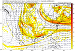
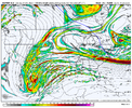
Could you imagine if models only went to D10 and we were left with these gfs_z500_vort_us_41.pngecmwf-deterministic-conus-vort500_z500-6510400.png

Speculation and optimism would be all time highs
 
Years ago, this used to be all we looked at to assess the long range, and this would have made us all very happy.

Now, we look 4 weeks out and see the pattern breaking down and feel bad.

Sometimes, I think the days of the Days Inn 5 day business planner, the CPC outlooks, and the MRF were more fun and exciting. With so much more information everywhere now comes so much more stress.

I preferred the Michelin 5 day planner with Jim Cantore. Much more entertaining and informative.
 
Also the monthly thread is at 120 pages and the month has not officially started!

At least we have something to be excited about!!

Praying we all can get something out of the approaching period… thank you to those with actual knowledge that share their thoughts!!
 
Always 300 hours out
Been that way for last 10-15 years. GFS always shows a bomb and never verifies. If gfs was right I would have had five feet by now. As much technology as there is now you would think models would be more accurate than having to wait 3- 5 days out at best. Rarely miss except winter seems like
 
Off topic question, but does anyone know what happened to Meteorologist Chris Simmons? He was a regular poster here, especially during winter..

Really miss his analysis
 
Back
Top