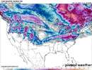
Big fan of zero clutter. Even if the timing/day changes we could do event 1 and event 2?Yeah I'd think later today or tonight we probably will do so
-
Hello, please take a minute to check out our awesome content, contributed by the wonderful members of our community. We hope you'll add your own thoughts and opinions by making a free account!
You are using an out of date browser. It may not display this or other websites correctly.
You should upgrade or use an alternative browser.
You should upgrade or use an alternative browser.
Pattern Jan 2025 Powered by Rheem AC
- Thread starter SD
- Start date
wow
Member
Event 1 is the 1300m storm. Event 2 is the Webber storm.Big fan of zero clutter. Even if the timing/day changes we could do event 1 and event 2?
I really don't understand where this is coming from. I have NEVER said that anything after 1/3 - 1/6 wasn't favorable. I just said 1/3 to 1/6 was the first window to watch. Everything with webber has to turn into a personal battle. I challenge anyone to go back and find a post where I've not said the period AFTER 1/3 to 1/6 is actually more favorable. A receding -NAO is when RDU usually scores, that doesn't mean you don't watch every chance.Event 1 is the 1300m storm. Event 2 is the Webber storm.
Crap like this makes me really wonder why I even bother posting on here.
SnowNiner
Member
Please let that be a foregleam of what the 12Z euro suite will be. Bring that sucker out!
wow
Member
Oh calm down.. that's not personal. But the bickering has been on full display on this thread. It's making a name for itself.I really don't understand where this is coming from. I have NEVER said that anything after 1/3 - 1/6 wasn't favorable. I just said 1/3 to 1/6 was the first window to watch. Everything with webber has to turn into a personal battle. I challenge anyone to go back and find a post where I've not said the period AFTER 1/3 to 1/6 is actually more favorable. A receding -NAO is when RDU usually scores, that doesn't mean you don't watch every chance.
Crap like this makes me really wonder why I even bother posting on here.
You're definitely appreciated here by me. People are allowed to have differences of opinion. There were points last year where...certain individuals on here claimed we were heading to glory and then they disappeared when it all fell flat. Wouldn't answer any questions as to what they think went wrong.I really don't understand where this is coming from. I have NEVER said that anything after 1/3 - 1/6 wasn't favorable. I just said 1/3 to 1/6 was the first window to watch. Everything with webber has to turn into a personal battle. I challenge anyone to go back and find a post where I've not said the period AFTER 1/3 to 1/6 is actually more favorable. A receding -NAO is when RDU usually scores, that doesn't mean you don't watch every chance.
Crap like this makes me really wonder why I even bother posting on here.
Either way, we're heading towards our best chance for winter weather in a long time. I am excited for the 1/6 time period, especially for us in the NC Foothills. We're severely snow starved.
It’s personal when you’re getting boxed into a perspective you’ve never had. Don’t comment on it if you don’t have all your facts straight and didn’t bother to do the reading.Oh calm down.. that's not personal. But the bickering has been on full display on this thread. It's making a name for itself.
Thanks! I’m just looking at all options and the closest one always gets priority to me! Hopefully we really do have multiple opportunities.You're definitely appreciated here by me. People are allowed to have differences of opinion. There were points last year where...certain individuals on here claimed we were heading to glory and then they disappeared when it all fell flat. Wouldn't answer any questions as to what they think went wrong.
Either way, we're heading towards our best chance for winter weather in a long time. I am excited for the 1/6 time period, especially for us in the NC Foothills. We're severely snow starved.
Peeps
Yes sir to the nc foothillsYou're definitely appreciated here by me. People are allowed to have differences of opinion. There were points last year where...certain individuals on here claimed we were heading to glory and then they disappeared when it all fell flat. Wouldn't answer any questions as to what they think went wrong.
Either way, we're heading towards our best chance for winter weather in a long time. I am excited for the 1/6 time period, especially for us in the NC Foothills. We're severely snow starved.
Im with you. Why pull the blinds on a window of opportunity, let the actual wx do it. Even if its not as shiny a picture as the one outside window #2. When chasing, which is what we do here. You go for them all, espeacilly the closest one. Jan 5th is to close to a hit of frozen, to just boo boo away, not discuss,track. And missing out on it,isnt going to do anything for storm 2. Thats all dependent on whether or not a vort can get released from the sw in the southern stream. Not held hostage. The air coming down late next week will survive fine without any refrigerator/snow cover on the ground. Thats normally not the case 9 × out of 10. I get webber point. But for mby,this time is the exception. And i also understand the barcolonic point of view as it creates thermal differences between the barren ground, verse white ground. Usually you knock 6-10 degrees off a high temp with snow cover on a full sunny day as it reflects solar insulation back out to space. Doesnt absorb.I really don't understand where this is coming from. I have NEVER said that anything after 1/3 - 1/6 wasn't favorable. I just said 1/3 to 1/6 was the first window to watch. Everything with webber has to turn into a personal battle. I challenge anyone to go back and find a post where I've not said the period AFTER 1/3 to 1/6 is actually more favorable. A receding -NAO is when RDU usually scores, that doesn't mean you don't watch every chance.
Crap like this makes me really wonder why I even bother posting on here.
I appreciate your post, knowledge. Keep it coming
Last edited:
I don’t get the bickering or the highs and lows outside of 72 hours! Let the systems progress and get into a range where they can be forecasted reasonably. Anything less is uncivilized! Sorry thought this was banter with all the other posts!
I haven't seen this posted yet but here is the FFC discussion from this morning beginning with the time frame we are wanting to see:
The next system to talk about is a potent wave that moves into
southeast Sunday night into Monday, developing a strong low that
appears to be able to tap into the subtropical jet and pull some
moisture up this way. Model consensus as of the 00Z runs is pulling
the system a bit further to the north compared to some of the
earlier runs, which would act to limit snowfall potential
substantially in all but far northern Georgia and the Appalachians.
NBM probabilities for seeing at least 0.1" of snow are 10-20% in
these areas. GEFS and EPS forecasts mirror this unsurprisingly,
showing mean 24 hour snowfall totals of around an inch in the
mountains. This forecast package maintains the rain/snow mix in
these areas. Outside of the mountains, it does appear that a decent
push of moisture will move through and give the rest of the state
what is likely to be a chilly rain at this time.
Want to take a moment and talk about next week. You are likely to
see plenty of social media-ologists posting model runs that could
show big snow totals across parts of Georgia. Snow in Georgia is
challenging to make happen. In many ways, it is like baking a cake.
First, you have to have all the right ingredients - forget one, and
the whole thing collapses. Next week, it looks like we will have the
possibility for all the necessary ingredients to come together over
the southeast and Georgia. However, then you have to bring all those
ingredients together at the right time and in the right amounts.
That is the really challenging part to forecast. Right now, small
changes in the positions of all the features - cold air, moisture to
south, the potential waves that will form the storm systems, etc -
create very different outcomes in the models. This is part of why we
run ensemble systems that allow us to test making small changes to
the models to see how it affects the outcomes. Looking at the
ensembles, they currently put the probability of seeing some decent
snow somewhere in Georgia at around 10-20%. So, the best thing this
forecaster can say is to stay tuned to the forecast, and know that
we will be entering a period of time where snow is possible anywhere
in the state. That`s not something we see too terribly often, but
even with the increased chance, it is still just a chance. It may
not come together right. And last, friends don`t let friends share
10-day-out snow maps on social media
Lusk
Please don’t kill me for posting a wxbrad tweet but feel like this is worth mention
Please don’t kill me for posting a wxbrad tweet but feel like this is worth mention
He’s not following his own advice by waiting until a timeframe that’s realistic to forecast. So show what you want when it suits you!
Blue_Ridge_Escarpment
Member
If this were summertime and a heat wave impending, the horns would be honking on his account.He’s not following his own advice by waiting until a timeframe that’s realistic to forecast. So show what you want when it suits you!
Please don’t kill me for posting a wxbrad tweet but feel like this is worth mention
Honestly it’s probably for the best that it’s modified a bit, if you want snow.
Ron Burgundy
Member
Interestingly, FFC dropped my grid forecast low for Sunday from 36 to 30 overnight and upped my rain chance from 40% to 60%.I haven't seen this posted yet but here is the FFC discussion from this morning beginning with the time frame we are wanting to see:
The next system to talk about is a potent wave that moves into
southeast Sunday night into Monday, developing a strong low that
appears to be able to tap into the subtropical jet and pull some
moisture up this way. Model consensus as of the 00Z runs is pulling
the system a bit further to the north compared to some of the
earlier runs, which would act to limit snowfall potential
substantially in all but far northern Georgia and the Appalachians.
NBM probabilities for seeing at least 0.1" of snow are 10-20% in
these areas. GEFS and EPS forecasts mirror this unsurprisingly,
showing mean 24 hour snowfall totals of around an inch in the
mountains. This forecast package maintains the rain/snow mix in
these areas. Outside of the mountains, it does appear that a decent
push of moisture will move through and give the rest of the state
what is likely to be a chilly rain at this time.
Want to take a moment and talk about next week. You are likely to
see plenty of social media-ologists posting model runs that could
show big snow totals across parts of Georgia. Snow in Georgia is
challenging to make happen. In many ways, it is like baking a cake.
First, you have to have all the right ingredients - forget one, and
the whole thing collapses. Next week, it looks like we will have the
possibility for all the necessary ingredients to come together over
the southeast and Georgia. However, then you have to bring all those
ingredients together at the right time and in the right amounts.
That is the really challenging part to forecast. Right now, small
changes in the positions of all the features - cold air, moisture to
south, the potential waves that will form the storm systems, etc -
create very different outcomes in the models. This is part of why we
run ensemble systems that allow us to test making small changes to
the models to see how it affects the outcomes. Looking at the
ensembles, they currently put the probability of seeing some decent
snow somewhere in Georgia at around 10-20%. So, the best thing this
forecaster can say is to stay tuned to the forecast, and know that
we will be entering a period of time where snow is possible anywhere
in the state. That`s not something we see too terribly often, but
even with the increased chance, it is still just a chance. It may
not come together right. And last, friends don`t let friends share
10-day-out snow maps on social media
Lusk
Tarheelwx
Member
It does seem we’re going from historic cold to a good solid cold period.
SimeonNC
Member
Please don’t kill me for posting a wxbrad tweet but feel like this is worth mention
This is what worries me honestly
Please don’t kill me for posting a wxbrad tweet but feel like this is worth mention
I like ----- alot...could be one of the reasons for the moderation of temps, and that's relative as it's still very cold...is not as much snow in that week 2 members.
It shouldn’t. He says it’s gonna be cold but maybe not historic cold. In my opinion that should help with less suppression. He’s the master and I’m just a student though!This is what worries me honestly
We get a foot of snow on the ground with the pattern coming we will get biblical cold.It does seem we’re going from historic cold to a good solid cold period.
Twister
Member
Well that could be a good thing as far as snow goes. I'd rather it snow at 33 than 20. I've seen some of our biggest snows here between 32 and 35°It does seem we’re going from historic cold to a good solid cold period.
coldfront22
Member
Brad is in the much to about nothing mentality on this upcoming pattern. He is a good one in reality most of the time. . Let’s hope we see his snow meter before January is done. Agree a little less cold may help the number 2 storm.
I like ----- alot...could be one of the reasons for the moderation of temps, and that's relative as it's still very cold...is not as much snow in that week 2 members.
About to post the exact same thing.
NBAcentel
Member
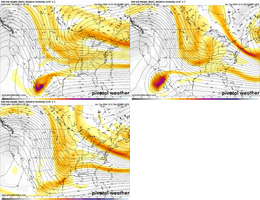
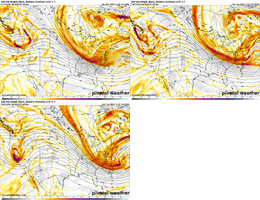
Starting to get a consensus on modeling on the first storm being a MA event. Not a bad thing. Icon shows that now. But laying the pack down isn’t a bad thing
ICON trying to do something with Storm #2. Edit: Fail.

We all know that, my issue is where he uses lr ensembles for temps alone but ignores the snow they also put down! I’m not saying it will be a blockbuster multiple event, no one knows. I’m just saying that he seems to cherry pick what he wants!Brad is in the much to about nothing mentality on this upcoming pattern. He is a good one in reality most of the time. . Let’s hope we see his snow meter before January is done. Agree a little less cold may help the number 2 storm.
Iceagewhereartthou
Member
I think for the sake of full accumulation and ratios we need below 32; like 28-30. We don't need temps in the low 20s or teens for that but those 33-35 degree snows wastes a lot of accumulation on compaction and melting.Well that could be a good thing as far as snow goes. I'd rather it snow at 33 than 20. I've seen some of our biggest snows here between 32 and 35°
One thing I would point out is that he’s posting the 2m temperature changes and while they can be useful, I think most mets would agree that at that range the 500mb charts are more usefulThis is what worries me honestly
Which again is NOT the likely scenario. The only thing we’re confident in is a prolonged period of below average temps. How below? Who knows. Winter weather? Chances increase due to cold air but absolutely no guarantee. Giant monster snowstorms for the Deep South? Not something that should be considered realistically at this point unless you get a storm signal within 150 hours.We get a foot of snow on the ground with the pattern coming we will get biblical cold.
Blue_Ridge_Escarpment
Member
As warm as the ICON is at 2m normally, that’s probably an ice storm for the CAD areas
Avalanche
Member
Kylo was cheering for it, not forecasting it.Which again is NOT the likely scenario. The only thing we’re confident in is a prolonged period of below average temps. How below? Who knows. Winter weather? Chances increase due to cold air but absolutely no guarantee. Giant monster snowstorms for the Deep South? Not something that should be considered realistically at this point unless you get a storm signal within 150 hours.
CNCsnwfan1210
Member


NAO forecast: ~-1.5 sigma
AO forecast :-4 sigma(!)
Both telecommunications stay negative for the majority of January
Sent from my iPhone using Tapatalk

