-
Hello, please take a minute to check out our awesome content, contributed by the wonderful members of our community. We hope you'll add your own thoughts and opinions by making a free account!
You are using an out of date browser. It may not display this or other websites correctly.
You should upgrade or use an alternative browser.
You should upgrade or use an alternative browser.
Pattern Jan 2025 Powered by Rheem AC
- Thread starter SD
- Start date
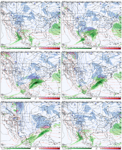
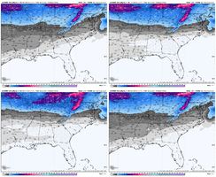
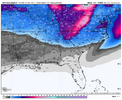
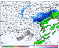
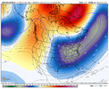
Borderline temps? I thought this is the timeframe we are in the freezer?Euro is a cutter for the first system and then brings wave 2 into the southeast but temps are very borderline.
View attachment 157979
CNCsnwfan1210
Member
Euro is a cutter for the first system and then brings wave 2 into the southeast but temps are very borderline.
View attachment 157979
The timing was off(late/too slow) on that northern shortwave with system 2 imo
Sent from my iPhone using Tapatalk
Euro has improved at 0z verse its 12z for 1/5 by a smidge. It is quickest to eject our vort out. HP is actually stonger above it compared to gfs. 1041. But it gets out in front a step to fast.
CNCsnwfan1210
Member
A few big dogs in there including some smaller hits too with plenty of time left. Good stuff
Sent from my iPhone using Tapatalk
Brent
Member
wow
Member
Euro loves hanging those lows back over the SW. It's going to be harder for it to break that. It trended in the opposite direction for wave 2.
Hope the ensembles are leading the way and the ops follow. I would gladly take half of thoae.
SnowwxAtl
Member
IGfs snows way south like GoM south
It is notorious for that.Euro loves hanging those lows back over the SW. It's going to be harder for it to break that. It trended in the opposite direction for wave 2.
wow
Member
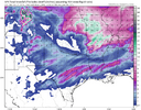
Euro vs GFS vs CMC. GFS game on with wave 2 position. Root for that one.


accu35
Member
accu35
Member
I’m not worried either way about the first wave but that second is our time to shine
accu35
Member
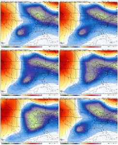
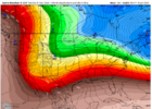
That cold really digs on the Euro tonight
wow
Member
Euro pushes wave 2 into central Mexico lol.. g'night!
NBAcentel
Member
NCHighCountryWX
Member
- Joined
- Dec 28, 2016
- Messages
- 699
- Reaction score
- 1,918
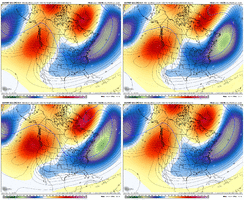
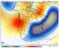
JB may be on to something as Sunday evening he expressed concern over EPO going positive
CNCsnwfan1210
Member
And the GEFS did the exact opposite

Sent from my iPhone using Tapatalk
accu35
Member
So the GEFS increased and the Euro ens decreased? Something got to give
SnowwxAtl
Member
Mahomeless
Member
And we all know who rules between those 2….its not even close. Ohio Valley is going to be the place to be over the next couple of weeks. Sadly, we will be gone by then after our 2.5 weeks here with family.So the GEFS increased and the Euro ens decreased? Something got to give
Forevertothee
Member
GSP
LONG TERM /FRIDAY THROUGH MONDAY/...
As of 250 AM EST Tuesday: By Friday morning, the axis of a potent
H500 trough will glide across the western Carolinas, steering an
ill-defined frontal circulation across the region during the day.
Most LREF ensemble members don`t key much on moisture return ahead
of this front, but theta-e pooling along the NC-TN border may
be enough to produce some light NW flow snow showers Friday and
Friday night. Temps at the high elevations ought to be cold enough.
The pattern gets a lot murkier after that. A quick shot of
rain/snow looks likely, though not guaranteed, starting Sunday
night, as a mature cyclone makes tracks across the Deep South.
There`s a LOT of spread in temperatures, though, and timing
remains in question, so we could be talking about anything
from bulk of the precipitation falling during the day with
above-freezing temperatures across most of the area, to most precip
falling at night with sub-freezing temperatures, to anything in
between...making the p-type forecast little more than a shot in the
dark at this timeframe. Ensembles are really starting to cluster
around the "Arctic blast" solution, though, on the backside of this
system...with the latest LREF cycle depicting ~50% probabilities of
lows in the teens even at some lower elevations in the NC Foothills
by Monday night. Low teens to single digits aren`t even out of
the question at the highest elevations by the end of the period.
Forevertothee
Member
Peachtree City
LONG TERM...
(Wednesday night through Monday)
Issued at 457 AM EST Tue Dec 31 2024
Key Messages:
- Several shots of cooler air will keep temperatures seasonable to
slightly below average through the end of the week into the
weekend.
- Next shot of rain (and possibly some winter precip mixed in
across far north Georgia) will be Sunday into Monday next week.
Forecast:
Wednesday night sees zonal flow over the CWA. Significant portion of
the tropospheric polar vortex has been pushed over the north
American continent, which is opening the door for multiple waves of
cooler air to come pushing into the Great Plains and eastern US.
Several shortwaves will push by the area through the end of the
week, but the most potent one looks to come through on Thursday
night into Friday morning. The good news is this wave doesn`t have
much in the way of moisture to work with and doesn`t produce much in
the way of rainfall at this time. The bad news (unless you like the
cold) is it will push yet another shot of cold air in that will
bring temperatures does into the 20s Friday night across much of the
CWA, the potential exception being east central Georgia which may
stay a balmy 30-32. High temperatures on Saturday only make it up
into the upper 30s to low 40s in north GA and the metro, and mid to
upper 40s in central Georgia.
The next system to talk about is a potent wave that moves into
southeast Sunday night into Monday, developing a strong low that
appears to be able to tap into the subtropical jet and pull some
moisture up this way. Model consensus as of the 00Z runs is pulling
the system a bit further to the north compared to some of the
earlier runs, which would act to limit snowfall potential
substantially in all but far northern Georgia and the Appalachians.
NBM probabilities for seeing at least 0.1" of snow are 10-20% in
these areas. GEFS and EPS forecasts mirror this unsurprisingly,
showing mean 24 hour snowfall totals of around an inch in the
mountains. This forecast package maintains the rain/snow mix in
these areas. Outside of the mountains, it does appear that a decent
push of moisture will move through and give the rest of the state
what is likely to be a chilly rain at this time.
Want to take a moment and talk about next week. You are likely to
see plenty of social media-ologists posting model runs that could
show big snow totals across parts of Georgia. Snow in Georgia is
challenging to make happen. In many ways, it is like baking a cake.
First, you have to have all the right ingredients - forget one, and
the whole thing collapses. Next week, it looks like we will have the
possibility for all the necessary ingredients to come together over
the southeast and Georgia. However, then you have to bring all those
ingredients together at the right time and in the right amounts.
That is the really challenging part to forecast. Right now, small
changes in the positions of all the features - cold air, moisture to
south, the potential waves that will form the storm systems, etc -
create very different outcomes in the models. This is part of why we
run ensemble systems that allow us to test making small changes to
the models to see how it affects the outcomes. Looking at the
ensembles, they currently put the probability of seeing some decent
snow somewhere in Georgia at around 10-20%. So, the best thing this
forecaster can say is to stay tuned to the forecast, and know that
we will be entering a period of time where snow is possible anywhere
in the state. That`s not something we see too terribly often, but
even with the increased chance, it is still just a chance. It may
not come together right. And last, friends don`t let friends share
10-day-out snow maps on social media.
- Joined
- Jan 23, 2021
- Messages
- 4,602
- Reaction score
- 15,197
- Location
- Lebanon Township, Durham County NC
- Joined
- Jan 23, 2021
- Messages
- 4,602
- Reaction score
- 15,197
- Location
- Lebanon Township, Durham County NC
Webberweather53
Meteorologist
rburrel2
Member
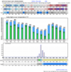
Alright I’ll start the coffee pot. Should set the stage for another pants busting gefs snow mean. Let’s see if we can beat widespread 4.5-inch means this time!
Forevertothee
Member
RAH
LONG TERM /THURSDAY THROUGH MONDAY/...
As of 400 AM Tuesday...
Surface high pressure will move into the area and then shift south
on Thursday with clear skies and light and variable winds.
Temperatures Thursday and Friday will be cooler with slightly below
normal highs in the upper 40s to low 50s. With light to calm winds
overnight along with mostly clear skies, temperatures will trend
colder each night. Thursday night expect lows to be in the 28-31
degree range while Friday will have some help from the upper level
tough exiting the Mid-Atlantic region bringing NW flow with another
round of chilly temps with lows Friday night in the 22-27 range. A
shortwave swinging across the Ohio valley could bring some light
isolated showers Friday afternoon across the northern Piedmont, with
little to no accumulation expected. After that, and Arctic airmass
extends into the Mid-Atlantic Saturday and much of Sunday. While the
forecast is dry for now, models have had a hard time of the timing
of the next weather system moving across the southern plains and
lower MS valley. One thing for for sure is that temperatures will be
cold. Temperatures are expected to be 10-15 degrees below average
with highs in the mid 30s to low 40s on Saturday and low to mid 40s
Sunday. Overnight lows will be chilly with temps expected to be in
the low to mid 20s Sat, and mid 20s to low 30s Sun night.
Sunday into Monday becomes a little unclear on the timing of the
next weather disturbance. The Euro has a surface low over the TN
valley Sunday afternoon then NE over the OH valley before moving
offshore the DELMARVA coast Monday afternoon. If this solution
occurs, or anything close to this track, central NC will stay in the
warm sector of the low resulting in no p-type issues and only
receiving rain between Sunday afternoon through early afternoon
Monday. The other scenario could be similar to the GFS, where a weak
surface low treks along the Gulf Coast during the day Monday, and
then offshore by Tuesday morning. With this track, the cold air will
stay in place as the arctic high could still be influencing much of
the US, resulting in some rain snow mix or just snow, Monday
afternoon through Tuesday morning. Thus low confidence on timing
and p-type for this period of the forecast. As time gets closer with
more Hi-res model solutions, more consistency with each model run
will increase confidence one way or another.
For now, have rain beginning in the far NW Piedmont late Sunday
night, with chance PoPs expanding across the region Sunday evening
and overnight hours, with chance rain/snow mix in areas across the
northern Piedmont. By Monday morning have rain/snow mix in areas
along and north of US64 and West of I85 returning to almost all of
the area with rain/showers Monday afternoon/ early evening.
Webberweather53
Meteorologist
It’s going to be a lot harder to get the Jan 8-12+ period to line up just right for us, but if we do, the ceiling is very high for any winter storm.
CNCsnwfan1210
Member
Parts of the Carolinas and SE VA got in on that one, nice!
Sent from my iPhone using Tapatalk
I was never on board for any particular winter storm due to the “clutter” of systems out ahead skewing the models. I knew when our recent severe weather cleared that models would start to decline for what was being shown. I was screaming at keyboard over the past week because I knew many would forget that golden rule. With that said, we are entering climo so yea it’s gonna get cold so chances will exist esp for the mountains and foothills we just need CAD to save everyone else imo. Furthermore, the pattern is eventually gonna favor ice and mix when we get some cold dry air locked in on the eastern slopes with some snow chances. But for most, I see a sloppy plethora of Ptypes not all snow events. Just my take
Brent
Member
Webberweather53
Meteorologist
Winter storm threat around the 8th thru the 12th is very real. Seeing all the right things for this range. Suppressed look with an active tropical jet & major cold sweeping south. Could be a doozy. Would much rather see this at this range than a fantasy storm.
Agreed. I still like this period a whole lot more than the first week of the month. Low floor, but a really high ceiling in the snow department
Webberweather53
Meteorologist
CNCsnwfan1210
Member

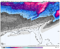
6z GFS came in hot, this is what we need to root for!
Sent from my iPhone using Tapatalk
rburrel2
Member
Webberweather53
Meteorologist
Webberweather53
Meteorologist
WXinCanton
Member
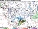
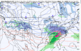
For entertainment purposes: 6z GFS Kuchera map


