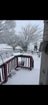
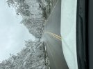
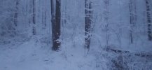
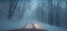
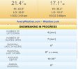
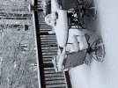
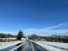
I largely agree there. Unfortunately, warm ground temps AND above freezing surface temps are a real killer, and it seems like we never get below freezing snow anymore, so it’s a big issue lol.Ended up with 2 inches here. Although I’m sure warm ground temps played a little part the biggest issue my area had was actually getting to freezing. Majority of the event was above freezing until about the last hour of snowfall and by then the best rates were gone. I saw lots of reports further south of 4-8 inches so ground temps were easily overcome with heavier rates and temps below freezing during the heaviest snowfall. My personal opinion is ground temps can play a part but are overrated when the snow is heavy enough and 2 meter temps are below freezing. Congrats to everyone who scored big amounts that didn’t get in on the action last year!
-
Hello, please take a minute to check out our awesome content, contributed by the wonderful members of our community. We hope you'll add your own thoughts and opinions by making a free account!
You are using an out of date browser. It may not display this or other websites correctly.
You should upgrade or use an alternative browser.
You should upgrade or use an alternative browser.
Wintry Jan 2-4 2022 Winter Weather Event/Obs
- Thread starter SD
- Start date
LickWx
Member
Jesus . Once I hit 401 it was different world . Like started dumping snow . I was seeing 0 accum then boom got up and it accumulated . Geez! Gon get some good pictures from the gardens in louisburg
LickWx
Member
wow lol. Not even the cars in Zebulon are getting covered but then up here it’s all covered .
buckinbronco
Member
I live on the Cherokee/Forsyth line and there was only a tiny amount of slush on the cars when I woke up this morning. We were always right on the line according the models so it makes sense.Congrats to everyone who saw at the very least some flurries. I do not believe my area saw anything, but I was sleeping through the worst of it.
@ForsythSnow what did you end up getting?
smast16
Member
Clouds are thinning and its getting bright. Nothing left on the pavement, and i'm seeing grass poking through.
#le Sigh.
#le Sigh.
I wonder if we’ll ever see precipitation fall below freezing again?
ForsythSnow
Moderator
Sleet, 5 mins of flakes, then it went to rain snow mix at the back end. Most I had was a very slight slush on cars and elevated surfaces. The real story was the winds, as those were some of the most intense winds in a storm since tropical storms that have passed through here.Congrats to everyone who saw at the very least some flurries. I do not believe my area saw anything, but I was sleeping through the worst of it.
@ForsythSnow what did you end up getting?
Ward Cleaver
Member
The sun is out and the snow show is over here 10 miles north of Greensboro. This was an overperformer but not compared to what the models were singing. Rather, it was an overperformer compared to RAH and local mets’ expectations.
A solid six hours of heavy, large flakes. In more ideal ground conditions, I could have easily ended up with 6” to 8”. But I’ll take my couple of inches of snow and be thankful for it.
A solid six hours of heavy, large flakes. In more ideal ground conditions, I could have easily ended up with 6” to 8”. But I’ll take my couple of inches of snow and be thankful for it.
ChattaVOL
Member
Dewpoint Dan
Member
Why does everyone always talk about Roxboro ? What about Yanceyville or Oxford ? What's so special about Roxboro ?
BHS1975
Member
I largely agree there. Unfortunately, warm ground temps AND above freezing surface temps are a real killer, and it seems like we never get below freezing snow anymore, so it’s a big issue lol.
Yep used to get snow and sleet in the teens and 20s.
Sent from my iPhone using Tapatalk
GeorgiaGirl
Member
Congrats to all that saw snow today and last night. Wet snow can make for a picturesque landscape, and I really would like to be able to experience that again at some point.
I wonder if there was some snow to wrap things up in NW GA where I have some family...didn't feel as if there was going to be, but maybe there was. What I said in Whamby yesterday still stands though...a random trip to NE GA would've been fun.
The wind earlier today when I had just woken up was absolutely crazy.
I feel like the rain/snow line used to be 95 and we were on the good side usually, but the past 4-5 years it sure seems like it’s been downtown Raleigh thats the dividing line and we’re just slightly on the wrong side of it every time.
It's funny that you say this. I've thought the same thing lately. When we used to get winter storms around here when I was younger, I remember Greg Fishel saying about 95% of the time that the rain/snow line was going to be I95. The last few years I have been watching cold rain/frozen slop fall while snow piles up from Raleigh North and West.
Edit: The Johnston/Wake line is just the pits when it comes to snowfall.
Last edited:
ajr
Member
jealous!View attachment 101641Not a pilot or meteorologist, but just went for a quick walk around Beach Mountain (~4600-4700 ft) and it looks like freezing fog with rime ice on the trees. Just beautiful
Shaggy
Member
I lied. I did get to see some snow just now as the first band slipped by. From. 62 at 8am to snow at 2pm. Not bad
Glad for all of you who saw snow. Fell asleep waiting on it to get here and missed seeing the flakes fly.
In Jasper, GA, where I am, light dusting on roofs and cars. Drove to Tate … little more snow. Drove towards Big Canoe. Not much there at entrance. However up in elevation on Mt. Oglethorpe was a little heavier dusting to maybe 2 inches from where I drove. Very pretty to look at. Dahlonega very little from what I heard.
Interesting to see the haves and have nots. Very scattered on my drive earlier today.
Hoping we all can cash in later … just shows you how quickly the weather can change. And why the study of it is very cool!
Jessy89
Member
I lied. I did get to see some snow just now as the first band slipped by. From. 62 at 8am to snow at 2pm. Not bad
Any accumulation or just flurries
Sent from my iPhone using Tapatalk
accu35
Member
It snowed for 10 minutes at the house last night. That’s a win for me
Shaggy
Member
Just a flurry. Snowed better at my.house so atleast.my kid got to see some.snow falling. Still have the best part of the band to go if it will hold togetherAny accumulation or just flurries
Sent from my iPhone using Tapatalk
The video was shot 1 mile from my sister's in Fort Walton Beach, Fl
That dividing line used to be at just south of Fuquay Varina but as you stated for about the past five years or so the dividing line has shifted north. I did end up seeing a rain/snow mix turn into around thirty minutes of snow before ending. It is frustrating for snow lovers to see the changes that are taking place in local climatology in our neck of the woods.I feel like the rain/snow line used to be 95 and we were on the good side usually, but the past 4-5 years it sure seems like it’s been downtown Raleigh thats the dividing line and we’re just slightly on the wrong side of it every time.
Jessy89
Member
The video was shot 1 mile from my sister's in Fort Walton Beach, Fl
That’s where we love to vacation at
Sent from my iPhone using Tapatalk
I saw thunder snow coming up 226 at Little Switzerland. Wind was blowing hard couldn't see the road had to stop at Wal-Mart in grassy creek for a bit. There was about 4 inches on the parkway with about 3 on the road. I'll post pics when I get home. Hope u guys down east saw some flakes.
smast16
Member
I was happy with my melty snow till i saw this.
#newlyaddedignore ? ? ?
Good to hear some folks got some good accumulation, at least for a bit. No live obs from me today. Had to drive from Wilmington area back to Raleigh.
Biggest obs for me was the winds. 40 east of 95 is usually a pretty laid back (almost boring) drive, but today the gusts were howling and I was constantly fighting the steering wheel, especially over bridges. Saw a couple high profile vehicles swerve pretty close to the median.
I peaked at the this thread before leaving, with high hopes to see some heavy white stuff in the Triangle just before it ended. Love driving through a changeover, and was hoping to see one of those where you go from a dreary slop to a white pasting within a few miles. Anyway I didn't see majority frozen until 540, right about the time I saw blue in the distance. 5 minutes later, it was flurrying with the sun out.
Here's my 'snow' pic...
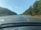
NOT the changeover I wanted. You can't see it but there were flurries falling with full sun out. Or at least they were for a few seconds before probably melting from sun rays. Or maybe I hallucinated it? ?
Anyway, I glad some of you in the triangle posted some obs/pics of white stuff, cause it sure isn't around anymore.
Biggest obs for me was the winds. 40 east of 95 is usually a pretty laid back (almost boring) drive, but today the gusts were howling and I was constantly fighting the steering wheel, especially over bridges. Saw a couple high profile vehicles swerve pretty close to the median.
I peaked at the this thread before leaving, with high hopes to see some heavy white stuff in the Triangle just before it ended. Love driving through a changeover, and was hoping to see one of those where you go from a dreary slop to a white pasting within a few miles. Anyway I didn't see majority frozen until 540, right about the time I saw blue in the distance. 5 minutes later, it was flurrying with the sun out.
Here's my 'snow' pic...

NOT the changeover I wanted. You can't see it but there were flurries falling with full sun out. Or at least they were for a few seconds before probably melting from sun rays. Or maybe I hallucinated it? ?
Anyway, I glad some of you in the triangle posted some obs/pics of white stuff, cause it sure isn't around anymore.
Avalanche
Member
Dang. Probably best spot of this storm. What were totals there bedor you left?
WeatherNC is a master at picking the best spots to chase.Dang. Probably best spot of this storm. What were totals there bedor you left?
Webberweather53
Meteorologist
Love all the pictures, video, and comments in here. Will take me a lot of time to sort through it all tomorrow. Hope to have something finalized by tomorrow evening or so. Will also add the other trace event earlier last month as well
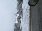
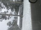
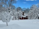
 As far as for my area it was quiet incredible the difference in just a few miles up into bluff park. My house apparently sits down in a little hole because we only had a light dusting this morning in areas.
The majority of bluff park looked like a winter wonderland with the trees and what looked like an inch or inch and a half in many spots. These are the pics from bluff park. Obviously the warmer ground hurt me, but I also mixed with sleet for the majority of the first hour and totally whiffed on the second band. I needed high intensity to even get the dusting I received during the peak of the event.
blueheronNC
Member

