-
Hello, please take a minute to check out our awesome content, contributed by the wonderful members of our community. We hope you'll add your own thoughts and opinions by making a free account!
You are using an out of date browser. It may not display this or other websites correctly.
You should upgrade or use an alternative browser.
You should upgrade or use an alternative browser.
Wintry Jan 2-4 2022 Winter Weather Event/Obs
- Thread starter SD
- Start date
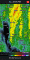
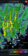
Yeah I'm just east of Cedartown on that and I've been watching it shift in start a loop wondering if going to get in on that swing aroundSick deformation band beginning to form View attachment 101437
Lostnthaweather85
Member
Dewpoint Dan
Member
Down to 32 here. Just windy and dry.
ForsythSnow
Moderator
Winds picking up and dropping even faster. 44.4
Snowflowxxl
Member
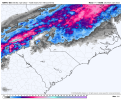
HRRR and RAP picked up on the defo band. Coming to take down everything in its path.
I got feeling I maybe one of those in about a hour as it slides just a little tiny bit more southward as it turnsLook at those returns. That heavy band is pivoting over some very lucky people!
NBAcentel
Member
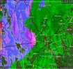
Right on cue, almost 3am…?Rotation has frozen precip headed straight towards Hotlanta.
View attachment 101439
I'm midway "Between" Atlanta and Athens and the lastest HRRR and RAP along with the lastest obs have forced me into brewing a pot of coffee!HRRR and RAP picked up on the defo band. Coming to take down everything in its path.
This wind is legit as bad as any tropical system I've been through here, I can't even believe it.
I would say that overperformed a little
Wow!!! I witness worst but the wind is crazy right now!!! Only to get worst as the ULL passes!This wind is legit as bad as any tropical system I've been through here, I can't even believe it.
Snowflowxxl
Member
Wind is giving me Hurricane Zeta vibes from 2020 other than missing the occasional 65 mph gust and power out.
NBAcentel
Member
Uhh that’s not given the hrrr has a maturing sting jet to the east laterWind is giving me Hurricane Zeta vibes from 2020 other than missing the occasional 65 mph gust and power out.
Showmeyourtds
Member
Oh stop with this nonsense!
The 6z HRRR just unleashed on the ATL. Take shelter
I believe it!!! Hopefully that will be the highest gust for day!I checked the NWS obs for the airport, they recorded tropical storm force wind gusts an hour ago.
I checked the NWS obs for the airport, they recorded tropical storm force wind gusts an hour ago.
No joke, we've all been through numerous tropical systems here, and it feels like it.
LovingGulfLows
Member
- Joined
- Jan 5, 2017
- Messages
- 1,499
- Reaction score
- 4,100
Imagine heavy snow with these winds....very blizzard like conditions at times.
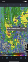
mPing report of sleet in downtown Atlanta.
Lostnthaweather85
Member
Tornado warning in South Carolina right now. Go figure.
mPing report of snow/grapuel near Newnan.
That is south of me let me check out at the airportmPing report of snow/grapuel near Newnan.
BufordWX
Member
Lostnthaweather85
Member
Bout to get what will likely be my heaviest snow of the event. Gonna bundle up and take a walk through the woods and down the road.
Showmeyourtds
Member
I’m 73.6% positive I just had sleet pellets get thrown up against my windows. Not totally sure tho. Wind is about to blow the place down it seems. Temp on the PWS is 38.7
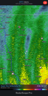
Double lightning alertLightning alert!View attachment 101445
Snowflowxxl
Member
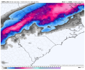
7z HRRR and RAP. I'm done posting clown maps for this event.


campamy
Member
This is tough seeing snow snow all around and just barely having changed over here. Seriously worried about accumulations imby.
Snowing in Douglasville! Ground report! The wind is so crazy out here!!
Those look exactly like the 00Z NAMs.
ForsythSnow
Moderator
The wind really is something else. On the NE side of the low and it's just blasting. As soon as it gets to our east it's showtime I think.Snowing in Douglasville! Ground report! The wind is so crazy out here!!
ga_ben
Member
Snow/sleet mix on Cobb/Paulding line.
Man, don't stop posting them now that you woke me up.7z HRRR and RAP. I'm done posting clown maps for this event.


Snowflowxxl
Member
Its pouring here, wasting good returns!

