Everybody always gets nervous before showtime. We are good
-
Hello, please take a minute to check out our awesome content, contributed by the wonderful members of our community. We hope you'll add your own thoughts and opinions by making a free account!
You are using an out of date browser. It may not display this or other websites correctly.
You should upgrade or use an alternative browser.
You should upgrade or use an alternative browser.
Wintry Jan 2-4 2022 Winter Weather Event/Obs
- Thread starter SD
- Start date
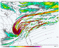
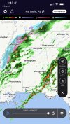
I am interested to see this system start amping up in the next few hours. It should start up soon. I hope lol. View attachment 101182
Good looking radar to me
NBAcentel
Member
But MEG reported 79 yesterday how can snow stick in that area?Some West TN reportsView attachment 101180
And their soil temperatures weren’t much different than the rest of the southeast.
DadOfJax
Member
Watching the webcams in Oxford, MS for an idea on changeover. Good cams from Ole Miss…
 livecam.olemiss.edu
Quad Live Cam | Ole Miss
Dewpoint Dan
Member
And its snowing there in the middle of the day ! So it should be even easier for the snow to stick further east tonight.And their soil temperatures weren’t much different than the rest of the southeast.
NBAcentel
Member
HRRR looks slightly less amped/a tick south
Glad we buried that bad science in under 72 hours. I stand by ground temps being the least important thing when forecasting winter weather.But MEG reported 79 yesterday how can snow stick in that area?
HSVweather
Member
The I40 west of River has an accident on it here, TDOT camsWatching the webcams in Oxford, MS for an idea on changeover. Good cams from Ole Miss…
Quad Live Cam | Ole Miss
livecam.olemiss.edu
Smartway
 smartway.tn.gov
Let's see where this goes!!ULL slightly more south this HRRR run so far View attachment 101183
I mean there will obviously be some melting if the ground is warm but there's more to itGlad we buried that bad science in under 72 hours. I stand by ground temps being the least important thing when forecasting winter weather.
olhausen
Member
Downeastnc
Member
HRRR looks slightly less amped/a tick south
Those of us in central and eastern NC gotta hope it trends back closer to what we saw yesterday afternoon if we want to see more than some token flakes at the end....less amped and the low tracking ILM to Lookout would be nice to see this run....
Psalm 148:8
Member
- Joined
- Dec 25, 2016
- Messages
- 344
- Reaction score
- 789
Dig you pig!!??. Someone had to say it! Hoping a south trend helps me get in the game even if just a few flurries… so what does this new hrrr actually mean? Draw in more cold air? Warm air? Precip placement?ULL slightly more south this HRRR run so far View attachment 101183
I’m liking where I’m sitting right now with the deformation band .. looks absolutely gorgeous on the HRRRThose of us in central and eastern NC gotta hope it trends back closer to what we saw yesterday afternoon if we want to see more than some token flakes at the end....less amped and the low tracking ILM to Lookout would be nice to see this run....
Not much difference for Us in AL, GA.Dig you pig!!??. Someone had to say it! Hoping a south trend helps me get in the game even if just a few flurries… so what does this new hrrr actually mean? Draw in more cold air? Warm air? Precip placement?
Agreed, however It doesn’t take long to cool the soil to a depth that supports snow/ice sitting on top of it.I mean there will obviously be some melting if the ground is warm but there's more to it
NBAcentel
Member
Basically what arc said, not much of a change, makes a bigger impact east of the mountainsDig you pig!!??. Someone had to say it! Hoping a south trend helps me get in the game even if just a few flurries… so what does this new hrrr actually mean? Draw in more cold air? Warm air? Precip placement?
NBAcentel
Member
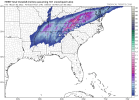
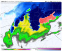
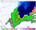
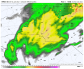
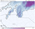
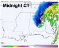
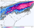
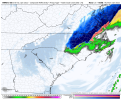
Can you show when it’s over wake? .. this will be more than your average flurries .. this will look like a snow squall type of feelHard not to get excited when the HRRR has been extremely consistent on this burst of snow under the cold pocket aloft for several runs in a row View attachment 101188View attachment 101189View attachment 101187View attachment 101186
Psalm 148:8
Member
- Joined
- Dec 25, 2016
- Messages
- 344
- Reaction score
- 789
Well poo… cause I think me and you are about on the same exact latitude lineNot much difference for Us in AL, GA.
Yea I don’t feel completely hopeless rn. If we get under that band as it pivots and switch to all snow we could get a nice dusting for sure.Hard not to get excited when the HRRR has been extremely consistent on this burst of snow under the cold pocket aloft for several runs in a row View attachment 101188View attachment 101189View attachment 101187View attachment 101186
IDK. There's just something special when every flake that falls sticks to frozen ground. It's the difference between some slush on the car tops and mulch and snow-covered roads in light events.Agreed, however It doesn’t take long to cool the soil to a depth that supports snow/ice sitting on top of it.
Psalm 148:8
Member
- Joined
- Dec 25, 2016
- Messages
- 344
- Reaction score
- 789
NBAcentel
Member
Psalm 148:8
Member
- Joined
- Dec 25, 2016
- Messages
- 344
- Reaction score
- 789
Whoops… first time posting a pic.. but not something you see everyday
Absolutely, I don’t expect accumulation here, but a it will be nice to see a decent burst of snow falling in the daytimeHard not to get excited when the HRRR has been extremely consistent on this burst of snow under the cold pocket aloft for several runs in a row View attachment 101188View attachment 101189View attachment 101187View attachment 101186
- Joined
- Jan 23, 2021
- Messages
- 4,603
- Reaction score
- 15,199
- Location
- Lebanon Township, Durham County NC
I *think* for the immediate(ish) triangle area:
I think RAH has the right idea of at least flakes north of 64. I think any accumulation is N&W of of say an area bounded by NC Highway 86 in Orange County on the west side, roughly north of 85 in Durham County and then maybe north of NC Highway 98 in Wake County bounded by either Highway 1 or 401 on the eastern end. I actually think the biggest area of question is bounded by 540 to the south and 98 to the north in Wake. They could do better than I anticipate.
I also think tomorrow is going to be much like a summer thunderstorm day. We dont know who yet but someone is gonna end up under a cell of heavy snow around the changeover time.
It’s an elevated bridge which cools very quickly given there is cold air both on top of and underneath the bridge. You better believe the fact that it was 75 yesterday will keep roadways relatively more clear than they would be if it was 25 yesterday, though. That’s not saying it can’t stick, I’m just saying it will be harder and it will melt quicker. The NWS talks about this in their forecast discussions.And their soil temperatures weren’t much different than the rest of the southeast.
ghost1
Member
Moderate snow… Tunica MS… 29F
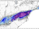
Here you goWish they had kuchera on wxbell for the hrrr butView attachment 101193View attachment 101194
Snowflowxxl
Member
Soil temps? These are going to be roof collapsing pancakes falling out of the sky, no need to worry!
NBAcentel
Member
HSVweather
Member
Central AL forecasted road temperatures at 7am tomorrow from fox6
NoSnowATL
Member
JLL1973
Member
It was
37
That gonna move through the shoals
What's your temp now?Like to see your observations being that you are just west of me!

