Iceagewhereartthou
Member
My memories from it last year was it was a trash model. Horrible with precip amounts, placement, and type.I thought the GRAF was a pretty decent short range model…
My memories from it last year was it was a trash model. Horrible with precip amounts, placement, and type.I thought the GRAF was a pretty decent short range model…

I can't remember... did December 2017 surprise people on the northern fringe at go time? Like were there some people expecting nothing who got accumulations?
Interesting to see Euro still the most SE while the Euro AIFS trended NW.
The AI models were right, but that doesn't mean a stronger than modeled fronto band won't streak across the northern edge of lift at go time and drop .2-.3 of liquid. We've seen it happen numerous times in the past... and not show up on modeling until it's developing on radar in real time.
I'm not saying it'll happen, but i'm saying it can still happen.

Brad P’s current thoughts!
Yall noticed too I see!Brad using AI to write his posts and leaving in the prompt…
Just saw that .... wow, talk about lazy.Brad using AI to write his posts and leaving in the prompt…
Still up in the air.anyone have thoughts on Atlanta seeing much of anything
Lol he just pulled it100% chance of chat gpt
I’m still thinking the chance of snow in Atlanta is extremely low. Gfs/gefs trending away from their previously snowy forecasts has solidified that for me.anyone have thoughts on Atlanta seeing much of anything
With the data shifts, I'd say somewhere betwixt none & slim.anyone have thoughts on Atlanta seeing much of anything
Yeah it kinda feels like we need an even bigger shift this time around than last year and even then, areas in the southern half of the metro only got .75-1.5 inches of snow with much colder temperatures.I’m still thinking the chance of snow in Atlanta is extremely low. Gfs/gefs trending away from their previously snowy forecasts has solidified that for me.
It’s interesting to see the 12z deterministic AIFS have a NW shift, but would like to see support from AIFS-ENS & the conventional ECMWF suite as well.
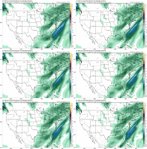
Notable QPF increase on the 12z AI-EPS. Central SC going from near 0.01 to near 0.25 in one run
View attachment 183807
View attachment 183808
It brings the warmth with it.This is insane! Wouldn’t want many more jumps like that for real.
It brings the warmth with it.
Huge? Pardon me but that is a bird fart
Was expecting half an inch at most. 12 hours before the storm GSP triggered warnings for the foothills. Got almost 9in in Marion at my house.I can't remember... did December 2017 surprise people on the northern fringe at go time? Like were there some people expecting nothing who got accumulations?
Damn, got called out so fast, Brad's post was poofedBrad using AI to write his posts and leaving in the prompt…
Huge? Pardon me but that is a bird fart
For southern GA? 2" is like a foot for you...just how much snow do you think southern GA to the Panhandle gets?
Huge in the sense that it is quite a rare event in those parts even if it is an inch or soHuge? Pardon me but that is a bird fart
