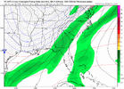
More than Charlotte and GSP, these daysFor southern GA? 2" is like a foot for you...just how much snow do you think southern GA to the Panhandle gets?

More than Charlotte and GSP, these daysFor southern GA? 2" is like a foot for you...just how much snow do you think southern GA to the Panhandle gets?
It's a big event for Raleigh too...1-2 inches for me in North Central Alabama is a big event in my book.

This is insane! Wouldn’t want many more jumps like that for real.
Weatherbell's graphics painted a little better picture.As others have pointed out Euro AI ens was a little more frisky...here is the snow mean ticking up
View attachment 183811
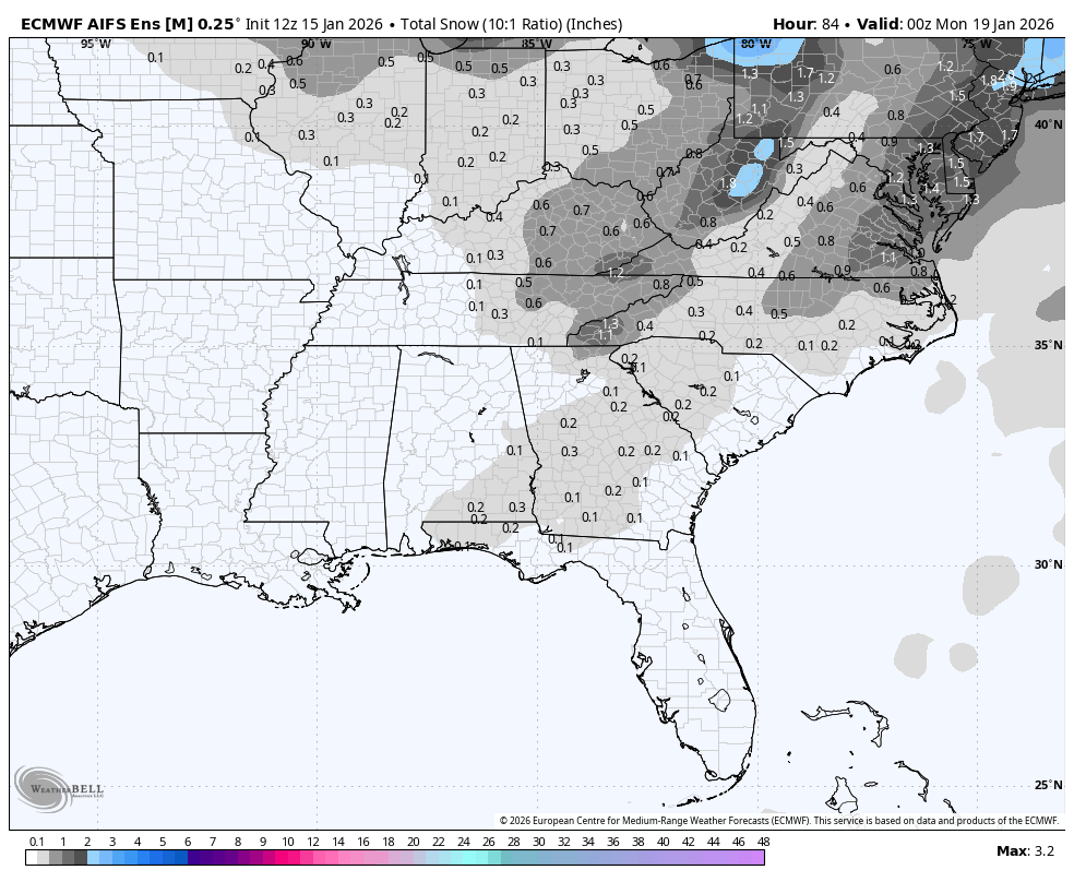
richmondAs others have pointed out Euro AI ens was a little more frisky...here is the snow mean ticking up
View attachment 183811

")


They were still saying an inch or less up until we were north of 3". Ended up with 12" and no power. The NAM was the first to catch on. Snow fell for 26 hours.I can't remember... did December 2017 surprise people on the northern fringe at go time? Like were there some people expecting nothing who got accumulations?
I’m right down the road from you Parker, but I am just not seeing it this time around for central AL. Would take one heck of a NW shift now that GFS folded to Euro.I’m sure it does for a lot but going to be very difficult for the temps to not be cold for a lot of us back here in central Alabama

lol I was eading thru the old forum about that. grit was still the man back then! the HRRRRR picked up on it last minute on the 8th i believe after every other model lost it for the most part.I can't remember... did December 2017 surprise people on the northern fringe at go time? Like were there some people expecting nothing who got accumulations?

Some of that up toward MBY I think is a very small Saturday disturbance, don’t believe it’s necessarily bombing out or anything up the coast.Weatherbell's graphics painted a little better picture.
And it looks like the signal consolidates over the evolution meaning more EPS members have the same evolution with less spread? Maybe?
I’m right down the road from you Parker, but I am just not seeing it this time around for central AL. Would take one heck of a NW shift now that GFS folded to Euro.

Not by south Georgia standards!Uh oh I made people mad. I understand what y’all are saying but in a pure meteorological sense that is a light snow event.
Looks a lot like the Google AI or whatever it's called, Weathernext I thinkWeatherbell's graphics painted a little better picture.


Brad P’s current thoughts!
Until proven otherwise using the eps mean as guidance is still the way to go
That's an intensity build trend as well
That's an intensity build trend as well

GuidanceUntil proven otherwise using the eps mean as guidance is still the way to go


Keep digging more regardless of the positive tilt and yall will be fine. Much better timing of cold air and precip the further west you are in this setupFoothills region , we are just a little to far away from true moisture source on most models. Plus, the angle in which its coming from is not ideal. Need a negative tilt which is not in the cards at this point. The fight is amongst models is east of here Triad east.


It’s basically the same thing in his latest twitter/x post minus some of the tells!did someone screenshot it before he yoinked it?
Some of the Foothills regions will be but back here in Northern Foothills we are dependent on moisture banking up against the Mountains in these setupsKeep digging more regardless of the positive tilt and yall will be fine. Much better timing of cold air and precip the further west you are in this setup View attachment 183834View attachment 183835
im thinking those eps means are actually just rain snow mix at this point here
still think its mixed here for us even on colder euro; the BL is getting warmer and warmer. wasn't the mean like 40+F at 2m?