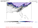
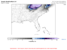
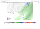
@jackendrickwx or @bouncycorn or anyone else that has access to Weathernext2 (the Google AI model), is there a more detailed map of accumulations and more regional? Really looked like it was very similar to what the Euro AI was showing
@jackendrickwx or @bouncycorn or anyone else that has access to Weathernext2 (the Google AI model), is there a more detailed map of accumulations and more regional? Really looked like it was very similar to what the Euro AI was showing


Watching the 12z roll in now on stormvista. @bouncycorn has greater capabilities than me for this. I am not a model whiz.@jackendrickwx or @bouncycorn or anyone else that has access to Weathernext2 (the Google AI model), is there a more detailed map of accumulations and more regional? Really looked like it was very similar to what the Euro AI was showing
Yeah not looking for specifics but a better look at the footprint which it and the Euro AI seem to be similar. Will be a great test of how it handles 2m temps in this scenario and if it's off, since it's AI, one would think it would "learn" and resolve that going forward.Watching the 12z roll in now on stormvista. @bouncycorn has greater capabilities than me for this. I am not a model whiz.
Something I will note about whatever it shows at 12z (or any z) is that it is a pretty coarse, 64 member ensemble. It is good, but I am not going to be trusting its 2m temps verbatim. I don't trust its snow maps either necessarily, i just don't know if it can resolve a borderline dynamic cooling scenario like this. Maybe it can, we'll see
65% to 20% in one run
A remarkably similar northwestern jump to the AIFS from the Weathernext at 12z. New on top
View attachment 183847
View attachment 183848
I should note that the 850s do progress eastward with the ensuing frames. Just trying to show the QPF jump, I know the thermos are bleh in general
That's the right take here I think. And they can still shift further inland with the rest of them. The ECMWF is the stickler right nowThe AI models are great at 5h, but I haven't seen any data saying they are the best in the world at predicting overrunning/WAA precip totals. Just keep that in mind.
Both can be true... AI models nailed 5h... and we have more precip than they've been showing from overrunning.
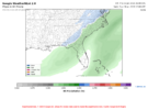
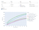
The AI models are great at precip. In fact, the purple line on this error chart "FGN" is the Weathernext2 model. Beats IFS HRES and IFS-EPS.The AI models are great at 5h, but I haven't seen any data saying they are the best in the world at predicting overrunning/WAA precip totals. Just keep that in mind.
Both can be true... AI models nailed 5h... and we have more precip than they've been showing from overrunning.
It’s not Sunday evening yet, still time for this to go anywhere!Be honest. Any hope for wnc at this point or should I stop checking every hour and forget about it?
light overrunning precip at mid-lattidudes? Or all precip in the Northern Hemisphere?The AI models are great at precip. In fact, the purple line on this error chart "FGN" is the Weathernext2 model. Beats IFS HRES and IFS-EPS.
(lower is better)
View attachment 183850
Always something to keep in mind with verification scores, too (which tend to be at h5). Something can be the best at h5 and not necessarily be the top dog translating that to the surface (and vice versa). Of course, all else being equal, being right in the mid / upper atmosphere should translate to being right at the surface, but all else is not necessarily equal.The AI models are great at 5h, but I haven't seen any data saying they are the best in the world at predicting overrunning/WAA precip totals. Just keep that in mind.
Both can be true... AI models nailed 5h... and we have more precip than they've been showing from overrunning.
Also January 28-29, 2014.
ha, dec 17 and jan 14. meet in the middle, perhaps?
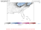
A nice increase on the snow map for the 12z WxNext. Now explicitly showing a 1-2" swath along a similar path to several EPS member
View attachment 183851
The AI models are great at precip. In fact, the purple line on this error chart "FGN" is the Weathernext2 model. Beats IFS HRES and IFS-EPS.
(lower is better)
View attachment 183850
A nice increase on the snow map for the 12z WxNext. Now explicitly showing a 1-2" swath along a similar path to several EPS member
View attachment 183851
@bouncycorn this is already like a hundred mile+ jump from the previous WeatherNext solution... earlier you were saying that this kind of jump just doesn't happen within 80 hours on WeatherNext/AIFS -- is this scenario maybe the kind of outlier case that these models are struggling with and this is just as surprising to you?
15z SREF snow mean. Gives a good indication of where the best accumulations could occur, imo.
View attachment 183859
Yeah I definitely agree there. On top of this, EPS has been shifting north as well so I don't think it's too much longer until Euro OP folds.Well predicting precipitation in general across the board is not the same as predicting precipitation in specific waa/overrunning setups like this one. These broad brushed model skill analyses do not tell us anything about how they handle specific situations as these skill scores and biases are likely state dependent to some degree.
My hunch is if you re-ran these models for the overrunning events we’ve had since the mid-20th century, they would still undervalue the waa aloft at this range
Thus far, I am not impressed with how the AI models are handling this setup. They’re really just correcting to the more amped GFS/GEFS solutions from yesterday which a lot of people scoffed at because they were “bad” models.
These suites thus far have been struggling just as much as most other models, tho I think they are an improvement over the traditional euro which is stubbornly (& likely wrongly) too far south & east.
considering 2017 and 2014 are our top analogs, I absolutely love where I am currently in Atlanta it will tick nw
I just dabble here but seems like these models are good with severe weather but every time I’m lurking during winter threats the models are always so far out of agreement it’s insane.
As of now, this is a Deep South storm, but with this NW trend happening and especially now with the Euro then I wouldn’t rule out snow in areas further north. Let’s wait and see.also just want to say that given we can go from everything to nothing like last night, i don't think its smart to rule areas further north getting stuff
