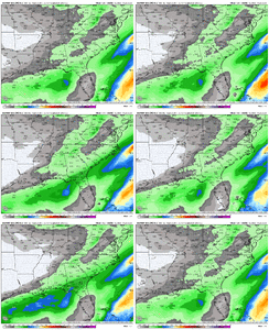
More than Charlotte and GSP, these daysFor southern GA? 2" is like a foot for you...just how much snow do you think southern GA to the Panhandle gets?
-
Hello, please take a minute to check out our awesome content, contributed by the wonderful members of our community. We hope you'll add your own thoughts and opinions by making a free account!
You are using an out of date browser. It may not display this or other websites correctly.
You should upgrade or use an alternative browser.
You should upgrade or use an alternative browser.
Jan. 17-18, 2026 SE Winter Weather Threat
- Thread starter RBR71
- Start date
It's a big event for Raleigh too...1-2 inches for me in North Central Alabama is a big event in my book.
accu35
Member
WolfpackHomer91
Member
This is insane! Wouldn’t want many more jumps like that for real.
Oh yea bring me 3 more like that. .25” Precip is nowhere near enough for even 1/2 inch in this setup
Sent from my iPhone using Tapatalk
packfan98
Moderator
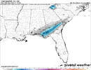
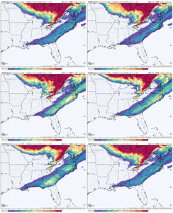
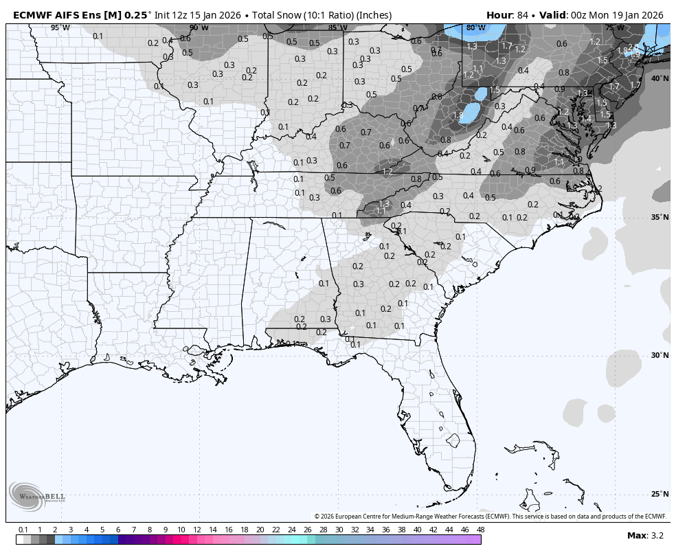
Weatherbell's graphics painted a little better picture.As others have pointed out Euro AI ens was a little more frisky...here is the snow mean ticking up
View attachment 183811
richmondAs others have pointed out Euro AI ens was a little more frisky...here is the snow mean ticking up
View attachment 183811
One big difference I've noticed between the AI models and deterministic models is the timing difference in precipitation. I'd wager that's also influencing temps. The GFS coming in a little later is giving temps a chance to drop overnight. But check out this change in precip arrival on the AIFS:
Attachments
They were still saying an inch or less up until we were north of 3". Ended up with 12" and no power. The NAM was the first to catch on. Snow fell for 26 hours.I can't remember... did December 2017 surprise people on the northern fringe at go time? Like were there some people expecting nothing who got accumulations?
ColdCoreLow
Member
I’m right down the road from you Parker, but I am just not seeing it this time around for central AL. Would take one heck of a NW shift now that GFS folded to Euro.I’m sure it does for a lot but going to be very difficult for the temps to not be cold for a lot of us back here in central Alabama
- Joined
- Jan 2, 2017
- Messages
- 1,566
- Reaction score
- 4,279
lol I was eading thru the old forum about that. grit was still the man back then! the HRRRRR picked up on it last minute on the 8th i believe after every other model lost it for the most part.I can't remember... did December 2017 surprise people on the northern fringe at go time? Like were there some people expecting nothing who got accumulations?
Edit: the storm came back to mesoscale models on the 7th(the day before). With the 3k nam, hrrr and the rgem leading the way from what im reading
one of your posts burrel
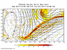
A nice band of snow showing up on the Hi-res NAM around lunchtime Friday up the I-85 corridor in SC. If it plays out like this I think the upstate could get a quick inch or two of snow as the heaviest burst comes through. Both the Hi-res NAM and RGEM are really slow to change over from rain to snow here, which I don't understand looking at the soundings. From what I see we should flip over to snow relatively quickly once rates pick up. We'll find out I guess.
Last edited:
Some of that up toward MBY I think is a very small Saturday disturbance, don’t believe it’s necessarily bombing out or anything up the coast.Weatherbell's graphics painted a little better picture.

HailCore
Member
And it looks like the signal consolidates over the evolution meaning more EPS members have the same evolution with less spread? Maybe?
I’m right down the road from you Parker, but I am just not seeing it this time around for central AL. Would take one heck of a NW shift now that GFS folded to Euro.

Don’t ever forget 1/28/14 or even 12/8/17. I will say that the models right now look strikingly similar to 1/28/14 and I don’t even think we had a single model on our side then. At least we have the NAM and GFS still not far off.
I looked at the GEFS for Cullman and Huntsville just for fun and they have 5-7 members with accumulation, that is encouraging to see some that far north. I’ve been harping on this storm for awhile, so I’ve got to hang in until it truly is staring me in the face. We are down but not out yet!
That 12z EuroAI shift was fairly substantial but we need quite a few more. Hopeful the 18z NAM is still showing something.
Not by south Georgia standards!Uh oh I made people mad. I understand what y’all are saying but in a pure meteorological sense that is a light snow event.
I like seeing some of the darker gray stretch back to the west into Louisiana as well.
Tsappfrog20
Member
Probably wishful thinking but I don’t think this thing is done completely yet still will be watching the models to see what happens and hope for the best!
Sent from my iPhone using Tapatalk
Sent from my iPhone using Tapatalk
Looks a lot like the Google AI or whatever it's called, Weathernext I thinkWeatherbell's graphics painted a little better picture.

Still catching up on this, but I definitely see some limiting factors for central NC. Not only are temps a concern from a P-type standpoint, but they are also a concern from an accumulations standpoint. That combined with the diurnal timing isn’t doing us any favors. Rates will be important. Light snow at 33 degrees at midday just isn’t really going to cut it. I need to check soil temps, too, although at least it’s cooled down the late few days so they may not be terrible. It’s plausible we see 3-5” of snow fall from the sky and only see 1-2” stick.
On the plus side, it’s mid January, not late February.
On the plus side, it’s mid January, not late February.
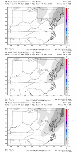
Let's just assume for the sake of conversation that the AIFS/ENS and Euro/ENS are not one run blips with some QPF increases. Wonder if they are just waking up to underdoing precip in general? H5 didn't look any better vs 0z to me, in fact looked worse on both OPs and ENS. Still several members with interesting solutions for many on this board:
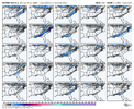
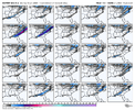
Whats interesting to me is I'd say about half of these are either further northwest or higher QPF than the OP euro.


Whats interesting to me is I'd say about half of these are either further northwest or higher QPF than the OP euro.
Brad P’s current thoughts!
did someone screenshot it before he yoinked it?
Until proven otherwise using the eps mean as guidance is still the way to go
im thinking those eps means are actually just rain snow mix at this point here
I’m always a little perplexed by the ensemble forecasting. I get the theory and I’m not saying they aren’t useful, but I often see them jump around just as much as their operational counterpart. Pretty sure the GEFS have followed the GFS with every single shift over these last couple days.
That's an intensity build trend as well
That's an intensity build trend as well
It absolutely is, just no more time to shift it back to Disney world
Pilotwx
Member
Foothills region , we are just a little to far away from true moisture source on most models. Plus, the angle in which its coming from is not ideal. Need a negative tilt which is not in the cards at this point. The fight is amongst models is east of here Triad east.
NBAcentel
Member
Keep digging more regardless of the positive tilt and yall will be fine. Much better timing of cold air and precip the further west you are in this setupFoothills region , we are just a little to far away from true moisture source on most models. Plus, the angle in which its coming from is not ideal. Need a negative tilt which is not in the cards at this point. The fight is amongst models is east of here Triad east.
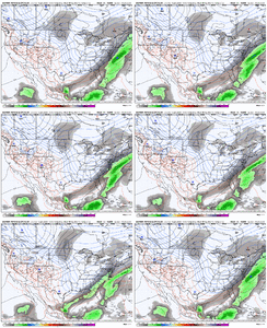
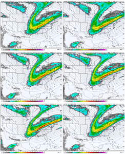
@jackendrickwx or @bouncycorn or anyone else that has access to Weathernext2 (the Google AI model), is there a more detailed map of accumulations and more regional? Really looked like it was very similar to what the Euro AI was showing
It’s basically the same thing in his latest twitter/x post minus some of the tells!did someone screenshot it before he yoinked it?
Pilotwx
Member
Some of the Foothills regions will be but back here in Northern Foothills we are dependent on moisture banking up against the Mountains in these setupsKeep digging more regardless of the positive tilt and yall will be fine. Much better timing of cold air and precip the further west you are in this setup View attachment 183834View attachment 183835
Not the mama
Member
Be honest. Any hope for wnc at this point or should I stop checking every hour and forget about it?
GeorgiaGirl
Member
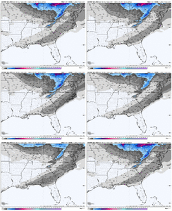
im thinking those eps means are actually just rain snow mix at this point here
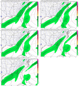
Eh, it isn't far fetched to think that the ensembles that all show snow are in the mid 30's and ones that aren't are in the 40's for central-south GA and SC (average mean temp at hr 78 is 37-39).
I count several whiffs without trying very hard that may well be rain or sunny/milky skies.
You can see a better precip response as well on the temp map in south GA.
still think its mixed here for us even on colder euro; the BL is getting warmer and warmer. wasn't the mean like 40+F at 2m?

