Area Forecast Discussion
National Weather Service Peachtree City GA
942 AM EST Sun Jan 16 2022
...Mid-Morning Forecast Update...
.UPDATE...
At the time of this writing, the dry slot is beginning to move
eastward out of the forecast area. Strong winds this morning have
led to instances of trees down and power outages scattered across
far north Georgia. Snow amounts of 2-4 inches have moreover been
reported, primarily in far northeast Georgia for now. The wedge
continues to hold strong with precipitation reinforcing it across
north Georgia and keeping temperatures near freezing. Bands of
moderate rain are moving towards northeast Georgia and will soon
overrun the wedge, and a transition to freezing rain is soon
expected in the northeast quadrant of the forecast area. The
combination of ice accumulation from this freezing rain and wind
gusts from 35-45+ kts in northeast Georgia and parts of the metro
will lead to an increase in downed trees and powerlines across this
area. Remember, please use caution and never drive or attempt to
move fallen powerlines.
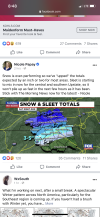
As the upper low over central Alabama approaches west Georgia, and
interesting observation to note is that temperatures are quite a bit
in south Alabama than in west Tennessee. This is because this low is
occluded to the point that cold air advection is wrapping around the
southwestern side of the low. This cold advection will lower
temperatures further as the low approaches, leading to the potential
for more snow than initially forecast in portions of west-central
Georgia and into the metro area. The Winter Weather Advisory has
been expanded further south as a result, and snowfall amounts have
been increased to 1 to 1.5 inches in the Atlanta metro area.


