That looks amazing!!ALL THIS COLD AIR IS WAITING TO BE RELEASED.
JUST GO AHEAD AND OPEN THE GATES AND SEND IT SOUTH
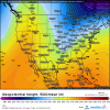
View attachment 11033
-
Hello, please take a minute to check out our awesome content, contributed by the wonderful members of our community. We hope you'll add your own thoughts and opinions by making a free account!
You are using an out of date browser. It may not display this or other websites correctly.
You should upgrade or use an alternative browser.
You should upgrade or use an alternative browser.
But then I see the reason no one mentioned the 6z GFS!! 3 apps runners , back to back to back, starting next weekend!That looks amazing!!

accu35
Member
6z gefs for next weekend system look great still. The mean looks little further south. Almost every member has snow in MS/AL on the backside. Don't focus on the OP runs this far out, look at the ens.
Fairly decent severe threat for TX, LA, AR, MS, and AL Friday night into Saturday ahead of the artic front. As for wintry wx, this scenario has played out countless times with artic fronts where post frontal precip type is a few hours of rain then predominantly zr/ip for an hour or two as the uppers dry out, and then the band dies over northeast MS /northwest AL/ southern middle TN. Aside from flurries I wouldnt count on any snow south of I-40 this weekend
Just being honest, this not our storm. Save your sanity for the following waves with an established cold airmass in place.")
Just being honest, this not our storm. Save your sanity for the following waves with an established cold airmass in place.
Last edited:
B
Brick Tamland
Guest
Nothing but rain here on the model runs next week. I am having doubts about this great pattern working out. But I get 10 inches of snow in early December pretty much out of the blue without a really great pattern. Go figure. I am starting to think we have no idea what setup and sypnotics will give us snow here anymore.


MEMBERS 6 AND 8 ARE BAD

MEMBER 19 IS GAME FOR LOTS OF PPL

MEMBER 19 IS GAME FOR LOTS OF PPL
Storm5
Member
Nothing but rain here on the model runs next week. I am having doubts about this great pattern working out. But I get 10 inches of snow in early December pretty much out of the blue without a really great pattern. Go figure. I am starting to think we have no idea what setup and sypnotics will give us snow here anymore.
You should probably take a break from the board . It’s gonna drive you crazy over the next few days
Sent from my iPhone using Tapatalk
ATLwxfan
Member
After looking at the 06z GFS this morning one can only conclude that it is active and cold. Nothing else can be extrapolated unless you are wishing or trolling.
Sent from my iPhone using Tapatalk
Sent from my iPhone using Tapatalk
Storm5
Member
Last nights EPS was a very cold run
Sent from my iPhone using Tapatalk
Sent from my iPhone using Tapatalk
Jessy89
Member
What is causing every storm on gfs to cut?
Sent from my iPhone using Tapatalk
Sent from my iPhone using Tapatalk
MONDAY THE 28TH AS SAID EARLIER IS LOOKING GOOD THIS RUN FOR NORTH CENTRAL BAMA, NORTH GA, NORTH MS. ALL OF TN PARTS OF THE CAROLINA'S AND ALL POINTS NORTH OF TN


Storm5
Member
We can’t get a consistent track with a system that’s 6-7 days away . It would benefit everyone if we did this one storm at a time . The OP runs are gonna be all over the place over the coming week. Whatever is showing currently between days 7-15 will 100 percent not be the final outcome .
Gonna be a long long week
Sent from my iPhone using Tapatalk
Gonna be a long long week
Sent from my iPhone using Tapatalk
FV3 SKIRTS NE MS, CENTRAL BAMA, N GA, SE SC, AND MIDD TENN ON SUNDAY THE 27th


Storm5
Member
FV3 lays down some good snow this coming weekend for Arkansas and tenn .

Sent from my iPhone using Tapatalk

Sent from my iPhone using Tapatalk
What is causing every storm on gfs to cut?
Sent from my iPhone using Tapatalk
Phasing.
I text you this last night. We are 7.5 hours into Monday and its already goingWe can’t get a consistent track with a system that’s 6-7 days away . It would benefit everyone if we did this one storm at a time . The OP runs are gonna be all over the place over the coming week. Whatever is showing currently between days 7-15 will 100 percent not be the final outcome .
Gonna be a long long week
Sent from my iPhone using Tapatalk
Sent from my SM-G955U using Tapatalk
Fountainguy97
Member
Guys if we ARE going to do this run by run let’s just focus on one system.
The closest one is the 20th. In fact it’s only 6-7 days out. So we can actually look at each run for trends with it.
That being said. The 20th storm is very amped up. I think our hope for it would be to see a less amped low pressure.
We have a 1040+ hp to work with in the 20th so a lot of us could definitely see some form of wintry weather. We just need a weaker low.
MichaelJ
Member
If there is a model out there that shows bad news, expect Tarheel to find it! It is the OP of the freaking GFS dude, it is going out of business because it was so bad, yet you keep posting it?
B
Brick Tamland
Guest
You should probably take a break from the board . It’s gonna drive you crazy over the next few days
Sent from my iPhone using Tapatalk
Nah, I am fine. I already got more than average with that one storm in December. I am just commenting on what I see now. Sure, things can change. I just think it is funny how that storm happened when we were not really in what is considered a great pattern, and now we have what is called a great pattern and the models are showing rain here. It's like having the number one seed in the NCAA tournament and losing in the first round.
Jon
Member
What is causing every storm on gfs to cut?
Sent from my iPhone using Tapatalk
For the 20th it’s a few things
-the energy is too strong (already a 1004mb now over Oklahoma)
-nothing to keep the energy south (no high pressure to suppress the low)
-orientation of the ridge isn’t ideal, which means this storm gets stronger, faster.
-also the energy is elongated, from New Mexico to Kentucky. This means the energy to the north of Kentucky can easily “pull” the system east, capturing it and essentially going inland. If this was a more organized wave it could possibly remain SE, but at the same time we would have to worry about a cutoff and that could create problems. The ideal solution would be a weaker shortwave.

After the 20th it’s pure chaos, model has no idea what to do with the energy. They’re cutting by chance. The pattern change wasn’t supposed to start until Jan 20 so I’ll say we are on track.

Sent from my iPhone using Tapatalk
ghost1
Member
I will be in east central Arky this coming wkend. Maybe I'll cash inFV3 lays down some good snow this coming weekend for Arkansas and tenn .
Sent from my iPhone using Tapatalk
You don't have a great pattern right now..... you wont have a great pattern for at least a few daysNah, I am fine. I already got more than average with that one storm in December. I am just commenting on what I see now. Sure, things can change. I just think it is funny how that storm happened when we were not really in what is considered a great pattern, and now we have what is called a great pattern and the models are showing rain here. It's like having the number one seed in the NCAA tournament and losing in the first round.
Sent from my SM-G955U using Tapatalk
Last edited:
Bro, you had 10 inches of snow already... Sheesh man, I’m begging for a inch down here. I feel like everyone up in that region is just in the bonus at this point anyways.Nothing but rain here on the model runs next week. I am having doubts about this great pattern working out. But I get 10 inches of snow in early December pretty much out of the blue without a really great pattern. Go figure. I am starting to think we have no idea what setup and sypnotics will give us snow here anymore.
Looking good. Did see a bunch of higher reports in Forsyth and Guilford (there are more but here's a good sample).Here's a preliminary map of the ice storm that struck NC late yesterday and early this morning merging data from NWS Local Storm Reports, CoCoRaHS, mPING, & person communication. For some parts of western NC, this is their 3rd significant ice storm of the winter & we're not even halfway thru our seasonal climo yet.
View attachment 10984
View attachment 10986
View attachment 10985
0450 AM FREEZING RAIN 2 NNE KERNERSVILLE 36.15N 80.06W
01/13/2019 E0.30 INCH FORSYTH NC 911 CALL CENTER
CORRECTS PREVIOUS FREEZING RAIN REPORT FROM
2 NNE KERNERSVILLE. TREE DOWN ON PINEY GROVE
ROAD IN KERNERSVILLE.
0256 AM FREEZING RAIN 1 SE WINSTON-SALEM 36.09N 80.25W
01/13/2019 E0.25 INCH FORSYTH NC 911 CALL CENTER
CORRECTS PREVIOUS FREEZING RAIN REPORT FROM
1 SE WINSTON-SALEM. A TREE WAS DOWN IN THE
ROADWAY AT 130 S GREEN ST IN DOWNTOWN
WINSTON-SALEM.
0354 AM FREEZING RAIN 4 N LEWISVILLE 36.14N 80.41W
01/13/2019 E0.20 INCH FORSYTH NC 911 CALL CENTER
CORRECTS PREVIOUS FREEZING RAIN REPORT FROM
4 N LEWISVILLE. A TREE WAS DOWN IN THE
ROADWAY ON THE 2400 BLOCK OF VIENNA - DOZIER
ROAD IN PFAFFTOWN.
0411 AM FREEZING RAIN 1 ENE RURAL HALL 36.24N 80.27W
01/13/2019 E0.25 INCH FORSYTH NC 911 CALL CENTER
CORRECTS PREVIOUS FREEZING RAIN REPORT FROM
1 ENE RURAL HALL. TREE DOWN ON CRESTBROOK
DRIVE IN RURAL HALL.
0743 AM FREEZING RAIN SUMMERFIELD 36.20N 79.90W
01/13/2019 E0.25 INCH GUILFORD NC PUBLIC
CORRECTS PREVIOUS FREEZING RAIN REPORT FROM
SUMMERFIELD. MULTIPLE TREES AND POWER LINES
DOWN IN SUMMERFIELD.
0744 AM FREEZING RAIN 4 NNE COLFAX 36.18N 79.99W
01/13/2019 E0.25 INCH GUILFORD NC 911 CALL CENTER
CORRECTS PREVIOUS FREEZING RAIN REPORT FROM
4 NNE COLFAX. MULTIPLE TREES AND POWER LINES
REPORTED DOWN IN OAK RIDGE.
Fountainguy97
Member
There is a lot of chaos in models right now.
Even only 84 hrs out.
This little system probably has track implications for the 20th. Although I don’t know what we would need it too do to give us a more favorable track for the 20th.

Even only 84 hrs out.
This little system probably has track implications for the 20th. Although I don’t know what we would need it too do to give us a more favorable track for the 20th.
Stilll have ice on all the trees up here by airport this morning. Makes for a beatifull landscape.
Wulfer
Member
Chattanooga is still sitting at 0 inches. However, Sunday's system might give us a shot.
BHS1975
Member
Stilll have ice on all the trees up here by airport this morning. Makes for a beatifull landscape.
Those minor icing events used to be common here. Not so anymore. I don’t even remember when the last one was.
Sent from my iPhone using Tapatalk
tennessee storm
Member
good question jon... but most time when we see pattern change... first or second storm will cut.... but each time... it gets further east... like it builds snow pack first further west first... then it starts going east... that's from my experience....
Euro op doesn’t know what to do with this weekends system yet either


Seems like a waiting game at this point. I must confess, I'm a pessimist 95% of the time, especially with winter weather... BUT, I think this is gonna be different. I'm not sure when, but I believe we're all gonna score at some point this winter.
The Radiant forecast for this morning is reflective of the SE ridge fighting back the cold the further SE you are in the SE. Whereas DFW and Memphis are 8 colder than normal (-8) for the period 1/19-28, Birmingham is -5, ATL is -4, RDU is -3, SAV/GNV are -2, and Daytona is only -1. I’ve been noticing a tendency on model consensus of cold having more and more difficulty getting deep into the SE. If this trend holds, the best shots at significant wintry in late Jan will be AL/TN westward.
Perhaps this SE ridging is related to the MJO then being back over on the right side. If so, hopefully this will change as the MJO comes back to the left as we approach the end of Jan. The good news overall though is the projected great high latitude blocking that should become a bigger and bigger factor as we go later in the month.
Perhaps this SE ridging is related to the MJO then being back over on the right side. If so, hopefully this will change as the MJO comes back to the left as we approach the end of Jan. The good news overall though is the projected great high latitude blocking that should become a bigger and bigger factor as we go later in the month.
Last edited:
Looking through the EPS members, the western ridge dominates the pattern for the foreseeable future.
I’m not sure Larry. I think it’s more transient than a feature we are having to worry about ATM.The Radiant forecast for this morning is reflective of the SE ridge fighting back the cold the further SE you are in the SE. Whereas DFW and Memphis are 8 colder than normal (-8) for the period 1/19-28, Birmingham is -5, ATL is -4, RDU is -3, SAV/GNV are -2, and Daytona is only -1. I’ve been noticing a tendency on model consensus of cold having more and more difficulty getting deep into the SE. If this trend holds, the best shots at significant wintry in late Jan will be AL/TN westward.
Perhaps this SE ridging is related to the MJO being on the right side. If so, hopefully this will change as the MJO comes back to the right as we approach the end of Jan.
Webberweather53
Meteorologist
Looking good. Did see a bunch of higher reports in Forsyth and Guilford (there are more but here's a good sample).
0450 AM FREEZING RAIN 2 NNE KERNERSVILLE 36.15N 80.06W
01/13/2019 E0.30 INCH FORSYTH NC 911 CALL CENTER
CORRECTS PREVIOUS FREEZING RAIN REPORT FROM
2 NNE KERNERSVILLE. TREE DOWN ON PINEY GROVE
ROAD IN KERNERSVILLE.
0256 AM FREEZING RAIN 1 SE WINSTON-SALEM 36.09N 80.25W
01/13/2019 E0.25 INCH FORSYTH NC 911 CALL CENTER
CORRECTS PREVIOUS FREEZING RAIN REPORT FROM
1 SE WINSTON-SALEM. A TREE WAS DOWN IN THE
ROADWAY AT 130 S GREEN ST IN DOWNTOWN
WINSTON-SALEM.
0354 AM FREEZING RAIN 4 N LEWISVILLE 36.14N 80.41W
01/13/2019 E0.20 INCH FORSYTH NC 911 CALL CENTER
CORRECTS PREVIOUS FREEZING RAIN REPORT FROM
4 N LEWISVILLE. A TREE WAS DOWN IN THE
ROADWAY ON THE 2400 BLOCK OF VIENNA - DOZIER
ROAD IN PFAFFTOWN.
0411 AM FREEZING RAIN 1 ENE RURAL HALL 36.24N 80.27W
01/13/2019 E0.25 INCH FORSYTH NC 911 CALL CENTER
CORRECTS PREVIOUS FREEZING RAIN REPORT FROM
1 ENE RURAL HALL. TREE DOWN ON CRESTBROOK
DRIVE IN RURAL HALL.
0743 AM FREEZING RAIN SUMMERFIELD 36.20N 79.90W
01/13/2019 E0.25 INCH GUILFORD NC PUBLIC
CORRECTS PREVIOUS FREEZING RAIN REPORT FROM
SUMMERFIELD. MULTIPLE TREES AND POWER LINES
DOWN IN SUMMERFIELD.
0744 AM FREEZING RAIN 4 NNE COLFAX 36.18N 79.99W
01/13/2019 E0.25 INCH GUILFORD NC 911 CALL CENTER
CORRECTS PREVIOUS FREEZING RAIN REPORT FROM
4 NNE COLFAX. MULTIPLE TREES AND POWER LINES
REPORTED DOWN IN OAK RIDGE.
Nice catch I'll definitely make the necessary changes, I had a sinking feeling the ZR reports in the Triad were a little low but didn't realize they were virtually all too low.
Last edited: