pcbjr
Member
I can’t imagine there being any real concern over a 46 day snowfall map. The take-away is to be happy it thinks the pattern will support snow at all. The rest will work itself out.
... all the whinin' ...
 ... if there were even a thought of 1" south of most, even just a thought, they'd ban an old Curmudgeon for a posting a continuos rampage of


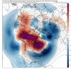
 ). Nice +PNA going up.