Brent
Member
the Euro lost my snow 

12z CMC brings a nice surprise. CMC is by itself, GFS and FV3 have different looks during that time.
I'm not sure. This is what the models were doing about 7 days ago when they were showing a cold first week of january. In time we should evolve to a look like this but im not certain we are only 12-15 days outStarting to see the light at the end of the tunnel?.?.?.?.
Yes. That said a perfectly timed wave could score in that setup. Not likely but better than nothingThe cmc sucks
Sent from my iPhone using Tapatalk
Snowbird Bob says it's coming, lol https://www.facebook.com/search/top/?q=snowbirdbob&epa=SEARCH_BOX
View attachment 9756
Why all of the yelling?
Snowbird Bob says it's coming, lol https://www.facebook.com/search/top/?q=snowbirdbob&epa=SEARCH_BOX
View attachment 9756
Woah, where is he getting that from? I thought that what was going to happen too at the beginning, but temps are going to be too warm for areas south and east of TN.Snowbird Bob says it's coming, lol https://www.facebook.com/search/top/?q=snowbirdbob&epa=SEARCH_BOX
View attachment 9756
fake news...Woah, where is he getting that from? I thought that what was going to happen too at the beginning, but temps are going to be too warm for areas south and east of TN.
.png")


Why can’t we squeeze something under that?View attachment 9764
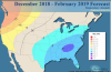
Below is the wxbell winter forecast: note the sub -5 over the heart of the SE. I'll be lenient and just call it -5:
Per the latest very warm forecasts for the first half of Jan of near +5 combined with Dec that will end up near +3, the period 12/1-1/13 is projected to be near +3.75. So, what would Wxbell need during 1/14-2/28 to get DJF down to -5 there? Near -13.5. Has this ever happened at, say, ATL? Let's see:
Top 8 coldest KATL 1/14-2/28 (9) since 1878-79:
1905: -9.9 (weak El Nino)
1940: -9.4 (weak El Nino)
1963: -9.4 (cold neutral)
1977: -9.2 (weak El Nino)
1978: -8.9 (weak El Nino)
1895: -8.1 (weak La Nina)
1902: -7.2 (cold neutral)
1885: -7.0 (weak El Nino)
So, the coldest on record is -9.9. If that were to occur this time, ATL and nearby areas would end up DJF only down to -3. By the way, all 8 of these had 12/1-1/13 that were -1 or colder vs the current projection of +3.75.
Conclusion: Wxbell will not get their -5. However, 4 of the 5 coldest were during weak El Nino and these were in
the ~-9 to -10 range. Getting that would get KATL down to -3. Then again, all 4 of these had -3 or colder for 12/1-1/13 vs the current projection of +3.75. So, getting -9 to -10 and thus the -3 for DJF will be very tough considering today's background state though not out of the realm of semireasonable possibilities. A more realistic hope though would probably be something like -6 to -7 for 1/14-2/28, which would get DJF down to the -1 to -2 range.
So, due to the near almost +4 for the first half of winter, I think the heart of the SE US has virtually no chance now of a -5 for DJF as it would take unprecedented cold going back nearly 150 years. However, the weak El Nino gives a good shot at a cold 1/14-2/28. But even with that, the best they could do now for DJF per recorded history is -3 with -1 to -2 being a more reasonable hope.


I’m listening..View attachment 9765


Like the almighty Brick says “snow comes after 70’s” book itThat sound you hear is my driver hitting golf balls
Sent from my iPhone using Tapatalk

Change of pace: happy hour GEFS best by far of at least the last 4 runs for 1/7+. Maybe just maybe??????
Can you post these please
Sent from my iPhone using Tapatalk
Can you post these please
Sent from my iPhone using Tapatalk
No, sorry, I can't, Private source. But will be on tidbits shortly.


Why didn't anyone post the Canadian earlier? This could happen...look at that Wake County gradient!!
View attachment 9767

It’ll be easy to get a low under that! More rain, the merrier!Why can’t we squeeze something under that?View attachment 9764