Yea, just a few days ago we was having good push of cold air. It does get discouraging.Perfect miller A like track unfortunately there’s a lack of cold air
Sent from my iPhone using Tapatalk
-
Hello, please take a minute to check out our awesome content, contributed by the wonderful members of our community. We hope you'll add your own thoughts and opinions by making a free account!
You are using an out of date browser. It may not display this or other websites correctly.
You should upgrade or use an alternative browser.
You should upgrade or use an alternative browser.
GeorgiaGirl
Member
Should note again I'm not a big fan of ULLs at all, but watch this if it stays closed. It's more of an western SE deal but it could drop some snow there.
GeorgiaGirl
Member
This ULL on the run is dropping some snow in the western SE. It's interesting because this looks quite different on H5.
RollTide18
Member
Eff this

Gfs has a very weird setup. It does produce snow for so far for west Texas, south Arkansas, north Mississippi and north Alabama.
Amazing how we go to a overrunning setup to a depending on a upper level low...
It's getting there for sure, it's still a good ways out. After this 0z GFS run, I'm really excited of what the 0z FV3 will show. If it was colder (which is still a possibility) this system would bring a lot of frozen precip that's for sure.
GeorgiaGirl
Member
Gfs has a very weird setup. It does produce snow for so far for west Texas, south Arkansas, north Mississippi and north Alabama.
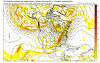
I'm pretty sure this is an ULL that is finally producing without a spring pattern:

I hate 'em, but they can drop some big time snows if you're in the right area. Interesting thing about this run is it was the first time this was a ULL though, on H5 this looks quite different from 18z, of course GFS lol.
RollTide18
Member
Gfs has a very weird setup. It does produce snow for so far for west Texas, south Arkansas, north Mississippi and north Alabama.
It was just showing a good cold push a run ago, guess I got PTSD from the 40 degree ULL earlier this month
Gfs snowmap. 
Well, I will be interested in the gfs ensembles for sure tonight. I would like to see if the upper low setup that this run has support for its ensembles.
Ilovesnow28
Member
So far models again are night and day...Hopefully the 6z run will be even better
Amazing how we go to a overrunning setup to a depending on a upper level low...
Losing the northern stream. See how the 552dm line is trending north. With that happening you are getting more separation and allowing the s/w to amp. An ULL is about the only hope if this continues. The bad part is it is way early for this to happen, so expect more amping and a farther north track.
Attachments
Stormlover
Member
Yeah, not sure why some were dissing this,I'll cash that in!Gfs snowmap. View attachment 9614
So far on the fvs-gfs at 120 the cold air push and cold air up north looks some better then the old gfs.
The FVS just looks better in my opinion. But I am no expert.
The FVS just looks better in my opinion. But I am no expert.
FVS gfs at 120 hours 

Old gfs. At 120 hours.


Old gfs. At 120 hours.
FVS a nice hit for south Arkansas, north miss/ala and northeast Georgia. And also some of tenn and North Carolina..


GeorgiaGirl
Member
FV3 says yes again to a winter storm for the western parts of the SE and the northern half of NC. Don't think it's a ULL either, let me check.
Edit: Nope, just overrunning. So yeah, while the GFS would work for some, let's trash it.") Overrunning is better.
Overrunning is better.
Edit: Nope, just overrunning. So yeah, while the GFS would work for some, let's trash it.
Overrunning is better.I would believe the new gfs at the junction. It has been more consistent with this threat.FV3 says yes again to a winter storm for the western parts of the SE and the northern half of NC. Don't think it's a ULL either, let me check.
Edit: Nope, just overrunning. So yeah, while the GFS would work for some, let's trash it.
LovingGulfLows
Member
- Joined
- Jan 5, 2017
- Messages
- 1,499
- Reaction score
- 4,100
If only the cold air could arrive faster ------. Another winter storm I'm gonna miss out on.
Wow at the snow map on this run..
Cut the totals in about half and that would be about right.
Cut the totals in about half and that would be about right.
Round Oak Weather
Member
Correct me if i'm wrong but it looks better than its last runI would believe the new gfs at the junction. It has been more consistent with this threat.
This is 0z gefs. For to post this while ago. So there some support from the gfs members for a threat.
GeorgiaGirl
Member
Correct me if i'm wrong but it looks better than its last run
It is, it's more south. However it might be a little bit north of the 12z that opened eyes.
Just guessing based off that FV3, it's an ice storm to 1-2 inches of snow outside of the northern half. I'll probably be on tablet by the time it's loaded, but the ice accretion map will be interesting.
Also hoping the Euro gets more on board. I'll be sleeping by then though.
It’s about the same. Just shifted south about 50 miles. The FVS has been the most consistent on the threat.Correct me if i'm wrong but it looks better than its last run
This was the 18z map

NBAcentel
Member
Fv3 says snow for my area in nc, 3 inches of paste on top on a sponge, it's game on
Clem282340
Member
Look at that warm nose right over the upstate sc
It’s the mountains. Cold air is always late to the party when our high pressure placement is to the west. This setup sucks out loud for us. Our time will come in a few more weeksLook at that warm nose right over the upstate sc
Clem282340
Member
I hope so been left out the past few yearsIt’s the mountains. Cold air is always late to the party when our high pressure placement is to the west. This setup sucks out loud for us. Our time will come in a few more weeks
Brent
Member
dunno whats up with the Euro but I cant get any precip maps to load even on the pay site
even on the pay siteI am using this site tonight.dunno whats up with the Euro but I cant get any precip maps to load
https://weather.us/model-charts/euro/2018122800/usa/snow-depth-in/20190101-1200z.html
The euro tried a little bit to give us something. It also looked like a overrunning setup 
Brent
Member
I am using this site tonight.
https://weather.us/model-charts/euro/2018122800/usa/snow-depth-in/20190101-1200z.html
looks like I just barely miss a half inch of snow on Wednesday lol
Storm5
Member
06z gefs 

Sent from my iPhone using Tapatalk


Sent from my iPhone using Tapatalk
ATLwxfan
Member
Time to have the lawn guy spray for weeds. The FV3 says spring in January.
Sent from my iPhone using Tapatalk
Sent from my iPhone using Tapatalk
I'll be putting out preemergent this weekendTime to have the lawn guy spray for weeds. The FV3 says spring in January.
Sent from my iPhone using Tapatalk
Sent from my SM-G955U using Tapatalk
Well if we aren’t going to have a wintry threat might as well enjoy the 60’s vs 30’s and high electric/gas bills.Time to have the lawn guy spray for weeds. The FV3 says spring in January.
Sent from my iPhone using Tapatalk

models are super inconsistent right now for sure. I will say it’s a little concerning to see that we are pushing that time frame back again. I will also say I don’t like seeing the SOI so + We need some drops in that to help keep pushing things along. Kudos to the GFS and GEFS for stalling out the MJO in the super crappy phases. Y’all correct me if I’m wrong, but we need some good NEG bursts to keep pushing the MJO eastward right?

NoSnowATL
Member
I think the MJO is controlling winter right now, once she moves into cold phases in mid January we all will be happy, models are still pointing to that “ backloaded winter” we all like to say. Weeklies pointed to it last night as well. We are getting closer so as always we sit a wait and wait. Good times ahead boys and girls. I will stay optimistic until Webb or 1300 tells me to jump.
Sent from my iPhone using Tapatalk
Sent from my iPhone using Tapatalk
Cad Wedge NC
Member
Yes, let's get it to phase 8 and then it can stall as long as it wants.models are super inconsistent right now for sure. I will say it’s a little concerning to see that we are pushing that time frame back again. I will also say I don’t like seeing the SOI so + We need some drops in that to help keep pushing things along. Kudos to the GFS and GEFS for stalling out the MJO in the super crappy phases. Y’all correct me if I’m wrong, but we need some good NEG bursts to keep pushing the MJO eastward right?
View attachment 9631