00Z GFS IS LOOKING GOOD. STARTING AT 42 HR WILL POST IMAGES IN A FEW
-
Hello, please take a minute to check out our awesome content, contributed by the wonderful members of our community. We hope you'll add your own thoughts and opinions by making a free account!
You are using an out of date browser. It may not display this or other websites correctly.
You should upgrade or use an alternative browser.
You should upgrade or use an alternative browser.


Here comes the next week mid week threat. Let’s see what does. 

Storm5
Member
Gfs trending towards the cmc and euro for next Tuesday
Sent from my iPhone using Tapatalk
Sent from my iPhone using Tapatalk
Could it be???


Storm5
Member
Nice widespread 2-4 inch deal
Sent from my iPhone using Tapatalk
Sent from my iPhone using Tapatalk


If we can get that wave separation like CMC was showing earlier watch out..def a step in the right direction but hard to get excited about anything the GFS shows
7.5 days away.
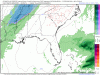
EXACTLY WHAT IS THE ORANGE AND YELLOW SHADED AREAS ON THE 500mb??
GeorgiaGirl
Member
FV3 looks like a hit with the 2nd system for the western part of the SE so far:

Pretty much all the energy in the upper atmosphere and what it is doing. This is a good question for @Webberweather53 or @deltadog03.EXACTLY WHAT IS THE ORANGE AND YELLOW SHADED AREAS ON THE 500mb??
GeorgiaGirl
Member
Wow the FV3 is going to be a very nice hit for Alabama it looks like.


mydoortotheworld
Member
And by the looks of it, N GAWow the FV3 is going to be a very nice hit for Alabama it looks like.
View attachment 12489
View attachment 12490
IM WAITING ON THE PIVOTAL AND TT IMAGES LIKE A KID AT CHRISTMASWow the FV3 is going to be a very nice hit for Alabama it looks like.
View attachment 12489
View attachment 12490

Yes the northern 1/3 of Georgia. And Atlanta I think.And by the looks of it, N GA
GeorgiaGirl
Member
Based off the snow map on NOAA, that looks like a general 1-3" for Alabama and north of 85 in Georgia. In Tennessee it's a hit too and some areas have higher totals.
Too bad it feels like model cartoons given the way things have gone though.
Too bad it feels like model cartoons given the way things have gone though.
mydoortotheworld
Member
How does one get access to the black and white CMC maps?
Webberweather53
Meteorologist
EXACTLY WHAT IS THE ORANGE AND YELLOW SHADED AREAS ON THE 500mb??
Shading is vorticity or "local" spin. Vorticity is measured at this level 500mb or halfway up in the atmosphere (also happens to be nearly halfway up in the troposphere) where the air is generally "non-divergent", which is important because convergence & divergence in the lower and upper levels respectively can distort the vorticity field. Positive or cyclonic vorticity (i.e. local spin that's in the same sense as earth's rotation) is shaded on this plot in yellows, oranges, and reds. The sign and value of vorticity therefore can help you determine the type of weather system you're dealing with (strong positive spin = low pressure & vis versa) Vorticity, like warm or cold air advection for instance, can also create vertical motions in the atmosphere. In a very hand-wavy sense, similar to when you open the drain in your shower or sink, positive areas of vorticity create a "suction" effect on the atmosphere whereby simply adding positive spin to a column of air will induce rising air beneath it, thus creating clouds and precipitation. This same process is also what makes supercell thunderstorms so dangerous in that a rotating thunderstorm will have the added impact of this so-called "dynamic spin effect" that lowers the air pressure even more in the storm than from latent heating of condensation would produce on its own, allowing the storm to become stronger & live longer than it would have otherwise if it wasn't rotating like an "ordinary" storm.
This is probably about as simplistic of an explanation as I could provide!
Storm5
Member
Based off the snow map on NOAA, that looks like a general 1-3" for Alabama and north of 85 in Georgia. In Tennessee it's a hit too and some areas have higher totals.
Too bad it feels like model cartoons given the way things have gone though.
Looks like the gfs
Sent from my iPhone using Tapatalk
WELL LOOKS LIKE TT HAS FROZE ON THE FV3 PRECIP MAPS.. ANYONE ELSE NOTICE IT GETS TO HR 60 AFTER SKIPPING FROM HR 42?
Yes. It does this. Come back in about a hour and it will be finish.WELL LOOKS LIKE TT HAS FROZE ON THE FV3 PRECIP MAPS.. ANYONE ELSE NOTICE IT GETS TO HR 60 AFTER SKIPPING FROM HR 42?
Next week threat. Fv3

EAST COAST GETS IT GOOD WITH THIS
Most of the snow accumulation is from the 29th storm. 
Snowflowxxl
Member
CMC says what storm?
dsaur
Member
I'm curious as to see what one of these dragging flurries thru does down here in this new wet pattern. For years the fronts would tilt such that I only got the crumbs when it pull thru here. The tail end would dry up as it passed the Ala line. By the time it got here it was 3 drops and a finger wave. Caa in the upper levels dried the air right out. If Atl got 4 inches of snow, I'd get a half inch, or a dusting. During the droughts I'd get just enough rain to dot the dust and the northern end of the front got good rain. Now, things have changed and I get rain like the fabled flood every time a front drags thru. Will this translate onto a front dragging in snow on the back side? I'm interested to see. The cold air needs to move into a more moisture laden air mass than I used to get. All the moisture was busy moving out of Ga by the time the cold air found me.
I’m guessing nada on 2nd storm? Euro looks like poop. From what I can see it’s leaving energy behind.

Ty
I know one thing. I think I have seen the wildest change of models in the past weeks. I bet the models will have horrible verification scores as well.
Basically meh! Congrats tennesee. 
WE CAN ONLY HOPE THIS IS ONE OF MANY

06Z GFS