Webberweather53
Meteorologist
If this was even reasonably close to normal, I could definitely see reason for excitement in early Jan. We’ll probably get this fixed later in January
If this was even reasonably close to normal, I could definitely see reason for excitement in early Jan. We’ll probably get this fixed later in January
Am I tripping or globals/ens means been retrograding the pattern faster, and blocking up the NATL quicker, great pattern to bring back legit cold in NW Canada can see cold pooling up in NW can on end of ens means. But the earlier/quicker retraction is making the overall pattern in early jan more mehI think we are seeing an average disconnect of the Deep South probably being out of much early on due to surface temps vs Mountains and more of the Northern SE will probably scoring earlier.
Well since Feb is now a Spring month for my area that should leave me with a few days to score...all in baby!This winter is doing pretty much exactly what I thought it would do thus far, even down to the week-to-week variability in the flow pattern.
Wouldn’t anticipate much of anything substantial til late January or so, but that’s pretty normal for winters like this. In the off chance it snows before then, great, but it’s a bonus
Am I tripping or globals/ens means been retrograding the pattern faster, and blocking up the NATL quicker, great pattern to bring back legit cold in NW Canada can see cold pooling up in NW can on end of ens means. But the earlier/quicker retraction is making the overall pattern in early jan more meh


It’s wild how it almost feels unrealistic for February to be an active Winter weather month. Lately, it feels like Winter basically is over after January 31st. I’ve missed the classic late Jan into Feb Winters. It’s been since 2015 I believe since we saw a favorable Winter weather pattern in the Southeast in the month of February. Let’s make that month great again.This winter is doing pretty much exactly what I thought it would do thus far, even down to the week-to-week variability in the flow pattern.
Wouldn’t anticipate much of anything substantial til late January or so, but that’s pretty normal for winters like this. In the off chance it snows before then, great, but it’s a bonus
Am I tripping or globals/ens means been retrograding the pattern faster, and blocking up the NATL quicker, great pattern to bring back legit cold in NW Canada can see cold pooling up in NW can on end of ens means. But the earlier/quicker retraction is making the overall pattern in early jan more meh
Exactly , everything to me is just pointing towards a transient cooler period ….To me the good looking pacific goes away very quickly and the western trough establishes faster. I know, but -nao, but meh for me.
I wouldn’t base anything on February off of recent history when we haven’t had an El Niño like this since… 2015-2016.It’s wild how it almost feels unrealistic for February to be an active Winter weather month. Lately, it feels like Winter basically is over after January 31st. I’ve missed the classic late Jan into Feb Winters. It’s been since 2015 I believe since we saw a favorable Winter weather pattern in the Southeast in the month of February. Let’s make that month great again.
In the very long term (late Jan ish onward), I see tons of reasons to be excited about snow potential.
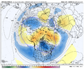
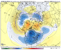
Classic polar vortex split pattern here on the EPS and GEFS. Sensible impacts in the troposphere usually occur more quickly during PV split cases than displacement events, especially when it comes to -NAO.
Getting the -NAO to show up during the onset of Sudden Stratospheric Warming Events is the key to getting it to couple to the stratosphere and anchor in place for a long time. Wouldn’t surprise me if this particular -NAO hits and holds, and lingers around possibly even into March. Classic way to set us up for a big hurricane season next year.
View attachment 139040
View attachment 139041
That's a good point.I wouldn’t base anything on February off of recent history when we haven’t had an El Niño like this since… 2015-2016.
Nope, it’s transient!Holy cow almost spit my coke out at those images. The models really want to lock the TPV over NA this time.
talking about the snow it showig bout 10 days from now to be more specificgood ole gfs throws us a bone..lol
Because its not a big deal for most of NC, SC or Georgia....lolAmazed no one is talking about it. It just outside 10 days. View attachment 139053View attachment 139052
Verbatim, not bad for this part of GA and WNC.Because its not a big deal for most of NC, SC or Georgia....lol
Why? That one gives me the Blutarsky Faber College GPAAmazed no one is talking about it. It just outside 10 days. View attachment 139053View attachment 139052
Yeah actually some parts of NC, TN , and VA have some nice amounts.Verbatim, not bad for this part of GA and WNC.
Probably because it’s 11 days out and the GFS.Amazed no one is talking about it. It just outside 10 days. View attachment 139053View attachment 139052
Meh, a lot of them 11 days pictures gets posted. ????Probably because it’s 11 days out and the GFS.
But it only snows in NE Georgia in the minds of most of the board.Verbatim, not bad for this part of GA and WNC.
Dude may be trolling.But it only snows in NE Georgia in the minds of most of the board.
I’m with you. The new locale is great for radiational cooling and Miller A’s. I’ll need a super CAD to ride up the valley to have any ice.Dude may be trolling.
You, JC and I do okay in those setups. I am in CAD hell though with those four thousand footers just to my East,
Absolutely, its related but I take anything that far out with a grain of salt as most do here. Possible, yes. Probable, who knows. I see lately the GFS is doing GFS things by continuing to push things out day by day.Meh, a lot of them 11 days pictures gets posted. ????
Greenland block and W Coast trough, should be $$$$ for me!
Nice stout ridge maximum over the Rockies with that second stormFirst one needs a deeper/closer vortex, it’s already exiting SE Canada, not like it looks like it has much a shot anyways. Appears to warm in general, a more amped storm with a slower SE can vortex could maybe fix it, second one has a better cold feed View attachment 139086View attachment 139087
First one needs a deeper/closer vortex, it’s already exiting SE Canada, not like it looks like it has much a shot anyways. Appears to warm in general, a more amped storm with a slower SE can vortex could maybe fix it, second one has a better cold feed View attachment 139086View attachment 139087
