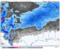
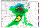
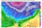
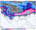
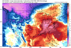
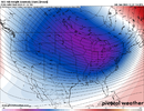
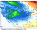
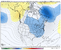
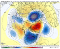
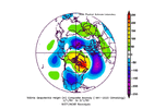
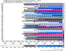
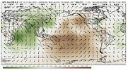
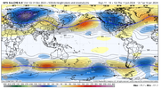
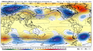
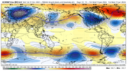
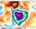
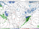
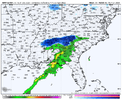
What is the euro control showing for wintry precip?Euro control tucked a bunch of blue stuff up under a strong block. That's the move we need to see post cutter


-
Hello, please take a minute to check out our awesome content, contributed by the wonderful members of our community. We hope you'll add your own thoughts and opinions by making a free account!
You are using an out of date browser. It may not display this or other websites correctly.
You should upgrade or use an alternative browser.
You should upgrade or use an alternative browser.
Pattern Jammin January 2024
- Thread starter SD
- Start date
Webberweather53
Meteorologist
tennessee storm
Member
Yeah that second cutter going have blizzard conditions on the nw side of it
Not muchWhat is the euro control showing for wintry precip?

I tracked two big rain events from 8-9 days out in december that trended cutter, way west day 5-7 range and corrected back way east. Just a footnote. May or may not happen again. Gfs has been west to far on all these.
Southern Track
Member
tennessee storm
Member
Always at the end …lol. But that is getting closer to a timeframe for more favorable colder air coming down. We see that holds
Alaska getting cold again, should be a big concern! ?Euro control tucked a bunch of blue stuff up under a strong block. That's the move we need to see post cutter


D10 of the euro was probably the best look of the 12z runs so far today be interesting to see the eps follows, the 0z was pretty mediocre
Noted. But that's all three major models with ensemble support. Finally, legit cold does seem to be around the corner.Always at the end …lol. But that is getting closer to a timeframe for more favorable colder air coming down. We see that holds
12z EMCF was pretty close for N Ga. Just off of the course TTB maps, thermals would have probably worked out for the ATL area if the precip shield was a bit further north. ? on this little system.
carolinachaos
Member
There is absolutely no blocking what so ever as of now
Sounds like the Carolina O line.
Sent from my iPhone using Tapatalk
whatalife
Moderator
- Joined
- Jan 23, 2021
- Messages
- 4,602
- Reaction score
- 15,197
- Location
- Lebanon Township, Durham County NC
EPS looks cold after day ten.
This is good because they say the EPS has the best verification scores. If it was the GEFS, I would expect it to waffle around back to warm. But because we're laying snowpack and because we're moving into the favored time frame and because it's the EPS, we can probably start to breathe easy now.EPS looks cold after day ten.
EPS has remained the most steady with the progression East also while the GEFS has wobbled back and forth.This is good because they say the EPS has the best verification scores. If it was the GEFS, I would expect it to waffle around back to warm. But because we're laying snowpack and because we're moving into the favored time frame and because it's the EPS, we can probably start to breathe easy now.
OkThis is good because they say the EPS has the best verification scores. If it was the GEFS, I would expect it to waffle around back to warm. But because we're laying snowpack and because we're moving into the favored time frame and because it's the EPS, we can probably start to breathe easy now.
12z EPS shows the cold air moving East with a reinforcing shot brewing in Canada at Day 10. Past day 10, it shows the entire lower 48 below average temperature wise.. In mid January. Long range models sniffed out the Western trough back in the 300s as far as hours out & hasn't let up since. Now we see how far East it gets as this will be a cross polar flow instead of what we are seeing right now temperature wise. A true cold air source.
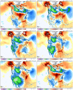

Burn Alaska, burn!12z EPS shows the cold air moving East with a reinforcing shot brewing in Canada at Day 10. Past day 10, it shows the entire lower 48 below average temperature wise.. In mid January. Long range models sniffed out the Western trough back in the 300s as far as hours out & hasn't let up since. Now we see how far East it gets as this will be a cross polar flow instead of what we are seeing right now temperature wise. A true cold air source.
View attachment 139568
Whamby worthy, but dude, it's way too early to mention 1960.
D
Deleted member 609
Guest
I think you need a hugThis is good because they say the EPS has the best verification scores. If it was the GEFS, I would expect it to waffle around back to warm. But because we're laying snowpack and because we're moving into the favored time frame and because it's the EPS, we can probably start to breathe easy now.
olhausen
Member
I think Most of us on the board feel this way every winter unless you are living in Canada.Yeah, i wouldn't want to be further south this Winter.
Brent
Member
olhausen
Member
I went back to San Diego one Christmas and the high was 60 and everybody was in huge jackets and hoodies like it was 20 below. I think it was in 2010 when the highs in Nashville were barely hitting the 20s for a few days. They say the air has bite in it at night when the lows hit 45 ?You must not have a mother in law visiting for the holidays from Florida who thinks she owns the place. Mine has hijacked the thermostat.
NBAcentel
Member
- Joined
- Jan 23, 2021
- Messages
- 4,602
- Reaction score
- 15,197
- Location
- Lebanon Township, Durham County NC
Yeah it wasn’t quite as cold as last Christmas but it was in the neighborhood
packfan98
Moderator
We are finally seeing the Barney purple colors showing up at the end of the model runs, and that will be during our coldest climo temps too! Could be fun times!
Drizzle Snizzle
Member
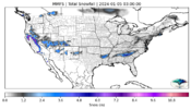
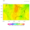
Too early to start a thread ?Interesting.. within 4 days..snow falls on Thursday AMView attachment 139583View attachment 139584
This response is trademarked, sir. Thx
OkThis response is trademarked, sir. Thx

