-
Hello, please take a minute to check out our awesome content, contributed by the wonderful members of our community. We hope you'll add your own thoughts and opinions by making a free account!
You are using an out of date browser. It may not display this or other websites correctly.
You should upgrade or use an alternative browser.
You should upgrade or use an alternative browser.
Tropical Hurricane Isaias
- Thread starter Snowfan
- Start date
Webberweather53
Meteorologist
Downeastnc
Member
Looks like the eyewall has opened back up again to the south on the last several radar scans. Intensification may have stopped yet again
Got a decent flare up trying to wrap it back up, still tough night ahead for the storm it appears....still have no clue what to expect up this way Monday lol.....
Webberweather53
Meteorologist
Got a decent flare up trying to wrap it back up, still tough night ahead for the storm it appears....still have no clue what to expect up this way Monday lol.....
Yeah, really need to see these flare ups rotate upshear, it's gonna be a constant battle between upshear propagating convection trying to axisymmetrize and strengthen the circulation vs shear/dry air attempting to tilt/weaken it
Been on vacation this week on Gulf coast just south of Clearwater Beach. Earlier this week, we decided that we would head over to Disney on the way home Saturday. I had been keeping an eye on storm, but felt ok about it. Bought tickets. We are now under a tropical storm warning here at WDW. Will head to Magic Kingdom tomorrow, get done, and hit the road to GA mid afternoon. Still feel like we should be fine, but will be interesting to see how weather goes as we head later into the afternoon.
Downeastnc
Member
Yeah, really need to see these flare ups rotate upshear, it's gonna be a constant battle between upshear propagating convection trying to axisymmetrize and strengthen the circulation vs shear/dry air attempting to tilt/weaken it
yeah exactly what I was thinking
......and they had some 90knt drops that last run through the core....72knt unflagged at the surface so its holding up so far...and it looks like both planes are done so we are not going to have data for a while

000
WTNT34 KNHC 010244
TCPAT4
BULLETIN
Hurricane Isaias Advisory Number 16
NWS National Hurricane Center Miami FL AL092020
1100 PM EDT Fri Jul 31 2020
...STRONG WINDS AND HEAVY RAINS CONTINUE OVER THE CENTRAL BAHAMAS...
...ISAIAS EXPECTED TO APPROACH THE SOUTHEAST COAST OF FLORIDA
TOMORROW...
SUMMARY OF 1100 PM EDT...0300 UTC...INFORMATION
-----------------------------------------------
LOCATION...23.3N 76.4W
ABOUT 135 MI...215 KM SSE OF NASSAU
ABOUT 265 MI...430 KM SE OF FREEPORT GRAND BAHAMA ISLAND
MAXIMUM SUSTAINED WINDS...80 MPH...130 KM/H
PRESENT MOVEMENT...NW OR 310 DEGREES AT 15 MPH...24 KM/H
MINIMUM CENTRAL PRESSURE...987 MB...29.15 INCHES
WATCHES AND WARNINGS
--------------------
CHANGES WITH THIS ADVISORY:
The Hurricane Watch is changed to a Hurricane Warning from the
Volusia-Brevard County line to the Flagler/Volusia County Line
SUMMARY OF WATCHES AND WARNINGS IN EFFECT:
A Hurricane Warning is in effect for...
* Boca Raton to the Volusia/Brevard County Line Florida
* Northwestern Bahamas
* Central Bahamas
A Hurricane Watch is in effect for...
* Hallandale Beach to south of Boca Raton Florida
A Storm Surge Watch is in effect for...
* Jupiter Inlet to Ponte Vedra Beach Florida
A Tropical Storm Warning is in effect for...
* North of Ocean Reef to south of Boca Raton Florida
* Lake Okeechobee
A Tropical Storm Watch is in effect for...
* Flagler/Volusia County Line to Ponte Vedra Beach Florida
Interests elsewhere along the southeast coast of the United States
should monitor the progress of Isaias. Additional watches or
warnings may be required on Saturday.
A Hurricane Warning means that hurricane conditions are expected
somewhere within the warning area. A warning is typically issued
36 hours before the anticipated first occurrence of
tropical-storm-force winds, conditions that make outside
preparations difficult or dangerous. Preparations to protect life
and property should be rushed to completion.
A Hurricane Watch means that hurricane conditions are possible
within the watch area. A watch is typically issued 48 hours
before the anticipated first occurrence of tropical-storm-force
winds, conditions that make outside preparations difficult or
dangerous.
A Storm Surge Watch means there is a possibility of life-
threatening inundation, from rising water moving inland from the
coastline, in the indicated locations during the next 48 hours.
For a depiction of areas at risk, please see the National Weather
Service Storm Surge Watch/Warning Graphic, available at
hurricanes.gov.
A Tropical Storm Warning means that tropical storm conditions are
expected somewhere within the warning area within 36 hours.
A Tropical Storm Watch means that tropical storm conditions are
possible within the watch area, generally within 48 hours.
For storm information specific to your area in the United
States, including possible inland watches and warnings, please
monitor products issued by your local National Weather Service
forecast office. For storm information specific to your area
outside of the United States, please monitor products issued by
your national meteorological service.
Brent
Member
Shaggy
Member
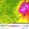
Icon much stronger and much further east at 39hrs
snowlover91
Member
GeorgiaGirl
Member
If other 0z models do the same (I honestly wasn't paying that close attention to the NAM), boy it's so bad that we're at the 3 day mark and still might not know what's going to happen.
Should get some resolution tomorrow though.
Should get some resolution tomorrow though.
Jessy89
Member
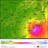
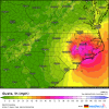
Icon basically a border line cat 2 making landfall around myrtle beach maybe cherry grove
Sent from my iPhone using Tapatalk
Sent from my iPhone using Tapatalk
Shaggy
Member
The Icon hit on this run would be a big deal for many board members. Especially if it was any stronger than cat 1
Jessy89
Member
The Icon hit on this run would be a big deal for many board members. Especially if it was any stronger than cat 1
Probably cat 2 in my opinion.
Sent from my iPhone using Tapatalk
Shaggy
Member
Probably cat 2 in my opinion.
Sent from my iPhone using Tapatalk
Could be yeah. Definitely a HUGE change from its earlier runs and back to what it had been running previously.
Downeastnc
Member
Jessy89
Member
Gfs is a lot weaker
Sent from my iPhone using Tapatalk
Sent from my iPhone using Tapatalk
Shaggy
Member
Gfs is a lot weaker
Sent from my iPhone using Tapatalk
Gonna be a tricky intensity forecast.
Cary_Snow95
Member
Welp Isaias officially ruined my vacation. Holden beach evacuating tomorrow @ 7pm. Evacuation seems ridiculous for a tropical storm
B
Brick Tamland
Guest
If other 0z models do the same (I honestly wasn't paying that close attention to the NAM), boy it's so bad that we're at the 3 day mark and still might not know what's going to happen.
Should get some resolution tomorrow though.
That's how it's been the past few years when we have a real threat. It's been as hard forecasting the track and intensity of tropical systems as it is possible winter storms here.
Shaggy
Member
We were at Carolina beach In June and the beach erosion was brutal from that week long NE fetch. If this storm has any size and strength its gonna crush those beaches down there.Welp Isaias officially ruined my vacation. Holden beach evacuating tomorrow @ 7pm. Evacuation seems ridiculous for a tropical storm
Sctvman
Member
We were at Carolina beach In June and the beach erosion was brutal from that week long NE fetch. If this storm has any size and strength its gonna crush those beaches down there.
I remember Irene in 2011 we lost the snack bar and pavilion at our local County Park at Folly Beach. It just reopened this year
Downeastnc
Member
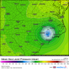
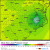
00Z HMON east a bit right over MHX into Pamlico Sound around 980mb
Downeastnc
Member
Brent
Member
Euro is east for sure this is gonna be somewhat better for South Florida but worse up the coast
Brent
Member
Downeastnc
Member
Our little hurricane is struggling quite a bit at the moment...Euro is about the same so far
Brent
Member
Downeastnc
Member
Looking at radar composite I’d be willing to say that it is very slowly trying to recover its center of circulation.
Agree, that the NHC bumped him up shows he is doing better than what sat presentation suggest at least....
Downeastnc
Member
Pretty decent flare up around the center again, this one a bit better than the previous few tries....
Composite radar looks like this cold top flare is putting it substantially closer to closing off again. Let’s see if it lasts or breaks up again.Pretty decent flare up around the center again, this one a bit better than the previous few tries....
Downeastnc
Member
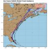
The NHC keeps it at 85 at 5am then slowly weaken it farther out....I guess outside of the Ukie and a few others most models do have it in the 995-1000 mb range off SC/NC....
6z ICON LF near Myrtle and up 95. Would be gusty and rainy around here for sure.
Downeastnc
Member
Downeastnc
Member
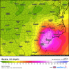
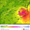
GFS about the same as the ICON/Ukie track wise but weaker with the wind and a much smaller wind field......
Downeastnc
Member
Well crappy sat presentation or not the recon is finding pressure down around 983mb....


