-
Hello, please take a minute to check out our awesome content, contributed by the wonderful members of our community. We hope you'll add your own thoughts and opinions by making a free account!
You are using an out of date browser. It may not display this or other websites correctly.
You should upgrade or use an alternative browser.
You should upgrade or use an alternative browser.
Tropical Hurricane Idalia
- Thread starter weather nerd
- Start date
JHS
Member
Almost the classic track for lots rain of and maybe a few tornados for much of FL, GA, and the Carolinas if this holds up. Plenty of time though for this to take a different track or maybe not form at all. Maybe this could be what finally shakes up the overall pattern in the US if it gets strong enough. This could be a big problem though if it gets organized enough and does not run into a lot of shear. The gulf water is very warm and could really give this a boost.
I'm torn on what kind of strengthening I want this thing to do.Almost the classic track for lots rain of and maybe a few tornados for much of FL, GA, and the Carolinas if this holds up. Plenty of time though for this to take a different track or maybe not form at all. Maybe this could be what finally shakes up the overall pattern in the US if it gets strong enough. This could be a big problem though if it gets organized enough and does not run into a lot of shear. The gulf water is very warm and could really give this a boost.
Stronger storms need less influence, while weaker ones need stronger pull. There looks like a trough, with modeling of various strengths dipping down and grabbing this thing.
I would like a big rain event in my back yard, so I'm selfishly hoping things slow on one side just enough to get a western track to bring it through GA/SC inland.

Don’t be surprised to see this tick west a bit. As we get to remember the hard way every winter; troughs are nearly always modeled too fast.
Idk, Ian kept on adjusting east last year. At one point in the medium range it was a big bend landfall. I'm unsure our well known winter axioms translate into the summer that cleanlyDon’t be surprised to see this tick west a bit. As we get to remember the hard way every winter; troughs are nearly always modeled too fast.
Much like this system, I am also a fan of hanging around Cancun for a couple of days not having my act together at all! Don't really see much here unless it can hit the Yucatan Channel with a head of steam and a pressure around 1001-1003ish
NoSnowATL
Member
Depends on the strength, stronger goes more N and W and weaker stays E and S. Looks like a weaker system is most likely per models.
The vorticity consolidation is going to be key as well. The cmc bombs convection North of the Yucatan which helps get it north faster which is west while the euro pulls it south towards convection so it's slower but strongerDepends on the strength, stronger goes more N and W and weaker stays E and S. Looks like a weaker system is most likely per models.
iGRXY
Member
Relying on models for strength is not wise. Especially once systems get into the gulf. Even with shear they've shown to explode.Depends on the strength, stronger goes more N and W and weaker stays E and S. Looks like a weaker system is most likely per models.
BHS1975
Member
Relying on models for strength is not wise. Especially once systems get into the gulf. Even with shear they've shown to explode.
Franklin has has constant very deep convection for weeks and is still a TS. Bath water means nothing if it can't stack up.
Sent from my iPhone using Tapatalk
iGRXY
Member
That's fine, but you take your chances against something making it in the gulf and not strengthening if you want to. I know better.Franklin has has constant very deep convection for weeks and is still a TS. Bath water means nothing if it can't stack up.
Sent from my iPhone using Tapatalk
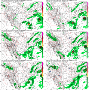
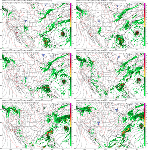
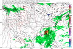
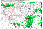
This track puts it pretty much on target for my backyard. Will be interesting to keep watch onCMC has a weird track and it has making landfall in the eastern Florida Panhandle. ICON has it making landfall in the Florida Bend as well. View attachment 136422View attachment 136421
The mcv from last night's storms along with a baggy trough in the northern gulf and other pieces of energy may try to consolidate into a weak ull to the north of this over the weekend. That'll put a decent wrench into into intensity and track as well
honestly i think i will take my chances; shear profile isn't fantastic for development and there's not really an anticyclone that could help with ventilation. also... it only has a day over the gulf?That's fine, but you take your chances against something making it in the gulf and not strengthening if you want to. I know better.

personally think the ceiling is like 994/995 storm
iGRXY
Member
I definitely don't think anything crazy but most of the models have this basically as a tropical storm and I'm saying a higher end Cat 1 is a possibility. These storms the last 5 years have shown that once it's in the Gulf they want to be stronger than what models showed.honestly i think i will take my chances; shear profile isn't fantastic for development and there's not really an anticyclone that could help with ventilation. also... it only has a day over the gulf?

personally think the ceiling is like 994/995 storm
I see this storm possibly becoming a weak Category 1 storm before landfall although I saw a chart on the Weather Channel from the EURO that gives it less than a ten percent chance of reaching that status this morning. The EURO does tend to underestimate storm intensity in the Gulf of Mexico. I hope it can become a rainmaker for the areas that need it like most of North Carolina.
There's a lot of moving parts with this potential system, and I do think we get a name at the minimum.
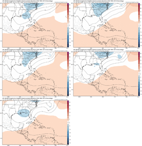
The ensemble means don't have much in the line of strength from it. The idea of the 06z GEFS and EPS to an extent is to have it kind of "absorbed" into the trough. At least from my maps.
I don't have access to individual member maps.
The ensemble means don't have much in the line of strength from it. The idea of the 06z GEFS and EPS to an extent is to have it kind of "absorbed" into the trough. At least from my maps.
I don't have access to individual member maps.
Models are never accurate this far out. The track can change dramatically.
NoSnowATL
Member
GFS wants to troll me this Friday.


This is definitely not out of the realm of possibility.GFS wants to troll me this Friday.

Canadian right in the middle of the Euro and GFS.
PERFECT.
PERFECT.
Invest 93L
Brent
Member
A POSSIBLE LOW LEVEL INVEST IN THE NORTHWEST CARIBBEAN SEA
NEAR 20.0N 86.2W FOR 27/1800Z.
A POSSIBLE NOAA G-IV SYNOPTIC SURVEILLANCE MISSION OVER
THE GULF OF MEXICO DEPARTING KLAL AT 27/1730Z.
NEAR 20.0N 86.2W FOR 27/1800Z.
A POSSIBLE NOAA G-IV SYNOPTIC SURVEILLANCE MISSION OVER
THE GULF OF MEXICO DEPARTING KLAL AT 27/1730Z.
tbh i misread your first message.. thought you were implying more than just "strengthening". i still don't think it gets its act together in time but if it is able to spend more time over water the next few days and consolidate then what you're saying is totally reasonableI definitely don't think anything crazy but most of the models have this basically as a tropical storm and I'm saying a higher end Cat 1 is a possibility. These storms the last 5 years have shown that once it's in the Gulf they want to be stronger than what models showed.
Tornadocane
Member
93L actually looks really good from a structural standpoint. LLC and MLC are getting more aligned, but Mid-Level Vorticity appears to be stretched to the South. There's low pressure stretching from EPAC to 93. Also, we need to monitor whether the circulation passes through the Yucatan. I expect 93L to build convection over the next 18 hours, and the exact location of the COC will likely determine the potential with 93L.
I also think that the weakening of Franklin due to shear may work to provide 93L with some breathing room.
I also think that the weakening of Franklin due to shear may work to provide 93L with some breathing room.
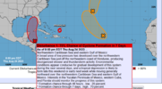
40/80Northwestern Caribbean Sea and eastern Gulf of Mexico (AL93):
Satellite images indicate that the area of low pressure over the
northwestern Caribbean Sea is gradually becoming better organized,
with increasing thunderstorm activity and a better-defined
low-level circulation. Environmental conditions appear conducive
for further development during the next several days, and a
tropical depression is likely to form late this weekend or early
next week while it moves generally northward over the eastern Gulf
of Mexico. Interests in the Yucatan Peninsula of Mexico, western
Cuba, and Florida should monitor the progress of this system.
* Formation chance through 48 hours...medium...40 percent.
* Formation chance through 7 days...high...80 percent.
Idk, Ian kept on adjusting east last year. At one point in the medium range it was a big bend landfall. I'm unsure our well known winter axioms translate into the summer that cleanly
Much like this system, I am also a fan of hanging around Cancun for a couple of days not having my act together at all! Don't really see much here unless it can hit the Yucatan Channel with a head of steam and a pressure around 1001-1003ish
I may be wrong, but I think Ian trended east because the trough off the east coast trended slower and grabbed it vs it just meandering westward. That said I wouldn’t bet on my memory.
NoSnowATL
Member
Probably right.
Not really a crazy solution with the models wanting to hang back that weakness/weak ULL over Texas.
Yep! That would likely bring flooding to the Blue Ridge, depending on forward movement, with the moist S/SE flow. Will be interesting to trackNot really a crazy solution with the models wanting to hang back that weakness/weak ULL over Texas.
It's ironic but last night I watched part of a documentary about the Great Flood of 1916 in Western North Carolina on PBS. One spot in the mountains got over 24 inches of rain in 24 hours. The French Broad River at one time was twenty feet above flood stage. That flood killed hundreds of people and devastated the economy in that part of the state. The Great Flood of 1916 was caused by two hurricanes that cut through the panhandle of Florida just weeks apart in July of that year. The tropical disturbance that everyone has its eye on could take a similar track and cause major issues if it develops to its full potential.Yep! That would likely bring flooding to the Blue Ridge, depending on forward movement, with the moist S/SE flow. Will be interesting to track
lexxnchloe
Member
Euro has it stuck off the coast for quite a bit. Hopefully it does a DianaProbably right.
BHS1975
Member
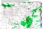
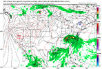
Quite the trend on the eps. The inland track is getting more favored with a hard right hook at the endView attachment 136437
What if the trough leaves it over the loop current for days?
Sent from my iPhone using Tapatalk
There's too much of a weakness for it to get left behind it'll ride the western edge of the Atlantic STR. As of right now I think the more possible but crazy random solution would be for it to round the ridge in the Atlantic and try to turn back SEWhat if the trough leaves it over the loop current for days?
Sent from my iPhone using Tapatalk
What if the trough leaves it over the loop current for days?
Sent from my iPhone using Tapatalk
Don’t see really any indication of a stall. Probably just more of a westward tick with the models showing the weakness growing over TX.

