• Hello, please take a minute to check out our awesome content, contributed by the wonderful members of our community. We hope you'll add your own thoughts and opinions by making a free account!

Tropical Hurricane Idalia

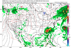
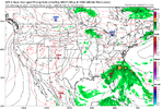
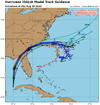
Dang 00z GFS definitely a bit west; and into GA etc too.

Someone smarter than me at 500mb maybe can figure out what these models are picking up on/changed to even show a slight tug to the west like the RGEM showed?
It makes a sharp turn in GA and the exits SC south of Myrtle Beach.
 
It makes a sharp turn in GA and the exits SC south of Myrtle Beach.

By around hour 60; it wasn't too far off from the 18z run in the grand scheme.
 
The models did tick west, I’m not sure what you are trying to convey here!

Read the original post again. I posted a graphic containing NHC forecast tracks, not model forecast tracks, that showed that the latest NHC track was indeed further West than the previous one.

Edit: It's a moot point now anyway because the NHC has already moved the latest forecast track back East.
 
Last edited:
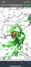
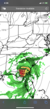
That GFS run! ??? It takes Idalia meanders it off GA/SC /FL coast for a few days after it exits SC and then slams Jacksonville, FL and then up into Carolinas again! One of the craziest runs I’ve ever seen! 22916C72-2DC5-4774-AA3C-923F165FF35A.png
 
That GFS run! ??? It takes Idalia meanders it off GA/SC /FL coast for a few days after it exits SC and then slams Jacksonville, FL and then up into Carolinas again! One of the craziest runs I’ve ever seen! View attachment 136585
Looks like a pretty good surface low track for a snowstorm. ?
 
033352_5day_cone_no_line_and_wind.png


I can't be the only one wondering if it's going to loop back around again.
 
The Euro also is drifting NW. personally I think the land interaction and some of the shear ahas tugged or appeared to make the storm seem east of guidance. But the big driver is that the trough is looking more and more likely to miss the storm. Listen you can’t have that many models trend west and even the eastern sided guidance starting to make small incremental shifts west and NW to not call it a trend. Whether you want to believe or not it is a clear trend and what was once a quick exit OTS is quickly becoming a slow meandering over land and that is shifting further and further to the NW.
 
033352_5day_cone_no_line_and_wind.png


I can't be the only one wondering if it's going to loop back around again.
It’s certainly a possibility. Also there’s a chance that it continues to slow down more over land or near the coast. That plot at 1pm Thursday is very close to where the 11pm advisory last night was showing it at 7pm Thursday… so again about 6 hours slower. Two things have been very noticeable on the model trends since yesterday morning… a path a bit further west and slower movement over land. Models are not far at all from the trough pulling away and leaving the storm sitting in southern SC
 
I thought there was a west trend. Those look farther south and east as it relates to previous tracks into NC.
Not really… yesterday they were showing the storm exiting in the area between Hilton Head and Charleston and now they’ve clustered closer to Myrtle Beach
 
Back
Top