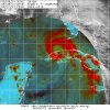
Yep if it is it jumped a good bit W, hot towers NE of that are near the center. IR can play tricks on the eyesNope just a area of warmer cloud tops
-
Hello, please take a minute to check out our awesome content, contributed by the wonderful members of our community. We hope you'll add your own thoughts and opinions by making a free account!
You are using an out of date browser. It may not display this or other websites correctly.
You should upgrade or use an alternative browser.
You should upgrade or use an alternative browser.
Tropical Hurricane Ida
- Thread starter Snowfan
- Start date
Tornadocane
Member
One of the HH missions has winds of 90 MPH at Flight and Surface levels. All of is't data just flooded out in the last few minutes.
Ida (Aug. 28, 2021) - HDOB - NOAA2 - Atlantic Non-Tasked Miss. WA - Tropical Atlantic
View decoded High-Density Observations (HDOB) available for (August 28, 2021) from NOAA2 on a non-tasked mission, the first flight of a sequence of non-tasked research missions into this system, in the North Atlantic basin.
tropicalatlantic.com
Webberweather53
Meteorologist
First pass through the NE quad confirms that Ida is still a hurricane. FL winds at 700mb around 75 kt supports ~65-70 kt cat 1.
Tornadocane
Member
First pass through the NE quad confirms that Ida is still a hurricane. FL winds at 700mb around 75 kt supports ~65-70 kt cat 1.
This is the link to the HH flight data.
Ida (2021) - HDOB - Atlantic AF Miss. 6 - Tropical Atlantic
View decoded High-Density Observations (HDOB) available for Ida in 2021 from Air Force mission 6 in the North Atlantic basin.
tropicalatlantic.com
Webberweather53
Meteorologist
New microwave pass looks somewhat favorable for Ida to kickstart an eyewall replacement cycle (EWRC) with spiral banding wrapping more than halfway around the small, young eyewall. Curious if we'll see it meld together, dissipate, or be a long arduous struggle as is more often the case w/ much stronger major hurricanes that encounter land interaction like this.


Henry2326
Member
If it comples an EWRC tonight, is there enough time that it will do again closer to landfall?New microwave pass looks somewhat favorable for Ida to kickstart an eyewall replacement cycle (EWRC) with spiral banding wrapping more than halfway around the small, young eyewall. Curious if we'll see it meld together, dissipate, or be a long arduous struggle as is more often the case w/ much stronger major hurricanes that encounter land interaction like this.
View attachment 89421
Downeastnc
Member
Yeah we should get a good idea on its heading after they drop the center a few times.....does appear to be east of all guidance though for at least the short term.
Tornadocane
Member
Recon found lowest pressures over 84W and 23N, so I think you may be bit too far NE with your pimple. It's on the extreme east side of solutions, but I don't think it's outside the wet spaghetti.
Also, I don't think they actually got to the true COC. On Tropical Tidbits, the image of the HH pass suggests that they couldn't reach the lowest pressures, because they were not able to fly any closer to Cuba. The HH site suggests lowest pressure was further S and W of tropical tidbits.
and that might be true for sure. The center might migrate more toward that deepest convection SW side for sure.Recon found lowest pressures over 84W and 23N, so I think you may be bit too far NE with your pimple. It's on the extreme east side of solutions, but I don't think it's outside the wet spaghetti.
Also, I don't think they actually got to the true COC. On Tropical Tidbits, the image of the HH pass suggests that they couldn't reach the lowest pressures, because they were not able to fly any closer to Cuba. The HH site suggests lowest pressure was further S and W of tropical tidbits.
creating a dangerous precedent having the pump stations work based on if they have electricity during the storm, can imagine it’s a national security risk too if hacked. I hope people don’t come to rely on the pump stations based on Ida or any storm it’s prob best to get out @Webberweather53
Tornadocane
Member
and that might be true for sure. The center might migrate more toward that deepest convection SW side for sure.
Hey... I know you're a Met and I know I get a lot wrong, but I'm just extremely confident about this being closer to Cuba. They literally had to stop and change courses as they were nearing the lowest pressures by the Cuban Coast, and that 991-993Mb data has SE to N and NE winds of 30-35 MPH. I think next pass it will be off the coast.
I don't know why no one is posting the Cuban Radar. It's probably the best resource to detect the COC. Wouldn't that settle things?
accu35
Member
oh hell I get plenty of things wrong...tag or no tag...hahahHey... I know you're a Met and I know I get a lot wrong, but I'm just extremely confident about this being closer to Cuba. They literally had to stop and change courses as they were nearing the lowest pressures by the Cuban Coast, and that 991-993Mb data has SE to N and NE winds of 30-35 MPH. I think next pass it will be off the coast.
I don't know why no one is posting the Cuban Radar. It's probably the best resource to detect the COC. Wouldn't that settle things?
accu35
Member
Storm5
Member
Well dang!! 0z coming east
View attachment 89425
Did you draw this in paint ?
Sent from my iPhone using Tapatalk
Well dang!! 0z coming east
View attachment 89425
That’s big. Ridge breaking down
Sent from my iPhone using Tapatalk
Cadi40
Member
The ridge is always underestimated. ALWAYS. The major east shift into Alabama/Florida panhandle you guys are dying to see will likely never occur or verify. Sure there’s always a small chance and forecasting mistakes are made, but I am extremely doubtful in a major shift at this point in time. The wishcasting so blatantly obvious. I am 85% confident that this will be an LA land falling storm.
Blue_Ridge_Escarpment
Member
0Z NAM run coming in a good bit E/NEWell dang!! 0z coming east
View attachment 89425
Jessy89
Member
Well dang!! 0z coming east
View attachment 89425
That east trend wouldn’t bold well for Georgia and Carolinas after the rain from Fred
Sent from my iPhone using Tapatalk
Well dang!! 0z coming east
View attachment 89425
It might, but it should be noted that tonight’s 0z run isn’t on the graphic.
Also that graphic is just showing the different runs of the same model. For instance 18z today was actually farther west than 12z.
Last edited:
The ridge is always underestimated. ALWAYS. The major east shift into Alabama/Florida panhandle you guys are dying to see will likely never occur or verify. I am 85% confident that this will be an LA land falling storm.
Explain “dying to see”
Sent from my iPhone using Tapatalk
Storm5
Member
0Z NAM run coming in a good bit E/NE
Which is pointless seeing how it was going to Texas earlier this am
Sent from my iPhone using Tapatalk
Brent
Member
Why do people even look at the NAM lol
Cadi40
Member
There’s members on here that have been advocating/hoping for an eastern shift in the guidance. I truly don’t mind wishcasting but when it comes to life threatening Hurricanes and catastrophic events, it ends up causing confusion and quite frankly clogs the thread of valuable credible information.Explain “dying to see”
Sent from my iPhone using Tapatalk
If I had a dollar everytime I heard you say "EAST" I have about a $1,000 bucks right now. Lol???Well dang!! 0z coming east
View attachment 89425
Storm5
Member
There’s members on here that have been advocating/hoping for an eastern shift in the guidance. I truly don’t mind wishcasting but when it comes to life threatening Hurricanes and catastrophic events, it ends up causing confusion and quite frankly clogs the thread of valuable credible information.
It happens year round. Winter is hands down the worst
Sent from my iPhone using Tapatalk
Because it's all we got for another hour or so lol.Why do people even look at the NAM lol
Cadi40
Member
Hell I’m probably the king of wishcasting, but now is truly not the time. I respect and value all opinions on this forum, but in this moment we only need credible and factual information.It happens year round. Winter is hands down the worst
Sent from my iPhone using Tapatalk
Tornadocane
Member
oh hell I get plenty of things wrong...tag or no tag...hahah
Yeah... But there's those people that just want to be "right" all the time instead of actually being right. It'd actually be pretty cool if we could put money on coordinates, winds, and pressures found by Recon. That would have settled a lot back in the early days. This is like the legit best way for weather sites to make money. However, there's an age issue, but like I've put rules together for websites skirting gambling rules. But it's not even gambling cause it could become a game of skill. Why has no one thought of this? OMG... This needs to happen. lol. I'd lose money and still be happy just to be playing lol.
Brent
Member
Jessy89
Member
There’s members on here that have been advocating/hoping for an eastern shift in the guidance. I truly don’t mind wishcasting but when it comes to life threatening Hurricanes and catastrophic events, it ends up causing confusion and quite frankly clogs the thread of valuable credible information.
I’m no fan of wish casting but I think only east shift is once it gets inland. Does it go up through Tennessee or make the east turn quicker and perhaps go up through north Georgia and NC/SC. Of course this topic more for the inland threat thread. But this is hitting Louisiana that’s pretty evident
Sent from my iPhone using Tapatalk
Good seeing you storm5It happens year round. Winter is hands down the worst
Sent from my iPhone using Tapatalk
Blue_Ridge_Escarpment
Member
Finally corrected. May not be done yet either.Which is pointless seeing how it was going to Texas earlier this am
Sent from my iPhone using Tapatalk
Yes, wish casting is at an all time high in winter...lol. I still think around 130mph at landfall.....right over NOLA......
ForsythSnow
Moderator
I can't speak for the Carolina crew, but further east means SE Louisiana hit to me.If I had a dollar everytime I heard you say "EAST" I have about a $1,000 bucks right now. Lol???
Brent
Member
Yeah she's ready
Radar data from Cuba indicate that the inner core of Ida has
remained intact after its passage over western Cuba with a
well-defined eye and relatively symmetric eyewall evident. In
addition, satellite images show deep convection increasing in both
intensity and coverage, a sign that Ida is strengthening.


