These post are better in banter thread unless you can provide reasoning, otherwise they just clog up the threadI’ll believe it when I see it. But I don’t think so.
-
Hello, please take a minute to check out our awesome content, contributed by the wonderful members of our community. We hope you'll add your own thoughts and opinions by making a free account!
You are using an out of date browser. It may not display this or other websites correctly.
You should upgrade or use an alternative browser.
You should upgrade or use an alternative browser.
Tropical Hurricane Ian
- Thread starter severestorm
- Start date
-
- Tags
- tropical
SCWXGuy
Member
Lee County (Ft Myers area) has issued mandatory evacuation orders for zone A and part of zone B. That includes Fort Myers Beach, Sanibel, Matlacha and Bonita Beach. A part of Zone B south of Veterans Parkway in Cape Coral is also under mandatory evacuation.
https://www.news-press.com/story/we...storm-cape-coral-fort-myers-beach/8120548001/
https://www.news-press.com/story/we...storm-cape-coral-fort-myers-beach/8120548001/
EMTime
Member
Could it hit cat 5 today? Seems very possible.
DadOfJax
Member
No, but potentially a 4.Could it hit cat 5 today? Seems very possible.
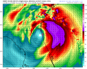
6z WRF has folded. Landfall just north of Tampa as 110-115knts with HMON south of Tampa about the same.
Sure looks like it. Both recon passes show slow deepening even over land with extrapolated pressure readings of 947Mb and 946Mb respectively. I expect some weakening as the eye is currently traversing the hilly terrain right now, but the storm sure looks poised to just explode in the SE gulf today into tonight.Could it hit cat 5 today? Seems very possible.

Possible. Probably unlikely, but I think it will have to happen in the next 12 hrs or so.Could it hit cat 5 today? Seems very possible.
Stormsfury
Member
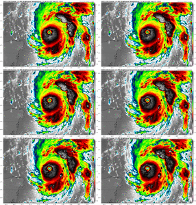
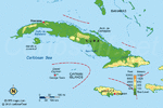
Not the most impressive eye atm. Let’s see if she can get her act back together between Cuba and the Florida coast.
smast16
Member
Henry2326
Member
The latest fix is 953Mb. Still very impressed with the eye over land for several hours now. The eye is intact and is almost assured of emerging off the coast in the next 1-2 hours still at a powerful CAT3. Wow.


EMTime
Member
I've seen enough of these storms in the gulf to recognize when one has everything going for it to rapidly strengthen. This one has it.
They always seem to over perform on forecasted strength.
Ian is about to hit bath water with no shear.
They always seem to over perform on forecasted strength.
Ian is about to hit bath water with no shear.
iGRXY
Member
Exactly. This thing has mid to upper 80 degree waters and with it's NE movement the shear is going to help venting the storm. Very easily could see a 150 mph Cat 4 right off the coast of Florida.I've seen enough of these storms in the gulf to recognize when one has everything going for it to rapidly strengthen. This one has it.
They always seem to over perform on forecasted strength.
Ian is about to hit bath water with no shear.
iGRXY
Member
6Z pulled back west a touch once over land. 0z had the core emerging right on the coast and the atlantic before being tugged back west.
If this does emerge back over the Atl it will be a shadow of it's former self with little to no re-intensification. So even if that scenario played out, it would be a weak system for 2nd landfall and would have bigger implications for qpf in certain areas and maybe severe threats.
iGRXY
Member

Widespread 5-7" totals now from WPC for all of SC/NC and majority of Georgia. Really got to feel for Florida as that is a swath of 10-20" totals from the WPC on top of Storm Surge.
Cary_Snow95
Member
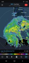
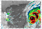
Northern edge of the eye now back over water
Cary_Snow95
Member
Cary_Snow95
Member
BHS1975
Member
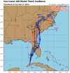
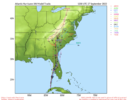
Now most tracks enter the Atlantic..
View attachment 122262
Ukie bout to pull another coup.
Sent from my iPhone using Tapatalk
EMTime
Member
he looks to be growing in size. Not sure.
There’s a reason cat 5’s are rare. I’d say this will top out at 140-145 mph or so, at best
Henry2326
Member
I believe that too.Ukie bout to pull another coup.
Sent from my iPhone using Tapatalk
smast16
Member
Too early to wobble watch, because i think he just wobbled east.
Again short term movement so maybe no huge deal, land interaction could play a role in this, but obvious some eastward of due north movement as noted by recon fixes


Henry2326
Member
He's big enough now, he can do what he wants.Too early to wobble watch, because i think he just wobbled east.
Also I’m sure we will have new blow up thunderstorms surrounding the center as we move over water and those are known to knock it around and I assume could shift it a bit N or even NW for a bit.There would almost have to be zero eastward wobbles, jogs, movement for it to hit Tampa... I'm going to lean Cape Coral.
View attachment 122257
Belle Lechat
Member
- Joined
- Aug 29, 2021
- Messages
- 1,529
- Reaction score
- 1,215
Shaggy
Member
Yeah on visible his short term he definitely has a slight eastward component to movement. Not sure any models had thatAgain short term movement so maybe no huge deal, land interaction could play a role in this, but obvious some eastward of due north movement as noted by recon fixes

Last edited:
DadOfJax
Member
All models have had that off of Cuba’s coastYeah lm visible short term he definitely has a slight eastward component to movement. Not sure any models had that
The ICON was also persistent in showing the hurricane reemerging into the Atlantic after crossing Florida. Score a coup for the crazy Kraut model too.Ukie bout to pull another coup.
Sent from my iPhone using Tapatalk
Stormsfury
Member
Ian's eye is actually already becoming better defined as it's set to move off the coast of Cuba. No doubt, Ian was in an explosive deepening phase as it made landfall (since pressure was still falling just after landfall early this morning)
What can be expected in Orlando this far inland? I'm stuck at Disney (staying off property). I'm not concerned with flooding as much I am wind damage with power out. I'm not home so I can't prepare other than getting food and water. I'm on the 6th floor of a hotel, so that should provide for some interesting views. My flight was supposed to leave tomorrow. Doubt that happens

