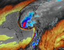
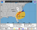
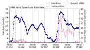
Been doing some thinking today, and while I’m not sure if it’s possible to have this happen and not disrupt the core of a major hurricane; I wonder if a little dry air in the upper levels of the atmosphere contributed to the rapidly strengthening of Ian. At least in my mind, it would explain the absolute wicked updrafts, extreme lightning and hail, and 60k foot echo tops in the eyewall if the dry air aloft formed a pseudo EML which in turn raised lapse rates as happens in severe weather episodes. Of course the near perfect position between trough providing ventilation and the anticyclone added to this as well. This may be mostly nonsense, as I’m tired.
All in all a few take a ways:
1. Models still have huge trouble nailing down the speed of troughs in the northern stream. Gonna be another miserable model watching winter I’m afraid.
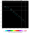
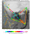
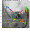
2. While not great on track, the hurricane models have become extremely good on intensity forecasts close to landfall. Both HMON and HWRF had Ian rapidly strengthening to near Cat 5 status, before holding steady and/or slight weakening at landfall to 125-130knts. They also nailed the fact that the highest winds would be in the western half. The Euro also deserves a huge shout out in strength forecasting. Even though it was too high with surface pressure, it too showed the strengthening episode before landfall.
3. I do believe Ian will be upgraded to Cat 5 before weakening to Cat 4 at landfall.
4. Another hurricane where timing made a disaster. Had it ramped up in the Caribbean as was predicted, it would have probably hit at much lower intensity. This whole organization thing right before landfall is very interesting.
5. Maybe the only time I’ve ever had a hurricane landfall close to where I thought it would.
Last edited:

