-
Hello, please take a minute to check out our awesome content, contributed by the wonderful members of our community. We hope you'll add your own thoughts and opinions by making a free account!
You are using an out of date browser. It may not display this or other websites correctly.
You should upgrade or use an alternative browser.
You should upgrade or use an alternative browser.
Tropical Hurricane Ian
- Thread starter severestorm
- Start date
-
- Tags
- tropical
That angle of landfall is the absolute, positively worst case scenario for the Charleston Metro.Umm this thing coming ashore almost exactly where the ICON shows and this is where it ends up... take it fwiw but something to watch
Belle Lechat
Member
- Joined
- Aug 29, 2021
- Messages
- 1,100
- Reaction score
- 847
and that is so important with forecasting a beast like this.Does anyone know why models continually initialize pressures too weak? You'd think someone would manually add if needed?
Stormsfury
Member
Taylor C
Member
So slow.
Belle Lechat
Member
- Joined
- Aug 29, 2021
- Messages
- 1,100
- Reaction score
- 847
As much as I blast the ICON, it has really been rock steady the last several days and is going to closest on the FL landfall. I still have to believe it’s strength here is overdone, but even if it’s 10mb weaker, that’s still a solid category 2Umm this thing coming ashore almost exactly where the ICON shows and this is where it ends up... take it fwiw but something to watch

Belle Lechat
Member
- Joined
- Aug 29, 2021
- Messages
- 1,100
- Reaction score
- 847
222.8 mph. What does that translate down to at the surface, anybody?
LovingGulfLows
Member
- Joined
- Jan 5, 2017
- Messages
- 1,300
- Reaction score
- 3,299
How far up are those readings?
GFS weaker but basically same track of ICON into SC
ZCZC MIATCUAT4 ALL
TTAA00 KNHC DDHHMM
Hurricane Ian Tropical Cyclone Update
NWS National Hurricane Center Miami FL AL092022
1200 PM EDT Wed Sep 28 2022
...12 PM EDT IAN POSITION UPDATE...
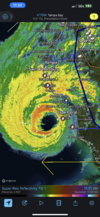
...EYEWALL OF IAN MOVING ONSHORE AT SANIBEL AND CAPTIVA ISLANDS...
The Government of Cuba has discontinued all Tropical Storm Warnings
for Cuba.
A Weatherflow station near Sanibel Island, Florida recently
reported sustained winds of 71 mph (114 km/h) and a wind gust of
98 mph (158 km/h), and a River, Estuary, and Coastal Network
station at Redfish Pass recently reported sustained winds of 67 mph
(108 km/h) and a wind gust of 84 mph (135 km/h).
SUMMARY OF 1200 PM EDT...1600 UTC...INFORMATION
----------------------------------------------
LOCATION...26.4N 82.5W
ABOUT 45 MI...70 KM SW OF PUNTA GORDA FLORIDA
ABOUT 50 MI...80 KM WNW OF NAPLES FLORIDA
MAXIMUM SUSTAINED WINDS...155 MPH...250 KM/H
PRESENT MOVEMENT...NNE OR 15 DEGREES AT 9 MPH...15 KM/H
MINIMUM CENTRAL PRESSURE...937 MB...27.67 INCHES
$$
Forecaster Beven
NNNN
Blue_Ridge_Escarpment
Member
GFS looks quite a bit further south coming on shore near HHIGFS weaker but basically same track of ICON into SC
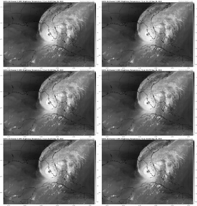
Yep, far enough north to get vented, yet far enough south to still be protected by the anticyclone.So what would have been shredding this to pieces if it had been in the northern GOM like it once was forecast, is now basically acting as an exhaust venting the beast. It's almost as if it decided it just wanted to go where the conditions were ripest, insane
View attachment 122414
Brick Tamland
Member
The scene on TWC right now is incredible.


