Henry2326
Member
Pluto TV carries weather nation.
Pull it up on internet.
Josh Morgerman was on a few minutes ago.
Pull it up on internet.
Josh Morgerman was on a few minutes ago.
Watching the street cams that are still up, and it still just blows me away how quick the water came up!A few of these webcams from Sanibel & Captiva are still up ...
Watching the street cams that are still up, and it still just blows me away how quick the water came up!
 www.mysanibel.com
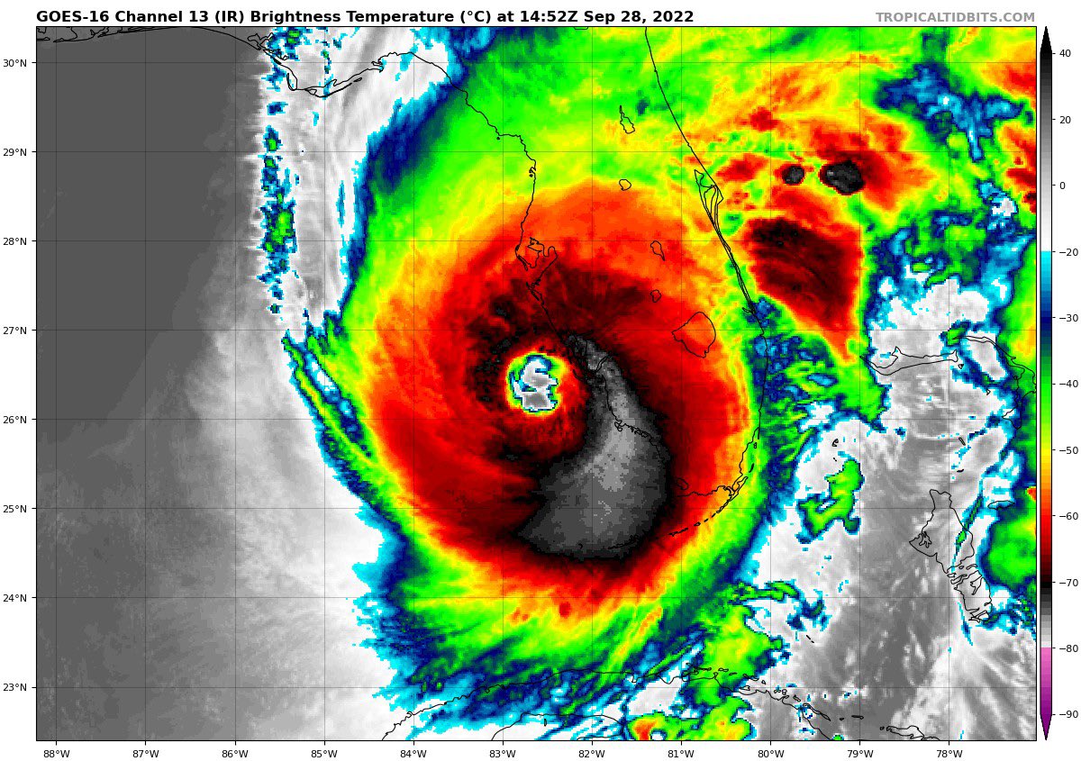
Ian is expected to make landfall in southwestern Florida in the next
few hours as a catastrophic hurricane. No changes were made to the
track forecast near Florida, except to be faster to come into line
with the latest consensus aids. One important change is that Ian
is likely to remain more intact as it crosses the Florida peninsula
(due to both its stronger initial wind speed and its faster forecast
forward speed), and this now increases the threat of hurricane-force
winds on the east coast of Florida. This necessitates the issuance
of a Hurricane Warning on the east coast of central Florida. While
significant re-strengthening of Ian might not occur over the
Atlantic Ocean, model guidance has been catching up with a
trough interaction from a shortwave over the southern United
States, and are stronger than yesterday on Ian's intensity with
more baroclinic forcing. Thus, a Hurricane Watch has been issued
from northeastern Florida northward up the coast through most of
coastal South Carolina. The new intensity forecast is raised from
the previous one, near the latest statistical-dynamical guidance

Yes. The mail box is about to be fully submerged. Probably about 5' of surge there now. I'm surprised this cam is still on! The power box, according to Google Earth, is about to be submerged. That will probably be the end of my storm voyeurism.Watching the Lindgren & East Gulf West cam at the link below you can see that the water has come up about 12in in the last 30 min.
Live Street Cams | City of Sanibel