Belle Lechat
Member
- Joined
- Aug 29, 2021
- Messages
- 1,547
- Reaction score
- 1,224
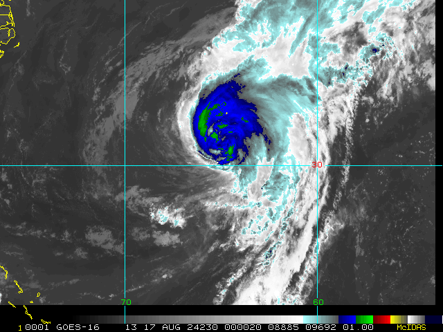
Brief movie. Bermuda visible. Not so bad for Bermuda.


| ...ERNESTO'S CENTER BEGINNING TO MOVE AWAY FROM BERMUDA AND WINDS HAVE PICKED BACK UP ON THE ISLAND... ...HAZARDOUS CONDITIONS WILL CONTINUE ON BERMUDA THROUGH THIS EVENING... |
| 8:00 AM AST Sat Aug 17 Location: 32.6°N 64.6°W Moving: NNE at 9 mph Min pressure: 974 mb Max sustained: 85 mph |

| ...HAZARDOUS WEATHER STILL OCCURING ON BERMUDA AS ERNESTO MOVES SLOWLY NORTH-NORTHEASTWARD... ...DANGEROUS BEACH CONDITIONS TO CONTINUE ALONG THE U.S. EAST COAST THROUGH EARLY NEXT WEEK... |
| 11:00 AM AST Sat Aug 17 Location: 32.9°N 64.4°W Moving: NNE at 9 mph Min pressure: 974 mb Max sustained: 80 mph |
Now forecast to be a Tropical Storm off Newfoundland. |
| ...ERNESTO COULD RESTRENGTHEN SOME TODAY... ...DANGEROUS BEACH CONDITIONS EXPECTED ALONG THE U.S. EAST COAST THROUGH DURING THE NEXT FEW DAYS... |
| 5:00 AM AST Sun Aug 18 Location: 34.6°N 63.0°W Moving: NNE at 9 mph Min pressure: 978 mb Max sustained: 70 mph |


| 32 | 08/19 11:00 AM | 41.8N | 58.5W | 90MPH | 968mb | Ne at 28 MPH | H1 | Ernesto | 08/19 11:03 AM |
| 33 | 08/19 5:00 PM | 43.8N | 56.1W | 90MPH | 968mb | Ne at 26 MPH | H1 | Ernesto | 08/19 4:48 PM |
| 34 | 08/19 11:00 PM | 45.7N | 53.1W | 80MPH | 973mb | Ne at 35 MPH | H1 | Ernesto | 08/19 10:45 PM |
| 35 | 08/20 5:00 AM | 47.3N | 50.0W | 75MPH | 975mb | Ne at 36 MPH | H1 | Ernesto | 08/20 4:45 AM |