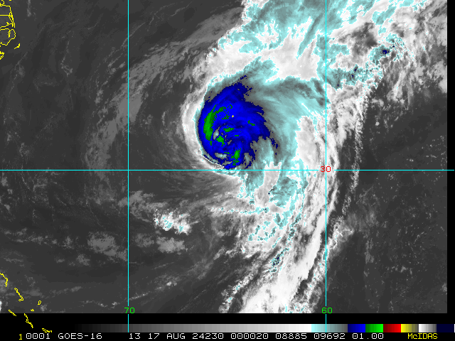
Nothing about this storm feels unique. We've had a few storms tease the NE in modeling before hitting Bermuda and grazing Atlantic Canada in the last few years. Barring any funny business that's should be what happens. Here's the funny business:
-How much latitude Ernesto climbs is determinant on how strong it gets. You have heard this before. Not unique. I do think Ernesto is embedded in a large robust wave envelope which could hinder strengthening and cause center reformations. Either/or could keep the storm further south
-If it stays further south it could get tangled with the islands/Hispaniola which would really bring it south
-A southern track could cause Ernesto to miss the trough (a weaker/flatter trough does this to) and could banish the storm to steering current hell in the Bahamas. (some GFS ensembles show this below) Even then I'm unsure that Ernesto is a US threat because another trough follows the first and this would sweep up any sloppy leftovers out to sea
I'm going to admit this is a pretty big spread for four days out, it's all dependent on trough influence. If I were a NHC forecaster I would be annoyed but not distraught.
The final wildcard is the shape/orientation of that second trough. The OP GFS is pretty close to a cut off with the trough which would exert some westward motion to the storm track. If that thing digs a little more and cuts off further south this is a problem. But it's rare, there's a reason hurricanes only hit the NE like once every fifty years lol
So yeah there's some fun cross tabs to keep track of on a just in case basis but don't expect this storm to be a barn burner