-
Hello, please take a minute to check out our awesome content, contributed by the wonderful members of our community. We hope you'll add your own thoughts and opinions by making a free account!
You are using an out of date browser. It may not display this or other websites correctly.
You should upgrade or use an alternative browser.
You should upgrade or use an alternative browser.
Tropical Hurricane Ernesto
- Thread starter SD
- Start date
Brent
Member
Probably gonna see a PTC today with the Antilles threatened
Certainly a dangerous storm to watch. For now, US impacts for Puerto Rico, US Virgin Islands and New England still need to monitor. And of course all the other non US areas too. This does not appear to be a clean cut fish storm. 
Stormsfury
Member
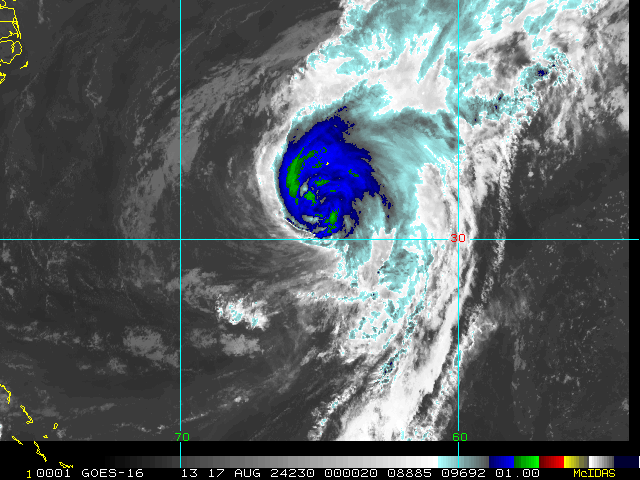
Looking at visible satellite today, I'm not seeing a well defined circulation at this time, and seeing that 98L is absolutely hauling ass. That bothers me on a potential later development of 98L due to just how fast it's moving and could serve to make it a little harder to close off a well defined low until it either slows down a little or delays it.
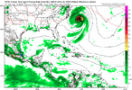
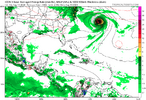
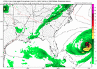
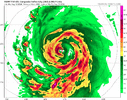
12Z runs:
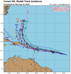
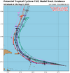
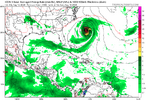
-ICON passes 150 miles NW of Bermuda
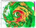
-GFS hits Bermuda very hard with a MH
-CMC also hits Bermuda hard with H center passing just to the W. That’s a big shift W for it
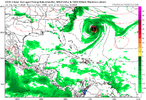
-GEFS mean shifts E significantly with virtually none near the CONUS and the mean centered on Bermuda. Some brush SE Canada.
-UKMET passes 150 miles W of Bermuda while moving NW
-Euro passes 150 miles SE of Bermuda with little effect on Bermuda
-EPS centered around Bermuda with only a few W outliers near CONUS.
Last edited:
Brent
Member
NHC will initiate advisories on Potential Tropical Cyclone Five, located over the Central Tropical Atlantic
Henry2326
Member
Henry2326
Member
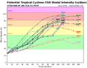
NHC has it topping at 110mph on this forecast, just short of a major. Bet it will be there when they add a day.
‐--------------------------------------
Tropical Cyclone Five Discussion Number 1
NWS National Hurricane Center Miami FL AL052024
500 PM AST Sun Aug 11 2024
NHC has been monitoring the a broad area of low pressure associated
with a tropical wave over the tropical Atlantic during the past
several days. Satellite images and earlier ASCAT data indicate that
the low has a broad circulation, but there is no evidence of a
well-defined center yet. The associated shower and thunderstorm
activity is showing some signs of organization, but visible
satellite imagery suggests that dry air is entraining into the
circulation. However, since the disturbance is forecast to become
a tropical storm in the next day or so, and there is a risk of
tropical-storm-force winds across portions of the Leeward Islands
during that time, advisories are being initiated on Potential
Tropical Cyclone Five. The NOAA and Air Force Hurricane Hunters
will be investigating this system on Monday.
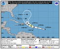
The estimated motion of Potential Tropical Cyclone Five is
285/18-kt. The track guidance is in fairly good agreement on a fast
west-northwestward motion through the next 36-48 h. This motion
should bring the system near or over the Leeward Islands on Tuesday.
Thereafter, a deep-layer trough moving off the U.S. East Coast
should approach this system, inducing a turn to the northwest by
Wednesday and to the north thereafter. This should bring the
system in the general vicinity of the Virgin Islands and Puerto Rico
Tuesday night, then emerging into the Atlantic north of Puerto Rico
on Wednesday. The NHC track forecast is based on a blend of the
latest GFS and ECMWF models. Users should keep in mind that the
track forecasts for potential tropical cyclones are inherently more
uncertain than normal since the system lacks a well–defined center.
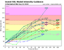
Potential Tropical Cyclone Five is currently located in an
environment of moderate easterly vertical wind shear. Over the next
day or two, the wind shear is forecast to decrease some while the
disturbance moves into an increasingly unstable environment. Given
the current organizational state of the convection and low-level
wind structure, the system likely needs at least one more day before
it can organize into a tropical cyclone. Around the time the system
reaches the Leeward Islands, it will be moving into an increasingly
conducive environment for strengthening. Therefore, once the system
is able to develop an inner core it should have an opportunity to
strengthen at a faster rate. The favorable environment will likely
continue in the 3 to 5-day time frame, and this system is forecast
to be a strengthening hurricane when it is moving northward over the
western Atlantic. The NHC intensity forecast is slightly below the
intensity consensus in the short term, but falls in line with the
consensus aids beyond a couple of days.
Key Messages:
1. The disturbance is expected to become a tropical storm before
reaching the Leeward Islands, where Tropical Storm Watches are in
effect. Tropical storm conditions could begin on Tuesday for
portions of the area.
2. Heavy rainfall may result in locally considerable flash flooding
and mudslides in portions of the northern Leeward Islands Tuesday
and Wednesday, and into Puerto Rico Wednesday through Thursday.
3. Additional watches or warnings will likely be required for the
British and U.S. Virgin Islands, and Puerto Rico tonight or early
Monday, and interests in these locations should monitor the progress
of this system.
FORECAST POSITIONS AND MAX WINDS
INIT 11/2100Z 13.6N 48.0W 25 KT 30 MPH...POTENTIAL TROP CYCLONE
12H 12/0600Z 14.3N 51.2W 30 KT 35 MPH...POTENTIAL TROP CYCLONE
24H 12/1800Z 15.2N 55.5W 35 KT 40 MPH...POTENTIAL TROP CYCLONE
36H 13/0600Z 15.9N 59.2W 40 KT 45 MPH...TROPICAL CYCLONE
48H 13/1800Z 17.0N 62.2W 45 KT 50 MPH
60H 14/0600Z 18.3N 64.4W 55 KT 65 MPH
72H 14/1800Z 19.8N 66.1W 65 KT 75 MPH
96H 15/1800Z 23.9N 67.4W 85 KT 100 MPH
120H 16/1800Z 27.7N 66.3W 95 KT 110 MPH
$$
Henry2326
Member
Henry2326
Member
Brent
Member
At least it might rack up some ACE
Were still on the high end of normal pace there anyway mostly because of Beryl
Belle Lechat
Member
- Joined
- Aug 29, 2021
- Messages
- 1,529
- Reaction score
- 1,215
| Adv# | Date | Lat | Long | Wind | Pres | Movement | Type | Name | Received | Forecaster |
| 1 | 08/11 5:00 PM | 13.6N | 48.0W | 30MPH | 1010mb | Wnw at 21 MPH | Ptnl | Five | 08/11 4:57 PM | Hagen/cangialosi |
| 1A | 08/11 8:00 PM | 13.9N | 49.1W | 30MPH | 1009mb | Wnw at 23 MPH | Ptnl | Five | 08/11 7:45 PM | Pasch |
| 2 | 08/11 11:00 PM | 14.1N | 50.1W | 30MPH | 1009mb | Wnw at 23 MPH | Ptnl | Five | 08/11 10:45 PM | Pasch |

lexxnchloe
Member
lexxnchloe
Member
lexxnchloe
Member
Possibly a threat to New England
0Z UKMET: similar to 12Z run
NEW TROPICAL CYCLONE FORECAST TO DEVELOP AFTER 84 HOURS
FORECAST POSITION AT T+ 84 : 22.7N 71.1W
LEAD CENTRAL MAXIMUM WIND
VERIFYING TIME TIME POSITION PRESSURE (MB) SPEED (KNOTS)
-------------- ---- -------- ------------- -------------
1200UTC 15.08.2024 84 22.7N 71.1W 1006 43
0000UTC 16.08.2024 96 24.1N 71.2W 1004 47
1200UTC 16.08.2024 108 26.1N 70.1W 1000 48
0000UTC 17.08.2024 120 27.7N 69.8W 998 43
1200UTC 17.08.2024 132 28.8N 69.9W 997 50
0000UTC 18.08.2024 144 30.2N 70.1W 995 52
1200UTC 18.08.2024 156 32.8N 69.3W 993 50
0000UTC 19.08.2024 168 36.4N 68.2W 982 63
Belle Lechat
Member
- Joined
- Aug 29, 2021
- Messages
- 1,529
- Reaction score
- 1,215
Belle Lechat
Member
- Joined
- Aug 29, 2021
- Messages
- 1,529
- Reaction score
- 1,215
| 1 | 08/11 5:00 PM | 13.6N | 48.0W | 30MPH | 1010mb | Wnw at 21 MPH | Ptnl | Five | 08/11 4:57 PM | Hagen/cangialosi |
| 1A | 08/11 8:00 PM | 13.9N | 49.1W | 30MPH | 1009mb | Wnw at 23 MPH | Ptnl | Five | 08/11 7:45 PM | Pasch |
| 2 | 08/11 11:00 PM | 14.1N | 50.1W | 30MPH | 1009mb | Wnw at 23 MPH | Ptnl | Five | 08/11 10:45 PM | Pasch |
| 2A | 08/12 2:00 AM | 14.3N | 51.4W | 30MPH | 1009mb | Wnw at 23 MPH | Ptnl | Five | 08/12 1:36 AM | Beven |
Belle Lechat
Member
- Joined
- Aug 29, 2021
- Messages
- 1,529
- Reaction score
- 1,215
Belle Lechat
Member
- Joined
- Aug 29, 2021
- Messages
- 1,529
- Reaction score
- 1,215

| 1 | 08/11 5:00 PM | 13.6N | 48.0W | 30MPH | 1010mb | Wnw at 21 MPH | Ptnl | Five | 08/11 4:57 PM | Hagen/cangialosi |
| 1A | 08/11 8:00 PM | 13.9N | 49.1W | 30MPH | 1009mb | Wnw at 23 MPH | Ptnl | Five | 08/11 7:45 PM | Pasch |
| 2 | 08/11 11:00 PM | 14.1N | 50.1W | 30MPH | 1009mb | Wnw at 23 MPH | Ptnl | Five | 08/11 10:45 PM | Pasch |
| 2A | 08/12 2:00 AM | 14.3N | 51.4W | 30MPH | 1009mb | Wnw at 23 MPH | Ptnl | Five | 08/12 1:36 AM | Beven |
| 3 | 08/12 5:00 AM | 14.4N | 52.5W | 30MPH | 1009mb | W at 25 MPH | Ptnl | Five | 08/12 4:54 AM | Beven |
Belle Lechat
Member
- Joined
- Aug 29, 2021
- Messages
- 1,529
- Reaction score
- 1,215
Henry2326
Member
5 am NHC.....Interpretation: they don't have confidence in the track yet.
"While the model
guidance is generally in good agreement with this scenario, there
is still uncertainty on where the predominant center will
eventually form, and this will affect where the system may track
with respect to the Leeward Islands, the Virgin Islands, and Puerto
Rico. The new forecast track has only minor adjustments from the
previous forecast."
Henry2326
Member
Belle Lechat
Member
- Joined
- Aug 29, 2021
- Messages
- 1,529
- Reaction score
- 1,215
Belle Lechat
Member
- Joined
- Aug 29, 2021
- Messages
- 1,529
- Reaction score
- 1,215
Belle Lechat
Member
- Joined
- Aug 29, 2021
- Messages
- 1,529
- Reaction score
- 1,215
| 1 | 08/11 5:00 PM | 13.6N | 48.0W | 30MPH | 1010mb | Wnw at 21 MPH | Ptnl | Five | 08/11 4:57 PM | Hagen/cangialosi |
| 1A | 08/11 8:00 PM | 13.9N | 49.1W | 30MPH | 1009mb | Wnw at 23 MPH | Ptnl | Five | 08/11 7:45 PM | Pasch |
| 2 | 08/11 11:00 PM | 14.1N | 50.1W | 30MPH | 1009mb | Wnw at 23 MPH | Ptnl | Five | 08/11 10:45 PM | Pasch |
| 2A | 08/12 2:00 AM | 14.3N | 51.4W | 30MPH | 1009mb | Wnw at 23 MPH | Ptnl | Five | 08/12 1:36 AM | Beven |
| 3 | 08/12 5:00 AM | 14.4N | 52.5W | 30MPH | 1009mb | W at 25 MPH | Ptnl | Five | 08/12 4:54 AM | Beven |
| 3A | 08/12 8:00 AM | 14.6N | 54.3W | 30MPH | 1009mb | W at 26 MPH | Ptnl | Five | 08/12 8:00 AM | Reinhart |
Belle Lechat
Member
- Joined
- Aug 29, 2021
- Messages
- 1,529
- Reaction score
- 1,215
122330 1558N 05458W 9781 00320 0138 +250 +244 089028 029 040 001 00
7:23 CDT
40 kts=46 mph Peak 10-second average surface wind speed
7:23 CDT
40 kts=46 mph Peak 10-second average surface wind speed
Drscottsmith
Member
Thanks for doing this - I like the summary table!
1 08/11 5:00 PM 13.6N 48.0W 30MPH 1010mb Wnw at 21 MPH Ptnl Five 08/11 4:57 PM Hagen/cangialosi 1A 08/11 8:00 PM 13.9N 49.1W 30MPH 1009mb Wnw at 23 MPH Ptnl Five 08/11 7:45 PM Pasch 2 08/11 11:00 PM 14.1N 50.1W 30MPH 1009mb Wnw at 23 MPH Ptnl Five 08/11 10:45 PM Pasch 2A 08/12 2:00 AM 14.3N 51.4W 30MPH 1009mb Wnw at 23 MPH Ptnl Five 08/12 1:36 AM Beven 3 08/12 5:00 AM 14.4N 52.5W 30MPH 1009mb W at 25 MPH Ptnl Five 08/12 4:54 AM Beven 3A 08/12 8:00 AM 14.6N 54.3W 30MPH 1009mb W at 26 MPH Ptnl Five 08/12 8:00 AM Reinhart
Belle Lechat
Member
- Joined
- Aug 29, 2021
- Messages
- 1,529
- Reaction score
- 1,215
Highlighting this line0Z UKMET: similar to 12Z run
NEW TROPICAL CYCLONE FORECAST TO DEVELOP AFTER 84 HOURS
FORECAST POSITION AT T+ 84 : 22.7N 71.1W
LEAD CENTRAL MAXIMUM WIND
VERIFYING TIME TIME POSITION PRESSURE (MB) SPEED (KNOTS)
-------------- ---- -------- ------------- -------------
1200UTC 15.08.2024 84 22.7N 71.1W 1006 43
0000UTC 16.08.2024 96 24.1N 71.2W 1004 47
1200UTC 16.08.2024 108 26.1N 70.1W 1000 48
0000UTC 17.08.2024 120 27.7N 69.8W 998 43
1200UTC 17.08.2024 132 28.8N 69.9W 997 50
0000UTC 18.08.2024 144 30.2N 70.1W 995 52
1200UTC 18.08.2024 156 32.8N 69.3W 993 50
0000UTC 19.08.2024 168 36.4N 68.2W 982 63
1200UTC 15.08.2024 84 22.7N 71.1W 1006 43
43 kts=49.48 mph
Let's see how long it really takes to go up 3 knots.
Belle Lechat
Member
- Joined
- Aug 29, 2021
- Messages
- 1,529
- Reaction score
- 1,215
Glad you like it.Thanks for doing this - I like the summary table!
Ptnl Five Spotlight (2024) - FLHurricane.com
flhurricane is a Website focused on the tracking, data, and discussion of Atlantic Hurricanes with a focus on Florida.
Belle Lechat
Member
- Joined
- Aug 29, 2021
- Messages
- 1,529
- Reaction score
- 1,215
Intermediate Advisory Number 3A
NWS National Hurricane Center Miami FL AL052024
800 AM AST Mon Aug 12 2024
DISCUSSION AND OUTLOOK
Some strengthening is forecast during the next couple of days, and
the disturbance is expected to become a tropical depression later
today or tonight and become a tropical storm as it nears the Leeward
Islands.
Belle Lechat
Member
- Joined
- Aug 29, 2021
- Messages
- 1,529
- Reaction score
- 1,215
Shaggy
Member
Still hauling butt and still no clear area of circulation for the models to latch onto
Belle Lechat
Member
- Joined
- Aug 29, 2021
- Messages
- 1,529
- Reaction score
- 1,215
Second plane is up.
Belle Lechat
Member
- Joined
- Aug 29, 2021
- Messages
- 1,529
- Reaction score
- 1,215
If I am correct, I think I can see it in the large map in #27. It looks like the center lower down lags the center above.Still hauling butt and still no clear area of circulation for the models to latch onto
I have a feeling a weaker storm and running into land/islands will result in a further west track that could hammer New England or Canada
Belle Lechat
Member
- Joined
- Aug 29, 2021
- Messages
- 1,529
- Reaction score
- 1,215
Belle Lechat
Member
- Joined
- Aug 29, 2021
- Messages
- 1,529
- Reaction score
- 1,215

