-
Hello, please take a minute to check out our awesome content, contributed by the wonderful members of our community. We hope you'll add your own thoughts and opinions by making a free account!
You are using an out of date browser. It may not display this or other websites correctly.
You should upgrade or use an alternative browser.
You should upgrade or use an alternative browser.
Tropical Hurricane Dorian
- Thread starter RBR71
- Start date
B
Brick Tamland
Guest
No doubt, further west. Mean track looks to go right along the SC and NC coastline.
Dang this thing has increased in size big time
Jessy89
Member
Could this thing bring a storm surge to Charleston bigger then what Hugo brought?
Sent from my iPhone using Tapatalk
Sent from my iPhone using Tapatalk
ForsythSnow
Moderator
Latest pass definitely indicates this took a good NW jog. How far it goes we have yet to see.
gawxnative
Member
I would not be shocked if NHC "pulled the trigger" on a Hurricane Warning for the GA Coast for 2300 update. He is still keeping a NW-NNW Track and with expansion of wind field
FamouslyHot
Member
Last projection I saw for Charleston was about 10.5 feet which another poster said would be the second highest surge, although Hugo would still have it beat by a good bit.Could this thing bring a storm surge to Charleston bigger then what Hugo brought?
Sent from my iPhone using Tapatalk
Sent from my SM-G970U using Tapatalk
drfranklin
Member
- Joined
- Dec 1, 2016
- Messages
- 511
- Reaction score
- 760
is Dorian making a run for the FL coast?
edit: recent radar frame looks stalled
edit: recent radar frame looks stalled
Last edited:
SnowNotHappen
Member
I agree.I would not be shocked if NHC "pulled the trigger" on a Hurricane Warning for the GA Coast for 2300 update. He is still keeping a NW-NNW Track and with expansion of wind field
ForsythSnow
Moderator
Recon seems to say NW, but it's still a bit east of the Euro.Is the storm actually moving NW right now or is it more N? How's it moving in relation to the 18Z Euro and other models?
B
Brick Tamland
Guest
There's plenty of real estate there. Just a matter of how much Dorian wants to use.
Stormsfury
Member
Recon seems to say NW, but it's still a bit east of the Euro.
Doesn't really matter if that NW Jog takes it another full degree left in longitude in the next day
B
Brick Tamland
Guest
And this is a great visual of the west trend. Not only is it getting Dorian closer to land, it shows the curve is going to have to be very sharp to avoid GA.
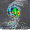
Dancing precariously close to the Fl coast

Sent from my SM-G950U using Tapatalk

Sent from my SM-G950U using Tapatalk
0z nam is west of 18z
Sent from my SM-G975U using Tapatalk
Sent from my SM-G975U using Tapatalk
Henry2326
Member
0z nam is west of 18z
Sent from my SM-G975U using Tapatalk
Also 923mb sitting about 50 miles SE of Savannah on pivotal
ForsythSnow
Moderator
The 3KM again is not reliable for pressure. Use the 12 KM. That shows a more reliable 962 mb.Also 923mb sitting about 50 miles SE of Savannah on pivotal
Good divergence over NC should be a decent shield of rain

Sent from my SM-G975U using Tapatalk

Sent from my SM-G975U using Tapatalk
Not huge I guess but Dorian looks closer to the Fl peninsula then the NAM initialized or has during it's run0z nam is west of 18z
Sent from my SM-G975U using Tapatalk
Little slower and nice westward expansion of the rain shield

Sent from my SM-G950U using Tapatalk

Sent from my SM-G950U using Tapatalk
Starting to see a solid jog toward the coastline right now
Henry2326
Member
3k nam is getting more rain on the northern and western side. We may be seeing the models start to show a more expensive area of rain farther west.Little slower and nice westward expansion of the rain shield
Sent from my SM-G950U using Tapatalk
Sent from my SM-G975U using Tapatalk
Downeastnc
Member
Little slower and nice westward expansion of the rain shield
Sent from my SM-G950U using Tapatalk
925MB winds on the NAM are 80-90 mph at 1800-2400 ft over most of eastern NC and 50-80 mph and a little higher up over the I-95 corridor, how efficiently those winds mix down will be critical....

Also that track of the 3K NAM is
I can see why the models are closer and closer to the coast in short term and long term
Henry2326
Member
Tropical Storm Watches 1 county away from RAH now!!!
Downeastnc
Member
3K NAM just plows into NC almost NNE never makes the turn ENE ends up over Belhaven on the last frame I saw....this is much further NW with the track than the GFS/ICON/EURO/UKIE by a good 50-75 miles
I swear on satellite, it’s moving WNW!?
ForsythSnow
Moderator
Almost looks like that on radar the last 10 or so frames.I swear on satellite, it’s moving WNW!?
I'm in the tropical storm watchTropical Storm Watches 1 county away from RAH now!!!
Sent from my SM-G975U using Tapatalk
Downeastnc
Member
I swear on satellite, it’s moving WNW!?
Its really hard to track storms with large irregular eyes as the uneven edges make it look like it is doing all kinds of stuff.....generally I would say he is moving NW....


