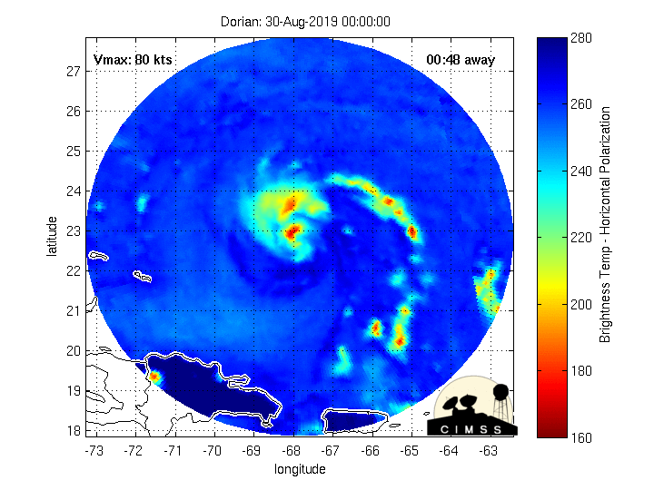
788
URNT15 KWBC 310003
NOAA2 2105A DORIAN HDOB 20 20190830
235330 2540N 07026W 7515 02530 0065 +130 +097 136064 065 052 001 00
235400 2539N 07028W 7509 02536 0064 +124 +100 134062 064 052 000 00
235430 2538N 07030W 7512 02526 0056 +122 +114 136060 062 052 003 00
235500 2537N 07032W 7514 02516 0049 +122 +115 140067 068 058 001 00
235530 2536N 07034W 7516 02500 0032 +131 +103 140073 075 060 001 00
235600 2535N 07036W 7516 02492 0023 +128 +100 139077 077 060 007 00
235630 2534N 07038W 7527 02469 0009 +128 +122 140080 082 064 010 00
235700 2533N 07040W 7519 02464 9993 +130 +111 139087 088 068 006 00
235730 2532N 07042W 7519 02445 9975 +127 +121 136090 092 073 013 00
235800 2531N 07044W 7518 02426 9954 +124 //// 131097 100 078 031 01
235830 2530N 07046W 7497 02420 9917 +125 //// 136100 103 085 038 01
235900 2529N 07048W 7491 02398 9873 +138 //// 140100 104 094 012 01
235930 2528N 07050W 7521 02326 9832 +140 //// 139109 112 103 007 01
000000 2527N 07052W 7485 02313 9772 +141 //// 137115 118 107 012 01
000030 2526N 07054W 7486 02236 9689 +142 //// 136122 125 114 015 01
000100 2525N 07056W 7491 02155 9583 +164 +155 132091 111 114 017 00
000130 2524N 07058W 7526 02079 9510 +214 +147 114045 055 112 027 03
000200 2522N 07100W 7529 02065 9495 +222 +120 102021 028 /// /// 03
000230 2520N 07100W 7528 02071 9496 +227 +106 094005 009 026 000 03
000300 2518N 07100W 7501 02105 9503 +223 +110 235007 009 025 000 03
Winds are up to 114 knots.