That is interesting, especially since the tracks of the 3k NAM and ECMWF line up pretty well. It might be on to something but I still think it is probably a little overdone.The mesoscale models and the NAM suite are a little more robust with the wind fields
-
Hello, please take a minute to check out our awesome content, contributed by the wonderful members of our community. We hope you'll add your own thoughts and opinions by making a free account!
You are using an out of date browser. It may not display this or other websites correctly.
You should upgrade or use an alternative browser.
You should upgrade or use an alternative browser.
Tropical Hurricane Dorian
- Thread starter Metwannabe
- Start date
It’s funny. I haven’t seen a drop of rain all day. Been partly cloudy and a little breezy. Gusts to about 15, but that’s it. Not a bad day at all.
And as soon as I say that we get a little rain shower. LOL
.8 so far at the house, I'm impressed with rain total for my area so far
Downeastnc
Member
Downeastnc
Member
If we get another north wobble its going to tuck the center up in right under Cape Fear, that blow up of storms on the south side will probably pull it east a bit more but when that rotates around to the north it might pull the center on or really close to Cape Fear.
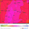
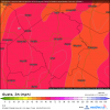
You are right. I was looking at the same 12z run on WeatherBell and it has a 51 mph max right over PGV. I guess the sites are using different algorithms to make the maps? I did notice the 12z wind gusts map from WeatherBell was a good deal lower than the previous ECMWF runs, even at the coast.Well HRRR
View attachment 23225
3K NAM
View attachment 23226
Even the recent Euro does better according to this map than you said.
View attachment 23227
Henry2326
Member
Between Georgetown and Pawleys Island....
Downeastnc
Member
You are right. I was looking at the same 12z run on WeatherBell and it has a 51 mph max right over PGV. I guess the sites are using different algorithms to make the maps? I did notice the 12z wind gusts map from WeatherBell was a good deal lower than the previous ECMWF runs, even at the coast.
They are likely overdone but even if you take 10-15% off the top thats still hurricane force gust....I guess I will know if they are right in about 12 or so hrs lol...
Another thing to note, the 18z HRRR says it should be gusting in the 40s and 50s right now in portions of the Sandhills. Current obs are showing gusts in the mid 20s. Not saying that the model won't be right in the future, but it is obviously not handling that secondary interior wind max well at the moment. It actually looks pretty good for the coastal counties though.
man its pouring here at work
On radar looks like one of those north wobbles is occurring..If we get another north wobble its going to tuck the center up in right under Cape Fear, that blow up of storms on the south side will probably pull it east a bit more but when that rotates around to the north it might pull the center on or really close to Cape Fear.
Downeastnc
Member
On radar looks like one of those north wobbles is occurring..
Yeah radar is much more reliable, obviously NNE the last few hrs.... if he doesnt move more east in the next 6-7 hrs it will landfall on Cape Fear, like the models have been showing for days....it should also begin speeding up a touch soon to....but I still think Cape Fear to MHX to just west of Hatteras is the most likely track....but when they go slow they like to "bounce" off and around land so he might roll around Cape Fear enough to avoid a technical landfall.
Radar looking to be extending a bit further west. Currently I’m on the fringe line.

Sent from my iPhone using Tapatalk

Sent from my iPhone using Tapatalk
Downeastnc
Member
Also as he gets closer to land and especially if he actually gets on shore the moat around the center should fill in with heavy rain, this will help mix those winds down to the surface....
B
Brick Tamland
Guest
Severe Weather Statement
National Weather Service Raleigh NC
353 PM EDT Thu Sep 5 2019
NCC051-052015-
/O.CON.KRAH.TO.W.0042.000000T0000Z-190905T2015Z/
Cumberland NC-
353 PM EDT Thu Sep 5 2019
...A TORNADO WARNING REMAINS IN EFFECT UNTIL 415 PM EDT FOR
SOUTHWESTERN CUMBERLAND COUNTY...
At 352 PM EDT, a severe thunderstorm capable of producing a tornado
was located near Jerome, or 13 miles southeast of Fayetteville,
moving west at 50 mph.
HAZARD...Tornado.
SOURCE...Radar indicated rotation.
IMPACT...Flying debris will be dangerous to those caught without
shelter. Mobile homes will be damaged or destroyed. Damage
to roofs, windows, and vehicles will occur. Tree damage is
likely.
Locations impacted include...
Hope Mills, Stedman, Bushy Lake Natural Area and Cedar Creek.
B
Brick Tamland
Guest
BULLETIN - EAS ACTIVATION REQUESTED
TORNADO WARNING
NATIONAL WEATHER SERVICE RALEIGH NC
401 PM EDT THU SEP 5 2019
THE NATIONAL WEATHER SERVICE IN RALEIGH HAS ISSUED A
* TORNADO WARNING FOR...
WILSON COUNTY IN CENTRAL NORTH CAROLINA...
* UNTIL 445 PM EDT
* AT 401 PM EDT, A SEVERE THUNDERSTORM CAPABLE OF PRODUCING A TORNADO
WAS LOCATED 8 MILES NORTHWEST OF FARMVILLE, MOVING WEST AT 35 MPH.
HAZARD...TORNADO.
SOURCE...RADAR INDICATED ROTATION.
IMPACT...FLYING DEBRIS WILL BE DANGEROUS TO THOSE CAUGHT WITHOUT
SHELTER. MOBILE HOMES WILL BE DAMAGED OR DESTROYED.
DAMAGE TO ROOFS, WINDOWS, AND VEHICLES WILL OCCUR. TREE
DAMAGE IS LIKELY.
* LOCATIONS IMPACTED INCLUDE...
WILSON, KENLY, LUCAMA, STANTONSBURG, BLACK CREEK, SARATOGA AND
BUCKHORN RESERVOIR.
Sctvman
Member
Literally nothing is open at all on James Island other than Bojangles. Damage is probably the worst since Hurricane Hugo on the island.
B
Brick Tamland
Guest
Debris signature on the radar with the Wilson County tornado according to WRAL.


