-
Hello, please take a minute to check out our awesome content, contributed by the wonderful members of our community. We hope you'll add your own thoughts and opinions by making a free account!
You are using an out of date browser. It may not display this or other websites correctly.
You should upgrade or use an alternative browser.
You should upgrade or use an alternative browser.
Tropical Hurricane Dorian
- Thread starter Metwannabe
- Start date
So to recap slightly west at 48, east at 72 the same or slightly east at 96
Sent from my SM-G975U using Tapatalk
No, it is further east at just about all points through 72 vs the prior 3 runs and about the same at hour 96 vs the 0Z run’s 108. My comparisons of today’s 12Z weren’t against the 12Z of yesterday.
B
Brick Tamland
Guest
NC coast not in the clear yet. Still a long ways to go.
Henry2326
Member
Its bwen holding....remember it was the only one many times along this journey.....when it changes, I will come along.The HWRF has been behind the curve it seems. This 12Z run is actually the furthest east of any when off FL/GA. So, this joins the consensus of being further east at 12Z when down there. Things continue to look better for FL/GA. But still watching. I expect the HWRF to keep trending east.
B
Brick Tamland
Guest
It’s now casting time
B
Brick Tamland
Guest
When do the short range models start to come into play and become helpful?
Nope. AgreeIt looks to me like he’s back from the slow WNW or NW drift to hardly moving at all. Any other opinions?
Jessy89
Member
At this point I’m done model watching with this one. We know the steering and the expected track. So what we watch for is wobbles. Because I really think the track is set.
Sent from my iPhone using Tapatalk
Sent from my iPhone using Tapatalk
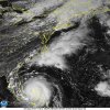
SUMMARY OF 300 PM EDT...1900 UTC...INFORMATION
----------------------------------------------
LOCATION...26.8N 78.4W
ABOUT 25 MI...40 KM NE OF FREEPORT GRAND BAHAMA ISLAND
ABOUT 105 MI...170 KM E OF WEST PALM BEACH FLORIDA
MAXIMUM SUSTAINED WINDS...150 MPH...240 KM/H
PRESENT MOVEMENT...WNW OR 285 DEGREES AT 1 MPH...2 KM/H
MINIMUM CENTRAL PRESSURE...938 MB...27.70 INCHES
pcbjr
Member
While a lot of Guidance shifts east the GEFS shifts west this run.
At this point I’m done model watching with this one. We know the steering and the expected track. So what we watch for is wobbles. Because I really think the track is set.
Sent from my iPhone using Tapatalk
Agreed. The only question is if it clips HAT. I am thinking just offshore of HAT.
pcbjr
Member
Yup ...While a lot of Guidance shifts east the GEFS shifts west this run.
Cary_Snow95
Member
gawxnative
Member
One thing I have noticed is that the weakening trend has stopped.. Been constant 155/938mb last 3-4 hours
B
Brick Tamland
Guest
Mandatory evacuation ordered for the OBX.
https://www.darenc.com/Home/Compone...21?backlist=/departments/emergency-management
https://www.darenc.com/Home/Compone...21?backlist=/departments/emergency-management
B
Brick Tamland
Guest
All students must be evacuated from the UNC Wilmington campus by 5:00 p.m. on Tuesday, according to a campus email issued to faculty, staff and students.
SUMMARY OF 400 PM EDT...2000 UTC...INFORMATION
----------------------------------------------
LOCATION...26.8N 78.4W
ABOUT 25 MI...40 KM NE OF FREEPORT GRAND BAHAMA ISLAND
ABOUT 105 MI...170 KM E OF WEST PALM BEACH FLORIDA
MAXIMUM SUSTAINED WINDS...145 MPH...230 KM/H
PRESENT MOVEMENT...WNW OR 285 DEGREES AT 1 MPH...2 KM/H
MINIMUM CENTRAL PRESSURE...940 MB...27.76 INCHES
$$
Forecaster Blake


