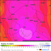
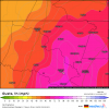
Canadian with a Florida landfall near Canaveral as it starts its NW motion
Sent from my SM-G975U using Tapatalk
Sent from my SM-G975U using Tapatalk
Yeah its already further SW then thatSo check this out....in the next 96 mins. 6z Mon or 2 am E the HMON (brand new run, just started running) says Dorian will be here....Do yall see a problem with that?
View attachment 22841
These slight shifts have huge implications
Sent from my SM-G950U using Tapatalk


slight problem to that, as Arcc said, its moving W (overall) with some WSW wobbles/short term movement and if that continues there track (and no models track for that matter) is gonna verify in the short term.
Looking at Longwave IR you can see cloud tops have slightly warmed in the last 2 hours and it appears the western edge of the precip shield is hitting a wall (evident on shortwave IR). It’s only a matter of time now before he/she/it begins to turn.
I am sorry but I have to respectfully disagree here. In fact, the western edge is still advancing westward. The cirrus outflow shield is now* basically hitting the coast of FL.. Also look at the WV, the northern side still has a slight look of being "flattened if you will" There is still ridging to the north or this wouldnt' be moving Westward with slight WSW jogs.Looking at Longwave IR you can see cloud tops have slightly warmed in the last 2 hours and it appears the western edge of the precip shield is hitting a wall (evident on shortwave IR). It’s only a matter of time now before he/she/it begins to turn.
It’s happening. Radar hallucinations will light up the twittersphere for the next several hours but it is hitting the proverbial wall and it will most definitely begin the long trip North soon enough. Next stop? Nobody knowsI noticed this as well, I think folks will be surprised how quickly it starts to jog WNW or even NW here in the next 6-12 hrs....
It could be worse.Can we just rename this site ncwx.com already?
This posting of these five day out maps and declaring 'east' or ' west' in reference to Wilmington while the rest of the world is looking at West Palm Beach is just too much.
It could be worse.
Imagine if Raleigh was on the NC coast.
