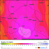
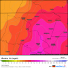
Canadian with a Florida landfall near Canaveral as it starts its NW motion
Sent from my SM-G975U using Tapatalk
Sent from my SM-G975U using Tapatalk
Yeah its already further SW then thatSo check this out....in the next 96 mins. 6z Mon or 2 am E the HMON (brand new run, just started running) says Dorian will be here....Do yall see a problem with that?
View attachment 22841
These slight shifts have huge implications
Sent from my SM-G950U using Tapatalk


slight problem to that, as Arcc said, its moving W (overall) with some WSW wobbles/short term movement and if that continues there track (and no models track for that matter) is gonna verify in the short term.
Looking at Longwave IR you can see cloud tops have slightly warmed in the last 2 hours and it appears the western edge of the precip shield is hitting a wall (evident on shortwave IR). It’s only a matter of time now before he/she/it begins to turn.
I am sorry but I have to respectfully disagree here. In fact, the western edge is still advancing westward. The cirrus outflow shield is now* basically hitting the coast of FL.. Also look at the WV, the northern side still has a slight look of being "flattened if you will" There is still ridging to the north or this wouldnt' be moving Westward with slight WSW jogs.Looking at Longwave IR you can see cloud tops have slightly warmed in the last 2 hours and it appears the western edge of the precip shield is hitting a wall (evident on shortwave IR). It’s only a matter of time now before he/she/it begins to turn.
It’s happening. Radar hallucinations will light up the twittersphere for the next several hours but it is hitting the proverbial wall and it will most definitely begin the long trip North soon enough. Next stop? Nobody knowsI noticed this as well, I think folks will be surprised how quickly it starts to jog WNW or even NW here in the next 6-12 hrs....
It could be worse.Can we just rename this site ncwx.com already?
This posting of these five day out maps and declaring 'east' or ' west' in reference to Wilmington while the rest of the world is looking at West Palm Beach is just too much.
It could be worse.
Imagine if Raleigh was on the NC coast.
Haha....good point.
Have had TPBI loaded for several hours now and if anything the precip shield is expanding west, not contracting. Not yet anyway.
Consistent slightly south of due west motion for literally about twelve hours now.
Will that matter, TBD, but if I were on the Space Coast I wouldn't like it.
Anyone have any info on that oil tanker field on Grand Bahama? I'm sure they are built to withstand a hurricane, but this is on a level they may not have planned for. Either way, it's taking a pounding right now.
Also, at least on TPBI the moat separating the inner eyewall and the outer eyewall (as such that it is) has closed considerably in the past hour.
a pretty big shift west to be honest on that panel
Yes it has. You could see the extreme western edge of the precip shield receive some pushback a little over an hour ago. Now it looks like the eye of Dorian is feeling it as wellAm I seeing things or did Dorian just stop moving?
Last few frames look like the eye hasn’t moved.
you were right Jimmy it has hit the brakes. Will be interesting to see what happens next. Good call.Yes it has. You could see the extreme western edge of the precip shield receive some pushback a little over an hour ago. Now it looks like the eye of Dorian is feeling it as well
You should sort back through my comments and see all of the bad calls I made this past week. I’m 1 for 20 tops. ??you were right Jimmy it has hit the brakes. Will be interesting to see what happens next. Good call.
If you look at the HRRR it shows Dorian picking up speed and tracking north.Could this be the stall we've been eagerly anticipating? If so, this could be very good news for the entire SE as this is early. However, because it is quite a bit earlier than model consensus had the stall, I'm wondering if this is a fakeout and that it will resume slow westerly movement. Hopefully not.
Also, cloud tops are warming, indicative of further weakening, which I assume would be largely due to upwelling and some due to land. Remember what Levi said about the HWRF. He think that it has been showing a motion more toward the NW than NNW after the slowdown and change in direction from W due to a lower steering level caused by weakening being assumed due to upwelling. Let's see what happens. Do we have the stall now that will then change to a NNW move offshore FL. Or does it threaten central/NE FL?

