This should probably go without saying, but please refrain from comments like "We're dead now" in this thread. You can always make nonsensical and OT comments in the banter thread. That's why we have that. Thanks very much.
-
Hello, please take a minute to check out our awesome content, contributed by the wonderful members of our community. We hope you'll add your own thoughts and opinions by making a free account!
You are using an out of date browser. It may not display this or other websites correctly.
You should upgrade or use an alternative browser.
You should upgrade or use an alternative browser.
Hurricane Debby
- Thread starter Brent
- Start date
Downeastnc
Member
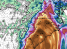
Yeah. I'm not saying the rgem is right, but it feels like to me that some of the other models are under-doing the amounts over inland sections. The rgem feels extreme, but the system may end up being very slow moving, like the models have been showing. And if that continues to be the case, I would expect higher amounts to be reflected across the board as we move in.
We have no trouble getting under "death bands" when it's rain during a cane...
jeremyt
Member
You mean town? No cities in Harnett County! LolWinds are going to be atm for my city at high teens low 20s.
weather bubba
Member
Floyd brings back memories. I was dating my wife then and she was living near Goldsboro. Her father and one of her uncles had their homes condemned due to the flooding around the Neuse River. The only time I have ever hydroplaned while I was driving occurred right after Floyd was pulling away from North Carolina on Highway 70 near Princeton. I ended up making it back to my house with about $ 1,000.00 worth of damage to the car I was driving. Ironically, my wife's name is Debbie. The dog in my avatar is named Gordon and his name is on this year's list of storm names too.Understood , Fran is my memory but understand Floyd for your location! I had just flown out to be stationed in Okinawa for a year but looked at the news for the area of the Neuse/Trent. Catastrophic flooding from Goldsboro to the Coast.
jeremyt
Member
Yeah…Brad typically does go with the WPC guidance, and they usually do really wellBrad P’s rain call for now!
Nerman
Member
Already raining in Charleston. That's not good.
jeremyt
Member
Absolutely!Yeah…Brad typically does go with the WPC guidance, and they usually do really well
Stormsfury
Member
Expected though. Light rain in the Creek also. The start of a very long week ahead.Already raining in Charleston. That's not good.
Henry2326
Member
Henry2326
Member
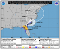
part of 11 am discussion:
Debby has been moving through a break in the subtropical ridge with
an estimated initial motion of 030/7 kt. Steering currents are
expected to weaken some more, resulting in a further decrease in
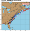
forward speed. Most of the track guidance turns Debby eastward,
with the center moving off the coast near the Georgia/South
Carolina border in about 36 hours. Debby should move very slowly
near the South Carolina coast through 60 hours or so. Then, a
mid-level ridge builds slightly to the northeast of the cyclone,
which should push the system back inland over the latter part of
the forecast period. The official forecast track is a blend of the
simple and corrected dynamical consensus models, TVCA and HCCA.
Continued weakening is expected while the center of Debby remains
over land tonight and Tuesday. By late Tuesday and thereafter,
some restrengthening is anticipated as the center moves offshore.
However the amount that the cyclone re-intensifies is dependent on
how far out over the Atlantic the system moves and how long it
remains over water. The current official forecast shows only
modest restrengthening, given the uncertainties.
Going forward, the biggest threat from this slow-moving system
system is extreme precipitation and flooding over the southeastern
United States.
lexxnchloe
Member
Henry2326
Member
lexxnchloe
Member
lexxnchloe
Member
snowc
Member
@Rain Cold @Webberweather53 @SD Does anybody know what the impacts is regarding wind in Harnett County? I have PTSD over Florence, and this is shaping up to be a Florence.
snowc
Member
Erwin is right in the storms path. Great...
Cool spin East of Hilton Head. Gonna have some tornado warnings shortly.
accu35
Member
- Joined
- Jan 5, 2017
- Messages
- 8,470
- Reaction score
- 10,057
I advise you to always watch your local news and weather reports for update on counties.@Rain Cold @Webberweather53 @SD Does anybody know what the impacts is regarding wind in Harnett County? I have PTSD over Florence, and this is shaping up to be a Florence.


