-
Hello, please take a minute to check out our awesome content, contributed by the wonderful members of our community. We hope you'll add your own thoughts and opinions by making a free account!
You are using an out of date browser. It may not display this or other websites correctly.
You should upgrade or use an alternative browser.
You should upgrade or use an alternative browser.
Hurricane Debby
- Thread starter Brent
- Start date
Some models (not all) have really struggled with Debby. Not the first storm this season either (see cat5). Kinda reminds me of 2004/2005 when models kinda stunk real bad at times.  Surprised at how quiet the bands are with Debby over the Atlantic.
Downeastnc
Member
She is actually trying to do just that though slowly cooling the western side and wrapping them around to the south.gotta cough out this dry air tonight coming in from the south, before she can start fixing her wounds
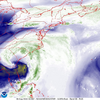
View attachment 149574
FWIW the 18z hrrr really starts rebuilding the system around mid morning tomorrow
I estimate that I’m at 8.5” so far from Debby (over last ~30 hours) with only ~1/2” since 2AM allowing good progress on drainage. If we were to not get too much more from this point forward (where I’m leaning now), I’d be near the low end of the range of predictions, which had a pretty good amount for today and tomorrow. As of last night I had guessed at least another 4” between then and Thursday. Still an 8.5” rain is enough to qualify as a very big rain event due to its rarity and very likely is the largest since Matthew of early Oct of 2016. Also, some nearby areas (Effingham and Jasper counties) got 10-11” per CoCoRaHS.
The storm is currently centered just E of here along the coast about to be offshore. Winds and rain are very light near the storm center.
The storm is currently centered just E of here along the coast about to be offshore. Winds and rain are very light near the storm center.
My call of less than an inch is looking good so far for the upstate along and north of 85. Starting to really wonder if we get anything more than a few showers from Greenville east and not a drop west of Greenville. Didn't need a model to tell me that a couple days ago. Climo with that track wins 9 out of 10 times.
Sctvman
Member
Charleston peninsula is closed today. Cops at every entrance into the city. But a lull pretty much most of the day here. Last night could very well have been the worst of the storm, but still a couple of days of very soggy weather ahead.
Very little traffic. Most people are at home.
Very little traffic. Most people are at home.
Everything is good in Mount Pleasant I'm on my way to the gymCharleston peninsula is closed today. Cops at every entrance into the city. But a lull pretty much most of the day here. Last night could very well have been the worst of the storm, but still a couple of days of very soggy weather ahead.
Very little traffic. Most people are at home.
I saw the staging in Pooler and it was crazy. Huge big black trucks that said hydro solutions (I guess they suck and remove water). Looked military like. May still be there if you ever go to Tanger Outlets. If the GFS is right tho man Savannah could easily teeter on the edge of disaster over the next 48hrs. Metro Diner was the only thing open over at the shopping center. Saw a few homes surrounded in water on Highway 80 and a large lake on the right hand side of i95 south. Glad everything is reopening for dinner, Bella’s is my go to place when I’m in town they open at 5.I estimate that I’m at 8.5” so far from Debby (over last ~30 hours) with only ~1/2” since 2AM allowing good progress on drainage. If we were to not get too much more from this point forward (where I’m leaning now), I’d be near the low end of the range of predictions, which had a pretty good amount for today and tomorrow. As of last night I had guessed at least another 4” between then and Thursday. Still an 8.5” rain is enough to qualify as a very big rain event due to its rarity and very likely is the largest since Matthew of early Oct of 2016. Also, some nearby areas (Effingham and Jasper counties) got 10-11” per CoCoRaHS.
The storm is currently centered just E of here along the coast about to be offshore. Winds and rain are very light near the storm center.
Everything running to the ocean. Garden City residents asked to stop washing clothes and using water. Sewer is backing up. This is right beside of Savannah.
ENCSnowdawg
Member
That is not good.Everything running to the ocean. Garden City residents asked to stop washing clothes and using water. Sewer is backing up. This is right beside of Savannah.
JHS
Member
It is going back east for sure and is faster. The ICON from a couple days ago had the right idea. The 2nd landfall may very well be in NC now.My call of less than an inch is looking good so far for the upstate along and north of 85. Starting to really wonder if we get anything more than a few showers from Greenville east and not a drop west of Greenville. Didn't need a model to tell me that a couple days ago. Climo with that track wins 9 out of 10 times.
It looks to me like things have pretty much zeroed in on a landfall between Georgetown and Myrtle Beach… that’s were the EURO, UKMET, and ICON have been holding steady and is where the guidance plots are clustered up as well. Actually just looking at the 18z ICON, it’s ticked back south a tad to a landfall just south of Georgetown after being the most northern of the three the last couple days.It is going back east for sure and is faster. The ICON from a couple days ago had the right idea. The 2nd landfall may very well be in NC now.
snowc
Member
I heard that outages are going to be localized. Is that true?
snowc
Member
Possible Wind Advisory?
Gusty winds could blow around unsecured objects.
Tree limbs could be blown down and a few power outages may
result.
Use extra caution when driving, especially if operating a high
profile vehicle. Secure outdoor objects.
Gusty winds could blow around unsecured objects.
Tree limbs could be blown down and a few power outages may
result.
Use extra caution when driving, especially if operating a high
profile vehicle. Secure outdoor objects.
I heard that outages are going to be localized. Is that true?
Power outages up this way (central NC) should be isolated.
Rain (and lots of it) will be our main concern.
HugeSnowStick
Member
It is the total end of times as Harnett County knows it.I heard that outages are going to be localized. Is that true?
High Risk canceled for Savannah and some of southern South Carolina for today. - WPC
High Risk canceled for Savannah and some of southern South Carolina for today. - WPC
The center of the storm really dried out, most of the heavier rain is north and east of the center.
Avalanche
Member
It’s def lost its punchThe center of the storm really dried out, most of the heavier rain is north and east of the center.
It will be interesting to see how much filling it will happen once out over water, if any at all.It’s def lost its punch
Downeastnc
Member
Possible tornado moving onshore in North Myrtle Beach one of the better couples this afternoon.
Avalanche
Member
They’ve dealt with a lot of reds on the radar todayPossible tornado moving onshore in North Myrtle Beach one of the better couples this afternoon.
Downeastnc
Member
Gonna be a long 48 hrs of bands coming in for coastal Carolinas...They’ve dealt with a lot of reds on the radar today
lexxnchloe
Member
I sure hope not. The ground wont dry out till the 60's and 70's dec-feb.
ENCSnowdawg
Member
Yes it's possible.
910guy
Member
If I’m not mistaken, we got about 37 inches from Florence in 2018 here in Elizabethtown.
RAH afternoon discussion mentions possibility of the westward shift and how it could change the impact to Central NC...
After re-strengthening some offshore Wednesday and early Thursday,
there is some better agreement amongst ensembles with the inland
track of Debby. Notably, the 12Z GEFS has finally come in better
agreement with the EPS/GEPS pulling the circulation into central SC
by Thursday evening, and then into our area through Friday. However,
also of note is there seems to be a consistent westward shift
amongst ensembles in bringing the circulation into central NC a bit
further west than previously thought. This could have considerable
consequences for the spatial distribution of rainfall totals
Thursday through Saturday which is further discussed below.
Regardless of the eventual path, several potentially life-
threatening hazards will occur Thursday through Saturday before the
system transitions to extra-tropical and pulls off to our north.
As discussed above, if the more westward track occurs, this could
enhance rainfall totals over the western piedmont, and consequently
decrease totals for areas further south. The latest 18Z WPC QPF
shows this westward trend, suggesting 4 to 6 inches across much of
the Piedmont (north, central, western), and more like 2 to 4 inches
over the Sandhills/southern Coastal Plain Thursday through Friday
evening. The main takeaway here is that the QPF field from Thursday
onward could continue to be dynamic, but the flooding headlines
remain unchanged area wide.
As the Debby center moved to the SE offshore finally putting us on the backside, steady mainly moderate rains resumed about 1.5 hours ago after little rain since late last night. I had been at ~8.5” for the storm before this. We’ll see how much gets added from this and more to come tonight.
Let’s not forget about Florence in 2018, so we know it’s definitely possible. Also I see they’ve backed that 8” line back to I-77 in the Piedmont.
Downeastnc
Member
JHS
Member
That is a major west shift in rain despite the track not moving this way very much on the 5pm advisory. I am almost in the 6–8-inch zone now with the 8-12 zone touching the eastern part of my county. If this holds up, GSP will need to add counties to their flood watch.Let’s not forget about Florence in 2018, so we know it’s definitely possible. Also I see they’ve backed that 8” line back to I-77 in the Piedmont.
Looks and feels non-tropical. Chilly  windy
windy  foggy
foggy  but rain is picking up right over SAV.
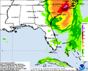
One thing that I’ve noticed is that all of the models seem to have a very intense and wide band that sets up to the west and northwest of the center as it moves inland. Where that band pivots and dumps over is going to add up totals very quickly.That is a major west shift in rain despite the track not moving this way very much on the 5pm advisory. I am almost in the 6–8-inch zone now with the 8-12 zone touching the eastern part of my county. If this holds up, GSP will need to add counties to their flood watch.
Blue_Ridge_Escarpment
Member
That is a major west shift in rain despite the track not moving this way very much on the 5pm advisory. I am almost in the 6–8-inch zone now with the 8-12 zone touching the eastern part of my county. If this holds up, GSP will need to add counties to their flood watch.
With the potential significant impacts to at least a portion of the GSP coverage area, I thought their afternoon forecast discussion left a lot to be desired.
JHS
Member
The ICON and Euro came about 30-40 miles west again at 18z and the Euro slowed it down a little. I know this is not right, but the Euro had gusts to around 60mph in a couple of areas north of the Charlotte metro. I'd expect 40-45 is what actually happens though.
lizajane
Member
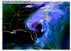
Just looking at the current satellite. Could it be possible that a new center forms closer to the gulf stream. I swear that's what it looks like to me.
JHS
Member
I suspect unless things change again, we get a much more detailed discussion and major forecast changes around 3am tomorrow.With the potential significant impacts to at least a portion of the GSP coverage area, I thought their afternoon forecast discussion left a lot to be desired.


