-
Hello, please take a minute to check out our awesome content, contributed by the wonderful members of our community. We hope you'll add your own thoughts and opinions by making a free account!
You are using an out of date browser. It may not display this or other websites correctly.
You should upgrade or use an alternative browser.
You should upgrade or use an alternative browser.
Misc General Banter Thread
- Thread starter Rain Cold
- Start date
WolfpackHomer91
Member
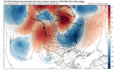
I love a well timed “GEFS looks bad” from Fro. Hope meter is maxed out. This is about to be a lot of fun over the next 24 hoursView attachment 182009
Yea…. Not the time of the dance you wanna start going backwards. Imo this next 24-36hrs be all or nothing….. Day 5-6 is like Those mid CFB teams that are 5-1 in Mid October bc they played cupcakes time to go one way or another here to be contender or pretender by Sun afternoon runs
Sent from my iPhone using Tapatalk
packfan98
Moderator
I believe we've had our happy hour for today, y'all. Hold tight on the rest of these runs. We are going to have to power through. Maybe we will get some more good looks over the next few days? At least there's potential!
Bro wakes up just to even out our excitement lmaoI love a well timed “GEFS looks bad” from Fro. Hope meter is maxed out. This is about to be a lot of fun over the next 24 hoursView attachment 182009
Man If we lived in a world that was at the end of the GFS we wouldn’t even have summer we’d still be dead buried in snow.fwiw, the end of the GFS OP is gorgeous pattern-wise.
View attachment 182017
packfan98
Moderator
I suck at this play-by-play. I didn't mean to hype everyone up. How does it rain with that look???
Load er up, let's head to Gatlinburg.
hahaha I got one picked out too.The cabins are chosen, pal. Just need to make sure it doesn’t snow at home first
The question we must ask ourselves instead is how does it not rain with that look.I suck at this play-by-play. I didn't mean to hype everyone up. How does it rain with that look???
You good. GoThe cabins are chosen, pal. Just need to make sure it doesn’t snow at home first
So true! But I still like that better than the entire US covered in crimson, as has been the case lately.Man If we lived in a world that was at the end of the GFS we wouldn’t even have summer we’d still be dead buried in snow.
Drizzle Snizzle
Member
78 for a high so far today.
LongRanger
Member
Get them Sleds ready, Models are honking!!
- Joined
- Jan 5, 2017
- Messages
- 3,770
- Reaction score
- 5,969
Give me member 3 and I'll hang up my snow hunting cap forever!
3, 9, 40 really throwing off that mean there lol
No you won’t lolGive me member 3 and I'll hang up my snow hunting cap forever!
SnowNiner
Member
I love a well timed “GEFS looks bad” from Fro. Hope meter is maxed out. This is about to be a lot of fun over the next 24 hoursView attachment 182009
Fun fact: It took me about 2 weeks to realize NBA was Fro.
Drizzle Snizzle
Member
Looks like the cold is going to be retreating to the north by Late January and Early February.
Drizzle Snizzle
Member
Yeah the pattern might be changing colder, but is it really changing if it just stays dry like it has been for months ? Maybe we go from Warm and Dry to Cool and Dry ?To bad its dry
NBAcentel
Member
Should we do a local obs thread so we can discuss things outside of chasing snow. The nc only thread would be a good example of what I'm thinking
What could have prompted this ideaShould we do a local obs thread so we can discuss things outside of chasing snow. The nc only thread would be a good example of what I'm thinking
NBAcentel
Member
So a slightly below normal dry contour is the reason now why we are saying it’s not gonna precipitate with the cold ? Ok
Drizzle Snizzle
Member
Below normal precip from Atlanta to Dallas is not what we need at a time when the temps actually get colder again !This 6-10 day, which has a notable BN temps signal, includes the 4 day period of 1/15-18, the main threat period for the 2 possible SE winter storms. Here’s the precip outlook showing mainly NN in the SE:
View attachment 182056
NN precip in mid Jan is more than sufficient when combined with midwinter BN temps to produce significant wintry precip. NN precip for what this 6-10 covers in the interior SE is ~0.65” on avg. If 0.65” were to fall as mainly wintry precip during this period, that could be quite impactful while also making a lot of wintry precip lovers quite happy.
Below normal precip from Atlanta to Dallas is not what we need at a time when the temps actually get colder again !
I was addressing the SE, not DFW. ATL is barely in the tan, which only barely leans BN, while much of the rest of the SE is neutral. This tells me the signal favors NN precip for much of the SE, not BN.
yeh idk how anyone can speak in absolutes when we just trended a period that was suppose to ridge into a pattern that's favorable for Winter weather.Looks like the cold is going to be retreating to the north by Late January and Early February.
That's a nice Channel Catfish you caught there.snow is cool but summertime cat daddies are cool to View attachment 182058
SnowNiner
Member
Some people have to work during the day. 5 pages for the afternoon runs?! Sweet.


You knowWhat could have prompted this idea
Barely 70 imby I was promised records
Are you new?yeh idk how anyone can speak in absolutes when we just trended a period that was suppose to ridge into a pattern that's favorable for Winter weather.
BrickTamland
Member
Barely 70 imby I was promised records

BrickTamland
Member
So the GFS had big back to back snow storms for NC between the 16th and 19th, and the Euro had mostly rain.
Geez, wonder which one will be right.

Geez, wonder which one will be right.

I hope it is the GFS. It actually did well with the last winter event the Triangle saw in December.So the GFS had big back to back snow storms for NC between the 16th and 19th, and the Euro had mostly rain.
Geez, wonder which one will be right.

excited to see if the big wet verifies in swnc/western upstate/north ga


