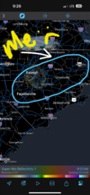
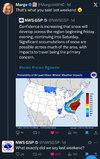
This time tomorrow it’ll be ripping fatties, LFG
-
Hello, please take a minute to check out our awesome content, contributed by the wonderful members of our community. We hope you'll add your own thoughts and opinions by making a free account!
You are using an out of date browser. It may not display this or other websites correctly.
You should upgrade or use an alternative browser.
You should upgrade or use an alternative browser.
Misc General Banter Thread
- Thread starter Rain Cold
- Start date
Weatherheels
Member
Pop the bottles baby, it’s gonna snow.
Triad - I got us with a 2-5” event - there may be some spots that hit 6” in the southeast Triad, wouldn’t surprise me. Overall, I think we are gonna watch Charlotte-Rah do better with this storm just based on the projected track of the ull. Rah is close enough to the coast that it’ll pay dividends if and when the coastal gets cranking. Charlotte is going to get paid off from the ULL.
Should be a great storm for our state, and SC as well.
Thrasher Fan
Member
hug the CAMs szn


broken025
Member
Every model showing 6+ here. Love to see it.
This is our storm, finallyEvery model showing 6+ here. Love to see it.
folks aint gonna keep being patient with youhug the CAMs szn

that playful model that took raleigh city by storm with his first forecast
he sat down and was like i love qpf! and he had the whole and all that
that was all cool! but we give that grace to young models
big dog you're supposed to be our number 1
and you're forecasting like a bum
i bet you better start doing your job!
GeorgiaGirl
Member
Yep, they just put Fulton/Cobb/Cherokee/etc under a warning for "up to 2" - I think they're not wanting a repeat of 2014
URGENT - WINTER WEATHER MESSAGE
National Weather Service Peachtree City GA
1018 AM EST Fri Jan 30 2026
GAZ021-032-033-044>046-048-055-057>059-072-084-311215-
/O.UPG.KFFC.WW.Y.0003.260131T0600Z-260201T0000Z/
/O.EXA.KFFC.WS.W.0002.260131T0600Z-260201T0600Z/
Cherokee-Cobb-North Fulton-South Fulton-DeKalb-Rockdale-Newton-
Clayton-Henry-Butts-Jasper-Jones-Wilkinson-
Including the cities of Toomsboro, Atlanta, Conyers, Stockbridge,
Jackson, Gray, Woodstock, East Point, Monticello, Covington, Decatur,
Riverdale, and Marietta
1018 AM EST Fri Jan 30 2026
...WINTER STORM WARNING IN EFFECT FROM 1 AM SATURDAY TO 1 AM EST
SUNDAY...
* WHAT...Heavy snow expected. Total snow accumulations of up to 2
inches with locally higher amounts possible. Winds gusting as high
as 35 mph.
* WHERE...Portions of central and north central Georgia.
* WHEN...From 1 AM Saturday to 1 AM EST Sunday.
* IMPACTS...Roads, and especially bridges and overpasses, will likely
become slick and hazardous. Gusty winds could result in areas of
blowing snow and poor visibility. Plan on very difficult to
impossible travel conditions.
* ADDITIONAL DETAILS...Wind chills will range from 5 degrees above
zero to the lower teens above zero on Saturday and from five
degrees below zero to to the single digits above zero Saturday
night.
They'll get jumped if this doesn't work out in their favor, but I really don't blame them for doing this.
At least it's a weekend, but while my brain is kinda fried already, I have seen several model runs that push 2" totals to knocking on the door of ATL proper.
I know a large church in Atlanta that’s still taking a group of hundreds of middle schoolers up to a retreat in Cleveland, GA tonight through Sunday. As of 11am the trip is still on and I’m stunned. Cleveland is supposed to get 4-6 inches lol. Stupid in my opinion
Tokenfreak
Member
Does anyone know if the GRAF models are using 10:1 ratios for the snow forecast or is it Kuchera?
Firm hand shakes all around ladies and gentlemen, I will be relieved and sad when it’s over.
Bigedd09
Member
Sorry mods meant for my last post to be in here not the storm thread my b
Sent from my iPhone using Tapatalk
Sent from my iPhone using Tapatalk
GeorgiaGirl
Member
I know a large church in Atlanta that’s still taking a group of hundreds of middle schoolers up to a retreat in Cleveland, GA tonight through Sunday. As of 11am the trip is still on and I’m stunned. Cleveland is supposed to get 4-6 inches lol. Stupid in my opinion
Yeah I wouldn't be taking a bunch of kids there just because right now. It's slightly less risky then Highlands/Cashiers/etc, but still, unless you're going after snow...
packfan98
Moderator
I cleaned it up for you...Sorry mods meant for my last post to be in here not the storm thread my b
Sent from my iPhone using Tapatalk
SimeonNC
Member
It feels so weird to be in a favored area during a winter storm lol
mx3gsr92
Member
Next person that saids "*** is terrible" because it doesn't show 14" in their backyard is getting slapped.
WXinCanton
Member
I personally think the NSSL is on to something, why? looks best for my back yard.


A snow map from y'all "friends...."
He gazed up at the BAM Weather snow map. Forty winters it had taken him to learn what kind of smile was hidden beneath the dark facade. O cruel, needless misunderstanding! O stubborn, self-willed exile from the loving breast! Two gin-scented tears trickled down the sides of his nose. But it was all right, everything was all right, the struggle was finished. He had won the victory over himself. He loved BAM Weather.
Firm hand shakes all around ladies and gentlemen, I will be relieved and sad when it’s over.
There is almost always an element of sadness once it’s here. The chase is half the fun with these systems, even if it’s often maddening.
@Jimmy Hypocracy, can you by chance "slow down" the weather database images?
Sort of bittersweet. Certainly more "sweet" when it arrives AND it's a doozy.There is almost always an element of sadness once it’s here. The chase is half the fun with these systems, even if it’s often maddening.
Per ChatGPT... I was asking questions about the storm and tilt of the trough.
Conclusion:
If I had to plant a flag conceptually:
Translation:
I’d be watching:
Conclusion:
My leaning (without hype)
If I had to plant a flag conceptually:
- I think the ULL strength favors at least neutral tilt
- That argues against a clean, sweeping dry slot for everyone
- But I do think precip distribution will be uneven
Translation:
- Someone in NC is going to jackpot
- Someone 30–50 miles away is going to be salty
- Central NC is right on that knife edge
I’d be watching:
- 500 mb height falls over GA/SC
- 850–700 mb moisture convergence near the coast
- Whether the coastal low deepens before the ULL passes latitude of NC
JimBobs
Member
FINAL CALL
CLT - 8"
GSP - 6"
CAE - 5"
MYB - 6"
ILM - 12"
GSO - 4"
RDU - 1"
CLT - 8"
GSP - 6"
CAE - 5"
MYB - 6"
ILM - 12"
GSO - 4"
RDU - 1"
Snowflowxxl
Member
Yes, last weekend proved thatThere will definitely be a good bit of Melting starting on Sunday with a stronger Early February sun. Even with temps in the 30s.
broken025
Member
I hate this hobbyInteresting that the AIGEFS went in the wrong direction. Better for Ga, worse for almost everyone else.
View attachment 191850
packfan98
Moderator
Yeah, I can’t just brush some of the best models off. They did pretty good last week with the first round of precip before the squall line last weekend.I hate this hobby
Thrasher Fan
Member
Interesting that the AIGEFS went in the wrong direction. Better for Ga, worse for almost everyone else.
View attachment 191850

AI sucks. Physics models baby!!!I hate this hobby
The AI models are lower resolution, or am I making that up? Wondering if they could be missing some mesoscale stuff, although I wouldn't be asking these questions if they showed me getting 8-12” of snow instead of 1-4”.Yeah, I can’t just brush some of the best models off. They did pretty good last week with the first round of precip before the squall line last weekend.
I really like the elevated warm front thump potential early tomorrow in this general area, including the Triangle area down to Fayetteville & Goldsboro-Wilson. Most (reliable) guidance is really honing in on this
View attachment 191853

BrickTamland
Member
FINAL CALL
CLT - 8"
GSP - 6"
CAE - 5"
MYB - 6"
ILM - 12"
GSO - 4"
RDU - 1"

Last edited:
BrickTamland
Member
And he's also

broken025
Member
Don’t worry tiger, you’ll get it next time.


