SimeonNC
Member
I like you’re 2nd December 12-13 2019 call map it looks pretty close to what I expect from this system. But I do want to see if this wave keeps trending weaker. Looks like the 06z euro went back towards a more amped up wave. However, it did still have a slightly stronger CAD.Worth mentioning, for verification purposes & to keep myself honest, I've also kept a running archive of forecast maps I've published since joining this forum in January 2017 on my website:
http://www.webberweather.com/winter-storm-forecast-verification.html
I wonder if that was in-situ CAD or classicalI like you’re 2nd December 12-13 2019 call map it looks pretty close to what I expect from this system. But I do want to see if this wave keeps trending weaker. Looks like the 06z euro went back towards a more amped up wave. However, it did still have a slightly stronger CAD.
View attachment 57633
I like you’re 2nd December 12-13 2019 call map it looks pretty close to what I expect from this system. But I do want to see if this wave keeps trending weaker. Looks like the 06z euro went back towards a more amped up wave. However, it did still have a slightly stronger CAD.
View attachment 57633

I wonder if that was in-situ CAD or classical
What about a map for the upstate


RGEM is that solution imo where CAD hangs on a few hours longer than we all thought, all though I think the areas that’s most likely to possibly have that is the foothills where CAD does typically hang out much longerFreezing Rain Accumulation Model (FRAM) output is a bit more reasonable but potentially still a little overcooked.
View attachment 57636
RGEM is that solution imo where CAD hangs on a few hours longer than we all thought, all though I think the areas that’s most likely to possibly have that is the foothills where CAD does typically hang out much longer
Hrrrv4 should be coming into range, I’m almost sure they fixed the BL mixing bias (could be wrong) so it should be interesting


Hope the RGEM is to cool here ? yeah there’s absolutely no chance of IP with this, that freezing layer is weak afHard to find a more classic freezing rain sounding than this area-averaged one on the RGEM Wednesday morning over the Triad.
View attachment 57638
Sfc temps and wet bulbs in the upper 20s-near 30F ✔
Mid-level warm nose > +3-4C (full melting of hydrometeors) ✔
Very shallow (< 2500 feet) below freezing air mass at and just above the surface ✔
Low-level cold advection ✔
Light-moderate precipitation ✔
View attachment 57639

Hope the RGEM is to cool here ? yeah there’s absolutely no chance of IP with this, that freezing layer is weak afView attachment 57643
What time does the 12z nam come out I’m watching the 3k one
ThanksIt'll be about another 30 mins or so
I would really hate to be in DC. Have a feeling they will get screwed while areas just north and west get hammered.Euro dumps over 2 feet of Snow on Bastardis House: Bet he is all gitty up this morning
View attachment 57637
I would really hate to be in DC. Have a feeling they will get screwed while areas just north and west get hammered.


I learned a new word today. " Sleetly".end of the hrrr coming into range, and it’s surprisingly sleetly for CAD areas (do not take serious yet) View attachment 57646
Oops lol, spell check maybe thought of the summertime drought and almost changed it to sheetly, LolI learned a new word today. " Sleetly".


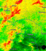
Confluence at H5 is a tad bit stronger as wellVerbatim the CAD is weaker here in the Carolinas this run but the parent high continues to trend stronger over Ontario & Quebec.
View attachment 57652
Brrrr @ the cold rain! Wish this would just run the interior honestly. We don’t need the mid Atlantic to receive 2 feet before we can even squeeze out a flake in the Carolinas. Wouldn’t be good for us looking down the road.
Huge clap of thunder right next to my house just nowCan verify some thunder & lighting in Raleigh with today's system.
.gif")