Round Oak Weather
Member
I think this could fill our gray area across north Alabama if it were to happen
I looked at that don't know if it was snow or not but it came across middle Georgia too. Let me know if it would be cold enough for snow according to that run. Ik it's too early but this could be our first real chance for snow in FebEuro control run has a trailing wave that drops snow in northern Northern North Carolina into Virginia. They have free EPS members
available.
http://wx.graphics/models/ecmwf/eps_ensembles.php


Yeah, there you go. BeautifulBesides the bomb in GA, this may be one of the all time great weenie charts. That ridging into Greenland is getting stronger over the past few runs.


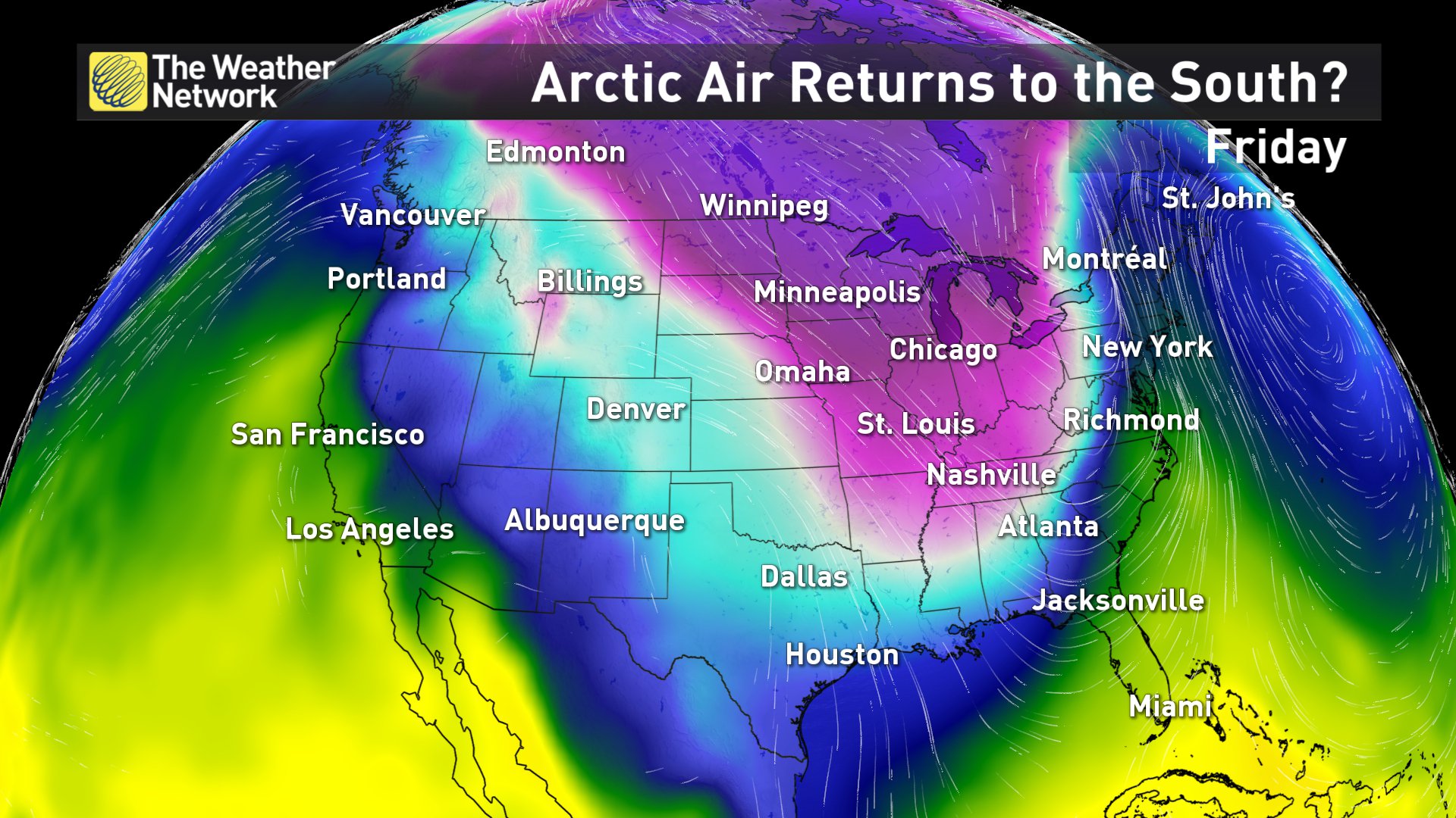
That's the 850 temp not the surface tempYikes...
Near 0 for KATL.
That's the 850 temp not the surface temp
No need to apologize lol. I was just letting you know . But yeah its looking colder and colder in the LROOps sorry, my mistake....
Not just the GFS
It’s over. Winter cancel. LOL
I think 5 or 6So will this be Groundhogzilla pt 3 or 4? I've lost count...
He specifically talks about snow and ice reaching the gulf coast, so, no, that's not about Maryland north.To my friends in Tn, Miss and Ala, I wouldn't run out to buy milk or bread just yet. As for Bastardi's comment, he could be right in general terms (mainly Md and north) but not sure the SE will get in to the cold stormy period with some help from the NAO. Remember his focus has always been the big cities of the MA and NE and he is talking primarily about cold for that market IMO

He specifically talks about snow and ice reaching the gulf coast, so, no, that's not about Maryland north.
Also here posts about Atlanta in mid Feb. being -14C, or about 7 F

it's coming on there too, just a little slowerCmc says enjoy the 60s and 70s next weekend
Sent from my SM-J320VPP using Tapatalk


If all the models keep saying cold then maybe it's not right. Hopefully it's not rightCmc says enjoy the 60s and 70s next weekend
Sent from my SM-J320VPP using Tapatalk
Depends on how far below you the low is, and how close above you the cold is. A low running by inside the Ga line is likely going to be bringing too much waa, unless it's plenty cold.If the low is below you dosent that mean you have a chance for winter weather?


I remember seeing that look on the GFS LR maps in mid-December. It wants a southeast ridge sooooo bad. Fun times, GFS.12z gefs leaves much to desire in the LR . Thankfully we've seen this song and dance before

Sent from my SM-J320VPP using Tapatalk
I remember seeing that look on the GFS LR maps in mid-December. It wants a southeast ridge sooooo bad. Fun times, GFS.

Yep, agreed. I expect the modeling to correct as we move in. Storm opportunities are another matter. Your earlier post about the NAO was interesting. I haven't given any consideration to a -NAO, since it seems they have become so atypical now and usually get lost in the modeling as we close in. It would be nice to get a legit block and the resultant enhanced major winter storm threat.Yeah the GFS & other models tend to oversell the SE US ridge in a pattern like this like we saw as recently as December (& in the winter of 2013-14 as well) and the Euro in particular tends to get arctic air masses hung over the Rockies. The arctic air will probably penetrate much deeper into the SE US than currently modeled.
I remember seeing that look on the GFS LR maps in mid-December. It wants a southeast ridge sooooo bad. Fun times, GFS.
Another wave developing along the tail end of the front. Doesn't look quite as good as the last threat, at least at this point 10 days out. That said, it will change. A lot.GEFS has a few members that support the operation run of some trailing snow.
