-
Hello, please take a minute to check out our awesome content, contributed by the wonderful members of our community. We hope you'll add your own thoughts and opinions by making a free account!
You are using an out of date browser. It may not display this or other websites correctly.
You should upgrade or use an alternative browser.
You should upgrade or use an alternative browser.
Pattern February 2024
- Thread starter SD
- Start date
Maybe it’ll create its own cold air. ?
Looks like we’re punting the first half of Fab Feb and all hopes will be pinned on the back half and Mischievous March now. Will be hoping for a 2015 repeat here.
Looks like we’re punting the first half of Fab Feb and all hopes will be pinned on the back half and Mischievous March now. Will be hoping for a 2015 repeat here.
We may not get any cold push and this thing may not work out, but the fact at 144 hours the Euro is closest to the Canadian definitely makes you step back and pause. UKMET is not a trash model, it has certainly had some poor performances over the years BUT it is also one model I can also say I have seen independently lead the way and whip all other models at H5 in the last two years for an event.
There's really no way to know which way this will go yet, but obviously the past few cycles overall aren't what we'd want to see. There's still too many players on the field, too close to prime positioning, to quit on this one though.
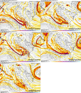
There's really no way to know which way this will go yet, but obviously the past few cycles overall aren't what we'd want to see. There's still too many players on the field, too close to prime positioning, to quit on this one though.

Checking in on the February Playbook 3 days later with updates in red:February Playbook:
Feb 5: Winter storm chance possible
Feb 1-10: Low pressure replaced with High pressure in East Asia
Feb 10-15: Momentum added into the Pac Jet; Aleutian Low swells and moves east; SW trough kicks east; AK and/or GLand Blocking Increases
Feb 15-25: Southern stream becomes more active; Chances for winter storm or 2 increases
Late Feb into Early Mar: Favorable pattern continues for the most part; favorable MJO phases
Possible Outcomes: Glory Delivered! / Can Kickage / Fail Boat
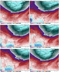
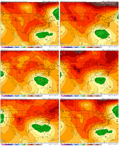
Euro Weeklies Feb 6 to Mar 12 in 7-day increments
View attachment 143490
February Playbook (1/26):
Feb 5: Winter storm chance possible - we have a winter storm chance on Feb 4-5
Feb 1-10: Low pressure replaced with High pressure in East Asia - this is on track and is the feature that adds confidence to the long range forecast. Sfc high pressure anomalies start in Africa in early Feb and migrate east to SE Asia by Feb 10
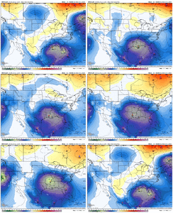
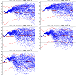
Feb 10-15: Momentum added into the Pac Jet; Aleutian Low swells and moves east; SW trough kicks east; AK and/or GLand Blocking Increases - this afternoon's Euro Weeklies show this progresson well albeit with a couple days of can kickage. In addition, the last 5 runs of the Euro Wk have shown a weakening trend with the Strat PV beginning the 2nd week of Feb. If this occurs in conjunction with weakening at lower levels of the strat, this would help with the development of high latitude blocking (-AO / -NAO) - see image loop below
Feb 15-25: Southern stream becomes more active; Chances for winter storm or 2 increases - on track here; today's Euro Weeklies is best run to date (images below) - right in the vicinity of President's Day looks like the highest potential IMO (Feb 19-21)
Late Feb into Early Mar: Favorable pattern continues for the most part; favorable MJO phases - no changes
Possible Outcomes: Glory Delivered! / Can Kickage / Fail Boat
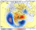
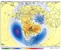
Last edited:
NBAcentel
Member
Wtf, icon has more confluence then last run
^ I added a blurb and image loop about potential Strat PV weakening as well
rburrel2
Member
rburrel2
Member
That run was going to be a massive crusher, imo. the southern lobe is bigger/stronger/deeper and further north too.
- Joined
- Jan 5, 2017
- Messages
- 3,772
- Reaction score
- 5,979
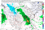
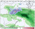
I saw that. It's not backing down. Interesting at the moment but an outlier among the globals.Going gangbusters with the northern lobe. Love to see it.View attachment 144132
Interesting how the gfs shears the wave entering the great lakes area around 2/1 much more than the icon and even the euro
NBAcentel
Member
Looks like less confluence on the gfs though. Dang
I think that shortwave coming in is at least a small piece to help pull some of the energy out of the vortex to its NE. Looks like it's originally what the euro blocked into the great lakes when it was hyper amplified and way SWLooks like less confluence on the gfs though. Dang
WEATHERBOYROY
Member
It looks like the Icon has everything condensed poleward in the Atlantic and Pacific?
In my experience living in the SE, a LOT more.How many runs in a row can the NE press keep trending worse?
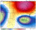
View attachment 144137
Cary_Snow95
Member
NBAcentel
Member
NBAcentel
Member
I mean if you think about this is far from being over lol, all it takes is a few swings back the other way because the southern stream wave has trended more amped/juiced. Certainly don’t wanna see anymore trends at H5 away though in the NE, but the WNC nuking kinda shows the potential of this system even with a mediocre ass cold feed 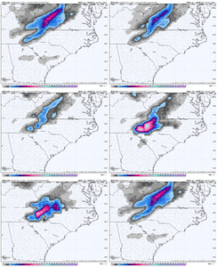

coldfront22
Member
I thought there is no way this storm could cut?
coldfront22
Member
Crazy GFS Run
NBAcentel
Member
coldfront22
Member
I’m corrected. You’re right…. Still a ways to go on this storm.
NBAcentel
Member
I mean if we lose the low in the NE completely it would probably go north some more, hope that doesn’t happen but it’s possibleI’m corrected. You’re right…. Still a ways to go on this storm.
SnowNiner
Member
We really suck at this
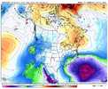
View attachment 144142
I think our blocking has really sucked this year. No true, real Greenland block keeping 50/50s where we need then. That thing is gone. So storm cuts
It doesn’t cut. It takes a further north track but it’s still moving east… then it looks like it transfers to a new low on the coast in a Miller B type set up which explains why the Foothills and Western Piedmont get pasted… there’s obviously some strong FGEN forcing to cool the column in those areas. This is actually the scenario I thought of yesterday when mets were posting the CMC and ICON that showed the low in that locationNow everyone said that the pattern and the setup prevented any cutters and this should ride the gulf. What happened?
NBAcentel
Member
Yeah this certainly not a cutter. Like I said if anything it’s setting up a Miller B transfer. This is honestly a solution that we could see even if the confluence improves and CAD trends stronger.I don’t see a cutter… ? Only thing I see is a weird sfc low pivoting N in response to the vort pinwheeling View attachment 144145
CNCsnwfan1210
Member
The 00z Spire showed what can happen when things go right with a miller BYeah this certainly not a cutter. Like I said if anything it’s setting up a Miller B transfer. This is honestly a solution that we could see even if the confluence improves and CAD trends stronger.
Sent from my SM-A136U1 using Tapatalk
Let’s be honest on this one, there really is not clarity or consensus on the modeling right now and they are kinda going all over the place. Our cold feed has definitely trended the wrong way on a lot models since last night but it’s trended better on both the ICON and UK. This really kinda reminds of that first storm in January 2022 when it was about 3 days about the globals really started to come into any sort of agreement.There’s no cutter, it’s just super amped with no cold air, cutter is it goes to our NW up into the Ohio valley/MA/NE or lakes View attachment 144146
MichaelJ
Member
Watching the EURO, we see why we aptly named it Dr No years ago
I just never seen any hp in place to the north to keep it from cutting. The last few days of gfs runs just don't reflect reality as the orientation ots. It's just looked funky this is more believable imo.Remember when yall were worried about this being too suppressed? Simpler times.
View attachment 144141
rburrel2
Member
Guys the surface low is literally doing the opposite of cutting thanks to the omega block. It's moving from the NW to the SE across the country.
CNCsnwfan1210
Member
That's def a Miller B look and as fro said if we had some additional energy sliding down out of Canada we'd be in business
Sent from my SM-A136U1 using Tapatalk
Again though… this didn’t cut and yes it would have a tough time doing that with the Canadian ridge to the northI just never seen any hp in place to the north to keep it from cutting. The last few days of gfs runs just don't reflect reality as the orientation ots. It's just looked funky this is more believable imo.

