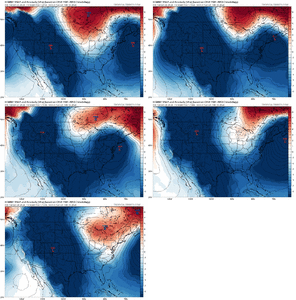
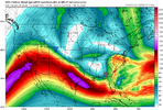
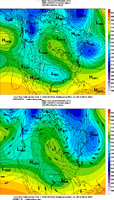
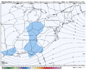
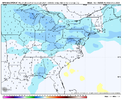
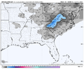
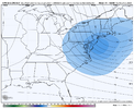
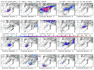
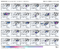
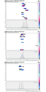
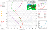
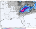
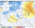
On the local you are darn borderline for sleet to big zr and I'm a little better off in the sleet dept. I guess 850s are somewhere in VaKind of feels like we are going to run face first into an ice storm here tbh.
-
Hello, please take a minute to check out our awesome content, contributed by the wonderful members of our community. We hope you'll add your own thoughts and opinions by making a free account!
You are using an out of date browser. It may not display this or other websites correctly.
You should upgrade or use an alternative browser.
You should upgrade or use an alternative browser.
Pattern February 2024
- Thread starter SD
- Start date
Where were these runs the other day with our low tracking to the south? Why can’t we just blow it up over the FL panhandle? One time?
We are probably going to see a significant spike in the Western NC on the GEFS with some big hits. I've seen us trend warmer like this before but over a couple day period. We have went from one extreme to the other in 24 hours. Makes more sense though with us talking about a storm 7-8 days out & not 3-5. What's wild is just the change up of the set up in general.
Seems like the typical evolution with the models. Outside 7 days they show the potential for a good snowstorm. Then between days 7 and 4 they go back and forth between rain, snow and ice. May even lose the storm all together. Then 3 days out things start to become clear one way or the other.
With that stronger 500mb low however, you can get some dynamic cooling at the mid levels. This can really help if you’re 850s are just a degree or two off.That's honestly what I was thinking from looking at the GFS and CMC. You're probably going to lose the ML temps due too the further east 50/50 but the bowling ball coming out of the west is stronger and deeper. Surface temps probably would work out but we lose the midlevels
iGRXY
Member
Problem is you have to get the track going really well vs already having it locked in from our Northeast. We can win with a bomb ULL and combine it with some CAD but we just will be running on a fine lineWith that stronger 500mb low however, you can get some dynamic cooling at the mid levels. This can really help if you’re 850s are just a degree or two off.
Mahomeless
Member
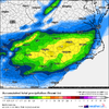
Flooding is going to be a BIG issue in the Carolinas with this.
NBAcentel
Member
GEFS stopped that bad trend at 500mb and has a slightly better cold feed so far
- Joined
- Jan 23, 2021
- Messages
- 4,602
- Reaction score
- 15,197
- Location
- Lebanon Township, Durham County NC
Pretty sure thats like 4" of sleet IMBY.
- Joined
- Jan 2, 2017
- Messages
- 1,566
- Reaction score
- 4,279
That looks very accurate...has the Oconee warm nose!I’ll just post this without context to get the good mojo flowing in here. Cant hurt I don’t think
Sugar/beech staring down the barrel of another monster. Might have to push my dates up View attachment 144070
NBAcentel
Member
Gefs really liking the Piedmont/foothills /mountains/upstate of SC, I’m starting to notice on modeling that’s a highly favored area on solutions
IF this storm turns into an all out ULL rage storm, then pockets of cold air aloft are going to do some weird things.Gefs really liking the Piedmont/foothills /mountains/upstate of SC, I’m starting to notice on modeling that’s a highly favored area on solutions
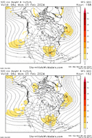
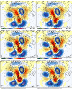
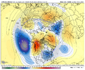
grit, Is there significance in the 552 opening up like that and encompassing the sw?GEFS adjustments - taller Canadian ridge; stronger wave with heights trend south in the Gulf and E of Florida; SW trend with the heights over the NEast
View attachment 144076
NBAcentel
Member
rburrel2
Member
The key take away here, we've curbed the horrible trend theme and now have generally improved at 12z... and we're still in the crosshairs.
Another few sets of runs/trends in our favor and this is a monster storm for a lot of folks.
Another few sets of runs/trends in our favor and this is a monster storm for a lot of folks.
NBAcentel
Member
The closer together the southern wave and 50/50 low are the better the cold air feed will be. We can't have the 50/50 sliding out quickly as that is our source for cold air. With some larger changes, I suppose we get drop some of that 50/50 low down into the southern wave, but that seems like a longer shot at the moment.grit, Is there significance in the 552 opening up like that and encompassing the sw?
NBAcentel
Member
Like the 12z ukmet , rightThe closer together the southern wave and 50/50 low are the better the cold air feed will be. We can't have the 50/50 sliding out quickly as that is our source for cold air. With some larger changes, I suppose we get drop some of that 50/50 low down into the southern wave, but that seems like a longer shot at the moment.

Im just zapping through, playing catch up at lunch. But I swear the canadian is like 12-18 hours slower with wave than other modeling. I stand to be corrected, but might explain why its a shade warmer. less on cold feed. I could be off. Anyway thanks for pbp
UKMet keeps the precip suppressed to the south with a weaker southern wave, so it's a balancing act. Need the stronger damming high with stronger bowling ball wave tracking to our southLike the 12z ukmet , right

rburrel2
Member
The 12z ICON seems to have a late phase that really helps suck in colder air from the northern cut off.
That's actually what the 00z Euro showed as well it was just really weak/warm with the northern cut off and also weak with the southern cutoff... which resulted in no precip for our area, and slightly warmer temps,(but still probably cold enough for snow if the southern low was stronger).
A lot of these other foreign models are also showing the late phase.
If the 12z Euro can stick with that same idea of a late phase, but trend a little stronger/further north with the southern low(which has been the clear trend at 12z)... it could be a really good run for us.
iGRXY
Member
severestorm
Member
Tsappfrog20
Member
Isn’t that for a storm later on?
Sent from my iPhone using Tapatalk
Euro looks like it will be amped even more compared to 0z. Warmer so far as well. TPV further off the NE coast is killing the cold feed early on
severestorm
Member
NoIsn’t that for a storm later on?
Sent from my iPhone using Tapatalk
By shifting the whole construct east and putting the main ridge axis over the lakes you start running the potential to lock into more of a classic CAD scenario. That said a 1025 high that is likely a sign of a polar pacific airmass and not really one that's going to drive single digit dews deep into the region