God bless you
-
Hello, please take a minute to check out our awesome content, contributed by the wonderful members of our community. We hope you'll add your own thoughts and opinions by making a free account!
You are using an out of date browser. It may not display this or other websites correctly.
You should upgrade or use an alternative browser.
You should upgrade or use an alternative browser.
Pattern February 2024
- Thread starter SD
- Start date
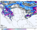
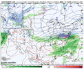
6Z Icon

Hate the issue is the cold air feed now. It's much easier to fix a suppression issue than cold air issue.
Thats the 0z ICON the 6z doesn't go out that far6Z Icon

This is exactly what I was thinking yesterday when everyone became so worried about suppression. Suppression is never a worry until 72 hours out.Hate the issue is the cold air feed now. It's much easier to fix a suppression issue than cold air issue.
My bad. Its a beaut for the deep south brethren thoughThats the 0z ICON the 6z doesn't go out that far
Well, maybe we get some favorable trends next couple of days.Hate the issue is the cold air feed now. It's much easier to fix a suppression issue than cold air issue.
Blue_Ridge_Escarpment
Member
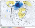
6Z GFS ensemble looks good
Yeah, we’re still 6-7 days out and the stretch of 50/50 lows and CAD push has definitely been known to fluctuate back and forth… January 2022 is a great example of thatWell, maybe we get some favorable trends next couple of days.
I bet that cold feed source will never come back. Once it’s gone it’s gone.Well, maybe we get some favorable trends next couple of days.
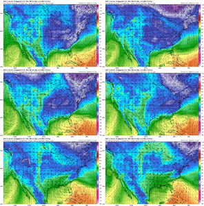
Notice on the 6z GFS how the wave hits a brickwall and moves SE off the coast. here's last frame. But the qpf isn't the issue that's for sure.


packfan98
Moderator
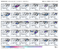
Looks like more hits for NC outside the mountains this time. I count 14 good ones compared to 8 yesterday. But once again it's mostly big hits or nothing outside the mountains.
I mean atleast the signal is still there. Maybe this is the usual models acting up for a few days before reeling us back in? Idk
ForsythSnow
Moderator
It's a massive shift which could very much stick. Really upstream if one slight issue happens days in advance and it locks in, then we're stuck and this is DOA. Better chances at "It'll make its own cold air" if something doesn't fall back into place in today's runs. We lost everything but the ICON in cold press which isn't good news at all for that drastic of a change on the main models.I mean atleast the signal is still there. Maybe this is the usual models acting up for a few days before reeling us back in? Idk
Webberweather53
Meteorologist
What’s happening to our 50:50 webb? Just a blip or is it high tailing it out at the wrong time.
Once we get inside 7 days is when everything goes from good to bad. Why it's so frustrating looking at the models past 7 days.It's a massive shift which could very much stick. Really upstream if one slight issue happens days in advance and it locks in, then we're stuck and this is DOA. Better chances at "It'll make its own cold air" if something doesn't fall back into place in today's runs. We lost everything but the ICON in cold press which isn't good news at all for that drastic of a change on the main models.
CNCsnwfan1210
Member
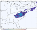
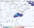
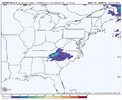
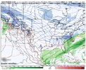
Looks like a Miller B setupI have no clue what this model is but it shows snow so we post it
View attachment 144018
View attachment 144017
Sent from my SM-A136U1 using Tapatalk
Blue_Ridge_Escarpment
Member
Looks like a very high resolution modelI have no clue what this model is but it shows snow so we post it
View attachment 144018
View attachment 144017
[
Spire folks say it's on par with the euro. If it shows snow here it's the best model out thereI have no clue what this model is but it shows snow so we post it
View attachment 144018
View attachment 144017
FWIW- JB has posted on it quite a few times in his blob, I think it's AI stuff, but he's tested it a few times and seems so far that it's no better than what we already have "model" wise says JB... Not to say it can't be right at any giving time though!Looks like a very high resolution model
rburrel2
Member
No reason to give up yet guys. We've still got the ukmet and icon showing a strong cold press, (and I guess kma&spire?). The 06z icon is even stronger and further south with the northern lobe.
Not saying it works out, but we're still in the game at least.
Not saying it works out, but we're still in the game at least.
iGRXY
Member
I have no clue if this will happen but this looks like every southeastern winter storm I’ve ever seen us track outside of MAYBE 1 or 2 over the last 15 years at least. You have a storm signal, lose it around day 6-9, pick it back up between day 4-6. No clue if it comes back but this is not even remotely out of the norm. Newbies on here are going to have to understand that rarely and I rarely do we get a day 10+ potential that holds together every run until go time. There’s always been a couple day stretch where the wheels look like they completely fall off just for it to come right back. Again, no idea if that happens here but you don’t throw this away on day 6 or 7. If we are still seeing this by Friday, then yeah it’s probably done.
- Joined
- Jan 23, 2021
- Messages
- 4,603
- Reaction score
- 15,199
- Location
- Lebanon Township, Durham County NC
I read about a poster this morning that says the KMA is basically a combination of the european and korean modelling suites.
Last edited:
Scraping the bottom of the barrel to keep hope alive.


On the GFS, Savannah has gone from dews around 5 degrees to dews near 60 since 00z Sunday
You must be getting old and forgot that oneThis is what it showed 5 days out for the January system, so yeah it's spot on....... oh wait
View attachment 144020
NBAcentel
Member
Cold and suppression is always preferable to to me over hoping we can find a cold air feed in the nick of time. Thankfully, we still have time to change that. In reality, it's just one bad (pretty bad, I'll grant you) trend. But we have time to fix it.
LukeBarrette
im north of 90% of people on here so yeah
Meteorology Student
Member
2024 Supporter
2017-2023 Supporter
Didn’t even snow in SW VA… freezing rainThis is what it showed 5 days out for the January system, so yeah it's spot on....... oh wait
View attachment 144020
LukeBarrette
im north of 90% of people on here so yeah
Meteorology Student
Member
2024 Supporter
2017-2023 Supporter
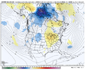
Kinda nuts how there is less changes with the pacific energy but way more with changes in the arctic. I would think it would be the other way around because the pacific energy is not on land currently. However both are low predictability
This is just bonus, mid to late February is when we get the big one.

