coldfront22
Member
Canadian? Good or bad
Can I have a blend please?I think the deterministic models are trying to mess with the machine-learning models lol. Such consistency ?


On the icon im a good bit behind the 534 line with a weak 1024 hp over Bastardis house and its rainingHelp me understand it. Surface, Dews, 850’s all sufficient around here as the Clipper drops in then *poof*. I want to understand it

South and stronger. Looks goodGEFS Mean is south of previous run

Too late.Don’t look at the Canadian, thanks
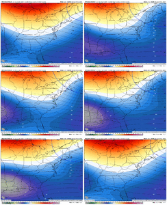
There's even a couple of I-10 hits in there. It just goes to show that if everything goes just right, any of us SE weenies get in on the action with this weird setup.GEFS coming in with I-20 hits. GEFS snow totals still loading for timeframe of interest.View attachment 143621
Yeh I mean, there isn't just one skewing the mean either. There is a couple larger ones in there, but there is also some moderate & light ones also. As of now, it's not like it isn't possible.Too late.
There's even a couple of I-10 hits in there. It just goes to show that if everything goes just right, any of us SE weenies get in on the action with this weird setup.
Right where we want it. Showing some I-20 hits and then having it settle in somewhere in the middle along I-85. ?GEFS coming in with I-20 hits. GEFS snow totals still loading for timeframe of interest.View attachment 143621
That's a board wide hit right there.KMA for those that avoid the whamby thread View attachment 143631
Not as pretty for some as 06 but still the signal stands.
View attachment 143624
Right where we want that at this lead
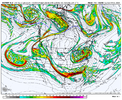
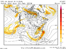
You can certainly see how it could happen though!One thing the KMA did was phase a piece of the low into the southern upper low. Lots of time...Euro isn't showing that like you pointed out.
But lots of time and not a bad spot to be in 8 days out.
View attachment 143637

Euro does that move lateOne thing the KMA did was phase a piece of the low into the southern upper low. Lots of time...Euro isn't showing that like you pointed out.
But lots of time and not a bad spot to be in 8 days out.
View attachment 143637
Bu

Reminds me of this one grandma/grandpa storm that had a piece of northern stream dumped into the southern wave and it unloaded in NC, can’t remember when that one happened though, it was a mega winter storm, I think it happened in March of something I’m not sure978mb surface low off Charleston. Imagine if you found a way to connect w/ this one.
View attachment 143640
This season, strong, deep low pressure systems haven't been much of a problem coming to fruition. Wouldn't be in the least surprised to see this trend of deep low pressure systems during this season.978mb surface low off Charleston. Imagine if you found a way to connect w/ this one.
View attachment 143640
